The PIGUM (which is an acronym for Porth I’r Gymru Ultra Marathon) is a 30 mile race with around 1700m (5500ft) elevation gain/loss, starting in the market town of Abergavenny, Wales. Porth I’r Gymru translates to “Gateway to Wales”.

Last year I deferred this race due to scheduling issues, and this year I wasn’t originally going to do it either, as I had booked the Rollin’ 100 (100 mile ultra in Shropshire). Unfortunately the Rollin’ 100 was cancelled a few months back due to number requirements not being met, so I booked in the PIGUM as a ‘filler’ race leading up to the the Swiss Alps 160 next month.
The weekend prior to PIGUM race weekend I did two training sessions. Friday was a coast path run, with around 20 minutes of threshold/VO2 max work sandwiched between a long warm up and cool down. Saturday was a long trail run in the Preseli Hills. Friday’s session felt like a bit of a slog. I was able to churn out a fast few intervals, but everything else felt really difficult.
On Saturday I really had to force out the long run, and in hindsight I should have bailed out early. It was a real chore. Everything felt fatiguing, and I thought I was overtrained. In fact my Garmin even told me I was ‘overtraining’ at the end of it. Turns out I was actually just getting ill. Sunday the full-on cold hit me.
I spent most of last week recovering by doing just about nothing. By Wednesday/Thursday I was starting to feel better and had managed one or two short and easy turbo trainer sessions, as well as an easy 5km run. I decided to wait until Friday to see how I felt and whether or not I would be on the start line for the PIGUM.
PIGUM Race Day
I woke up at 2:45am on Saturday morning after trying to get an early night. I didn’t get much sleep, and the race registration was close to 2.5 hours away. The lack of sleep didn’t aid in helping me full recover, but I was feeling decent enough to give the race a go. I still had a little bit of a chesty cough, but it was just residual, and I was sure I was not contagious.
Registration was cold and wet. We all huddled under the marquees as the skies bucketed down. I saw a bunch of running friends and familiar faces which really lightened my mood from the bad weather.
The Route
I divided the race up into thirds by the fact that it had 3 x major hills / climbs (listed below as peaks with their respective heights above sea-level):
- ⛰️ Blorenge (561 m)
- ⛰️ Mynydd Llanwenarth (410 m)
- ⛰️ Sugar Loaf (596 m)
PIGUM race start
I started up front as I didn’t want to get caught behind slower runners on the first climb’s narrow trails (which started very soon).
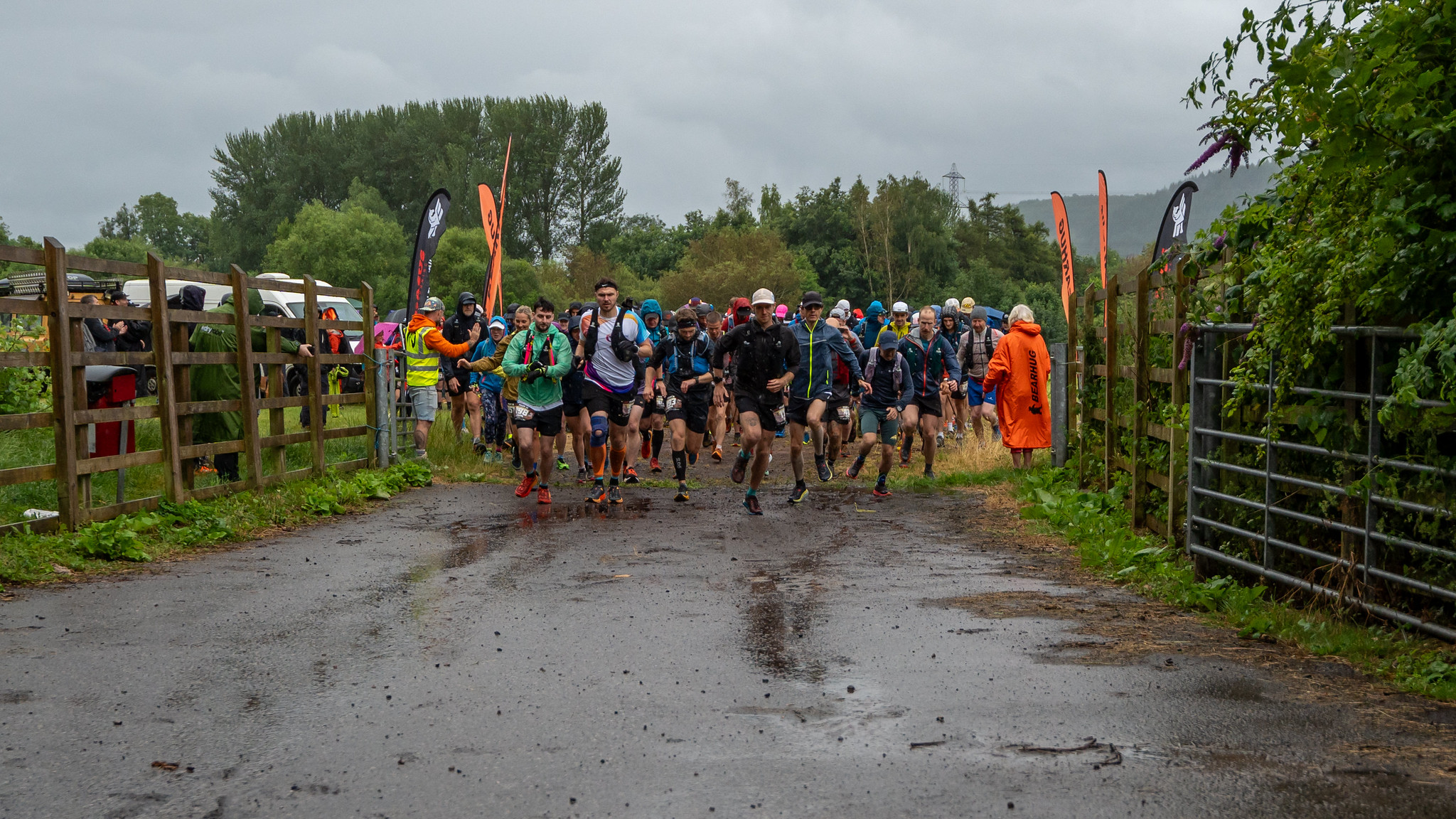
The front pack set off ‘hot’, which was needed as we were all shivering on the start line to begin.
If the first 1km didn’t warm us up, the next one did, as it had us climbing steeply up the Blorenge mountain. The climb was shaded in trees all the way up until it opened into bare mountain toward the very top.
I found myself in lock-step pace with another runner, Shaun. In fact, we found our ideal pace suited all the way through the first half of the event, running together, or within a few meters of eachother for around 15-16 miles.
At the start we sat in 4th and 5th position and held those positions all the way until the end.
Looking at the Pace, GAP, and Elevation stats for the first 6km shows how steep things were. Grade-adusted pace was quick up the first climb. I was thankful for Shaun’s company as he set a good pace up that climb, and I simply just hung on for the ride.

First climb done
Coming out on top of the Blorenge mountain we met with a nicer to run gravel path/trail. We were totally exposed to the wind and intermittent rain though, and it was pretty cold up there. Unusual for the season.

Shaun and I breezed past the first checkpoint at around 10km in, not stopping, but making sure they took down our race numbers to check-off. We both had enough fluids and race nutrition till Checkpoint 2 at around 22km in and didn’t want to waste any time stopping.

Trail to tarmac, tarmac to trail, and a soiled gel
The next section of the course had a fair bit of road running until CP2, with much of it being a long average ascent up toward Mynydd (mountain) Llanwenarth. Just before this was CP2, and we both stopped for 1 minute to top up fluids. I grabbed a cup of coke as the volunteers filled up one of my water flasks.
Heading up toward Mynydd Llanwenarth now, we were back on trail. A very narrow path worn into the open moorland and heather filled landscape. Again we were exposed to the weather, and the trail + gradient was much harder work than the prior road section.
Shaun and I were still stringing eachother along, feeding off of eachother’s pace. I was running in front up this trail until a sharp turn near the top of the ridge. Shaun led the way down.
Shortly after this I was forced to make a dash off trail and into the heather. My stomach had been feeling slightly off for the last half hour, and it suddenly presented itself in an emergency number 2. I had seconds to react and unfortunately dropped my last remaining unopened PF90 gel (precision hydration 90g gel) from my running belt as I squatted down. The result was a soiled gel and a horrible mess.
These were minutes I didn’t want to waste stopping, but these things happen and are part of the variables we need to contend with in a sport where we can be out for hours. In hindsight I think the problem was I ate way too much pizza the night before.
Getting back on track
I had unfortunately lost Shaun with the prior mishap, so I was on my own now, but picked the pace back up as I headed down hill. A fairly steep and technical drop down, with many more trails littered in stray rock and overgrown fern.
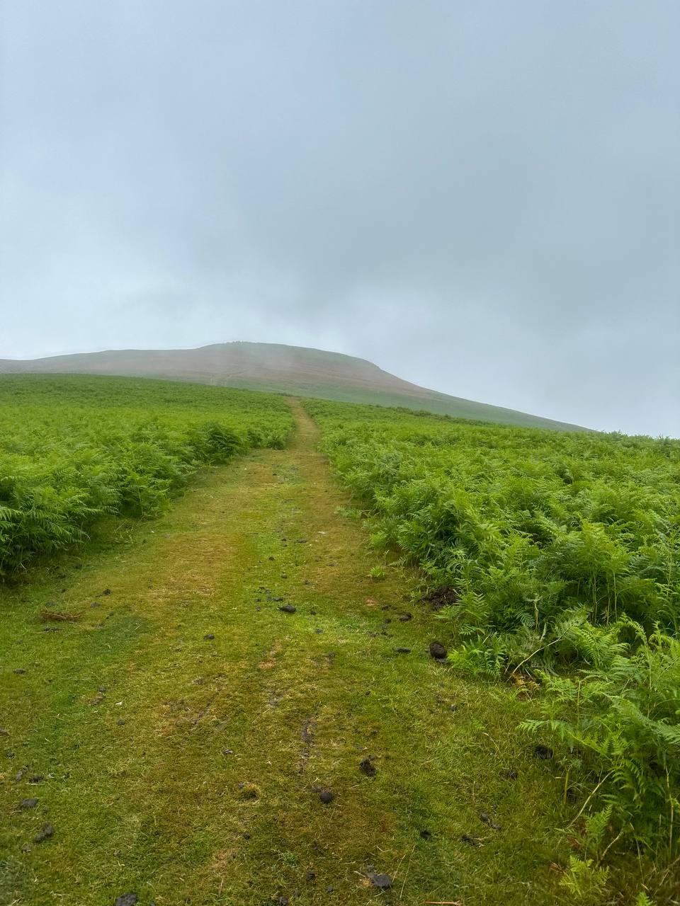
Soon I was climbing up toward “The lonely Shepherd”. A lone rock on the hill/mountain looking out toward the surrounding “Beacons” area. Quite fitting now that I was on my own.


I didn’t get a photo of the rock as the weather was rubbish at this point, but here is what it usually looks like.

Checkpoint 3 and up the big one, Sugar Loaf
Soon enough I was upon CP3 at around 21 miles in the town of Glangrwyney.
The checkpoint was a small out-and-back section on the road, and was staffed by a huge team of volunteers from She Runs Cardiff. I filled my re-usable cup with coke here, stopping for just a minute.
Heading back out of the checkpoint I got a good view of whether anyone was hot on my heels. If I saw anyone coming in, it would mean I might have a 3-5 minute lead on them. Thankfully I saw noone, and could begin the long climb (slog) up toward Sugar Loaf mountain.
Up Sugar Loaf, down again, and to the finish
The climb up toward Sugar Loaf was a hilly road that eventually met back to the trail. The rain was out again and on the way up I was met with a confusing branch in the trail, with a race arrow pointing one way, but a ‘private’ sign on a farm fence in the same direction.
I lost about 3 or 4 minutes here going back and forth till I figured out which trail was the correct one. The GPX on my watch was pointing in a different direction to the arrow.
The climb up was long and tedious. My legs burned as I pushed up the steep gradient, Sugar Loaf always looming ahead covered in low hanging cloud.
The final climb was a lot ‘rockier’, which was great as I knew I was not far from the top. I glanced over my shoulder and didn’t see anyone behind me as far as was visible. This didn’t relieve any pressure though, I couldn’t trust my eyesight without glasses so I kept on pushing.
Coming down sugar loaf I made three navigation errors. Initially on the top, I went too far right, and had to come back up, then down the ‘correct’ trail. A few hudred meers further, I went too far left on a much easier looking trail. Realising I was off, I had to correct back through a couple hundred meters of thick fern and bush.
A kilometer or so further down, running through thick and shoulder high fern, a branch in the trail confused me, with both forks looking similar in direction to the GPX line. Again, I took a wrong turn and had to double back after a couple hundred meters.
The added navigation mistakes forced me to keep up the pace as I didn’t want to lose hold of my 5th position.
I now had around 8km left to go, and a mostly downhill gradient back into Abergavenny. The sun came out and I (mostly) enjoyed the run back in, aside from some narrow trails and stinging nettles! At the end there were cheers and bells run by all the lovely volunteers and race staff of Pegasus Ultra Running.
Race loot and stats
Kudos to race director Mimi Anderson for directing an excellent race, and sticking around to hand out medals at the finish for everyone (when the race has no official cut-off time!)


PIGUM race stats
- Total time taken: 5 hours 3 minutes
- Distance: 48.62km
- Elevation gain: 1,682m
Race photos 📸 kindly taken and provided by Daz’s Photography.
You literally sh@#*t on your gel!!! Forgive me, Sean, but that’s hilarious!!
How fortunate you didn’t need to save the gel!
Apart from that: well done! Especially for standing at the starting line, as you were just recovering from that cold and it was miserable weather. Speaking of which, it seems to me that either Wales is blazing hot or freezing cold. Nothing in between!
Until now, I didn’t even know that my Garmin provides grade-adjusted paces. Thanks for pointing that out!
I just analysed my trail race from last Saturday and now officially know that my downhill running need improving… 😉
You are well-prepared for the Swiss Alps next month – I can’t wait to see how you will like it!
Embarrassed to say, but yes. Yes I did. It was a moment of pure disbelief at first 😂
We’ve had an odd Summer so far. It hasn’t felt like anything good in-between temperatures.
I found that you can create a custom (or edit an existing) face for your running activity- I have one specifically for ‘trail running’ and add a data field under the “pace” category for “grade adjusted pace”. This lets you see your current average GAP while you’re running.
And it’s totally unfair against you while running downhill, especially on technical trail! But great to judge going up what your relative sort of pace would be if you were on the flat.
I don’t plan on racing at Swiss Alps… it’s going to be totally alien for me there with the terrain and the altitude, so my goal will be to be sensible! But thank you, I’m feeling quite well prepared so far 😃