The Corris Round is the creation of (then) 12-year old Tom, who devised the route having been inspired by the Bob Graham Round during lockdown. It’s a route starting in the small village of Corris in Southern Eryri (Snowdonia, Wales) almost from his door step. Amazingly Tom and his Dad finished the round in about 11.5 hours.
The route is about 56km and has you taking on 12 Hewitts (3315 meters of total elevation gain/descent).
“Hewitt” is defined as “Hills in England, Wales and Ireland over two thousand” feet 2,000 feet (609.6 m) in height.
A ‘long run’ training day, taking on the Corris Round
I had itchy feet after attempting the Three Hunters at the end of February, and needed a good long day with time on feet as part of building up and training for Ultra-trail Snowdonia (UTS 100k).
The Corris Round fit the bill perfectly. 56km and 3315 meters of elevation gain in some very tough underfoot conditions. I also love the Cadair Idris mountain range. It has some spectacular views to take in.
Corris is about 2 hours drive from home for me. So with permission from the family, I set out at around 6am one Sunday morning in April for a long day out in the mountains of Southern Eryri.
Clockwise
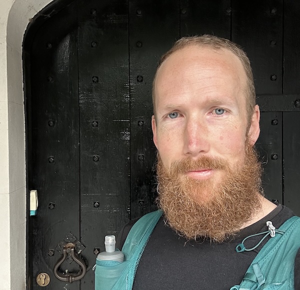
You start the Corris Round by rapping the knocker on the door of the Corris Institute building. I started my watch, and off I went up the switch back path out of the village, across the main road, and into the hills to the forestry above Corris.
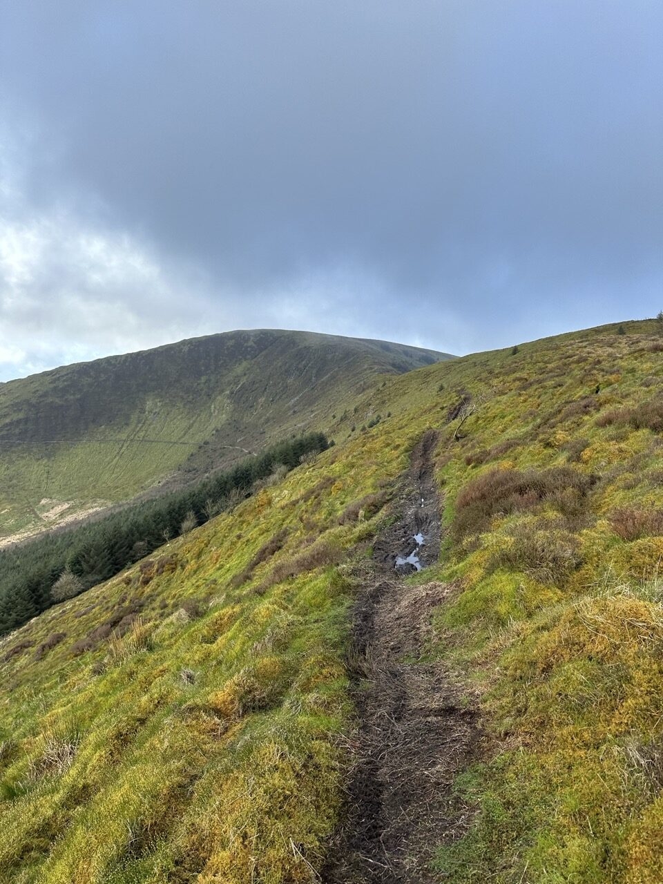
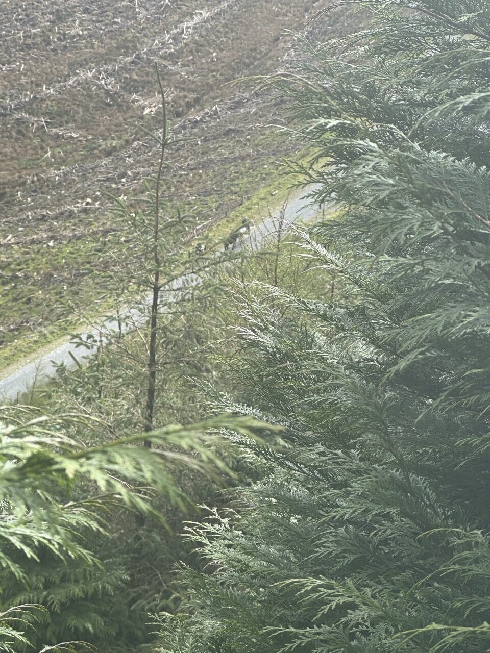
The initial path leading up the steep forestry already introduces some bog and thick grass to the mix. Once off the switch-back section it flattens out, and leads through this area until you reach a gravel fire track that goes further up into the forestry. There were red tape markers that someone had helpfully places every 50 feet or so. Useful to find your way through as the path is not well defined at all.
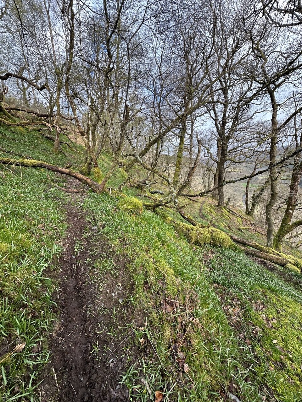
The forestry track, although a very long uphill, I found to be quite runnable. There were also small opportunities to cut off some of the switch-backs by cutting through the dense trees, short-cutting onto the next switch-back etc…
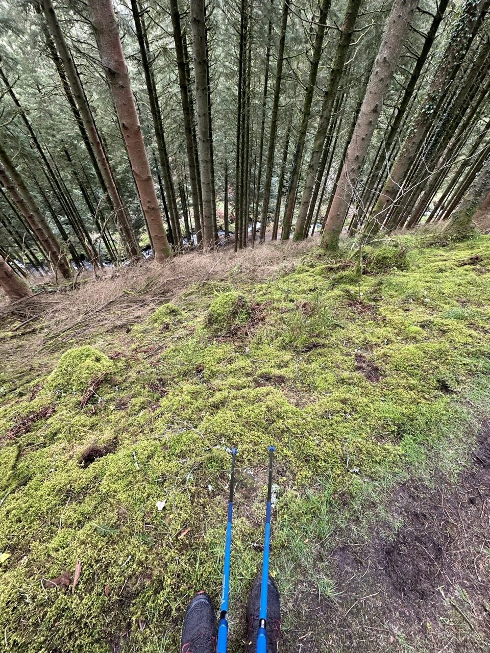
Eventually the forest track ends, and you enter an extremely wet, mossy, boggy, grassy uphill through the forest. There is no well defined track here, but right near the top I realised that it would have been possible to follow a fence line further off to the left.
I didn’t take any photos here as I was too busy trying not to sink knee deep into the steep uphill bogs.
This leads all the way up to the Tarren ridge line.
Difficulty underfoot
The trail leading out of the forestry and up to the Tarren ridge was very muddy, and at quite steep angle of camber. This made running up this section difficult as my feet kept slipping, even with the aggressive lugs of my La Sportiva Mutant shoes.
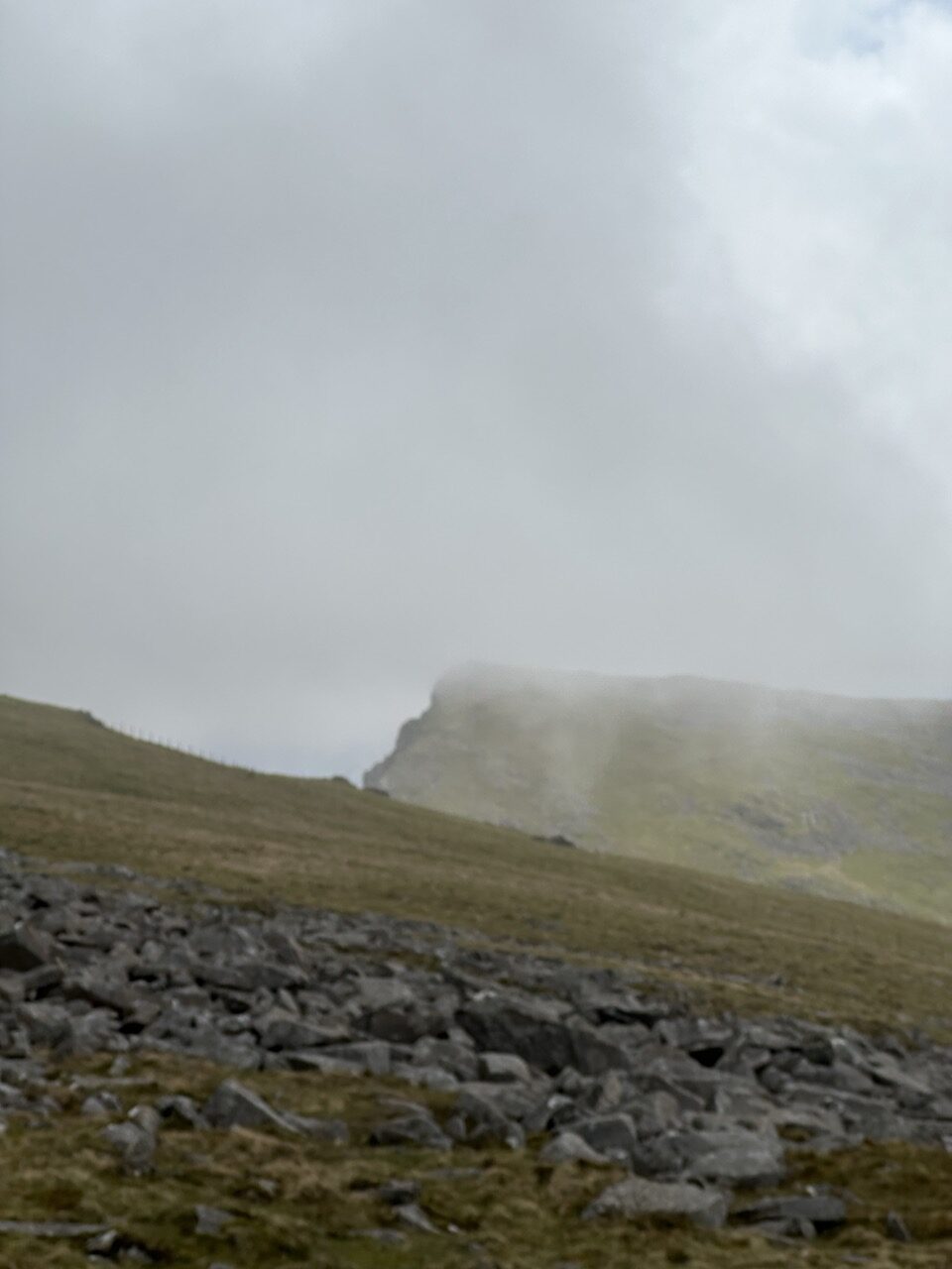
Eventually I made it up to the first of the Hewitts. The air was crisp, cold, and breezy. The sky filled with clouds, but now and then a brief moment of sun shone through, warming my shoulders and arms.
I took on a torq snack bar, and fluids here, then continued onward.

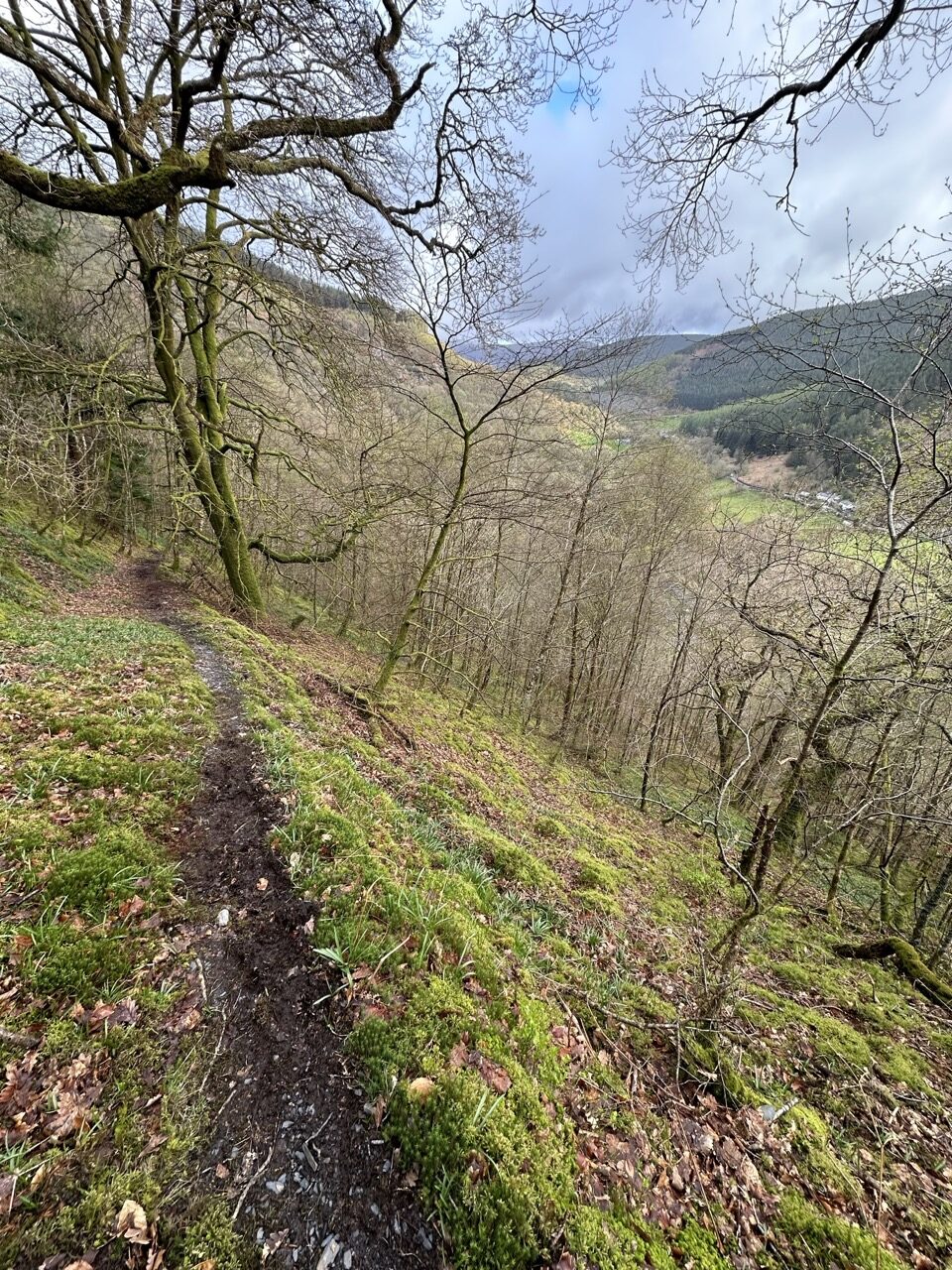
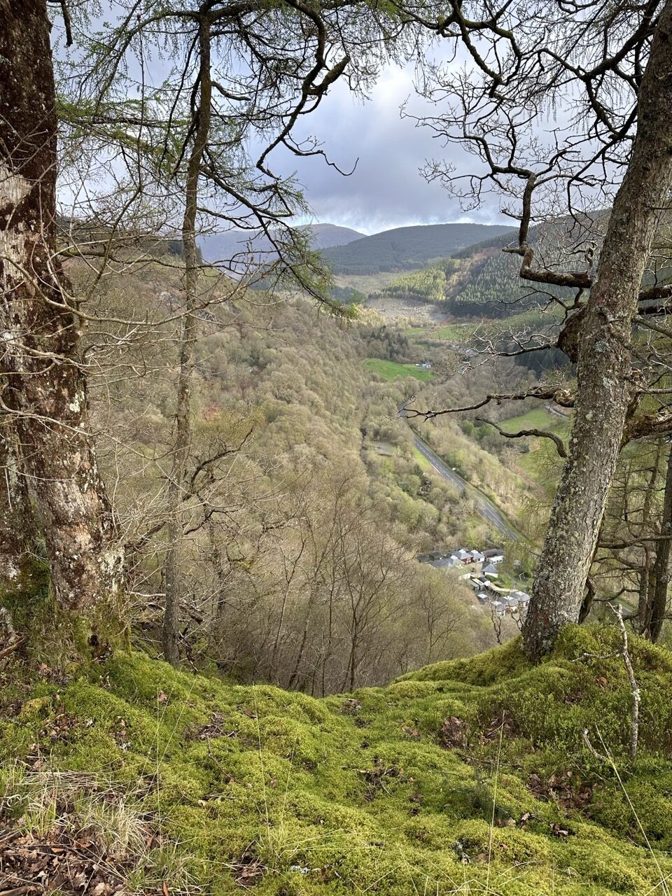
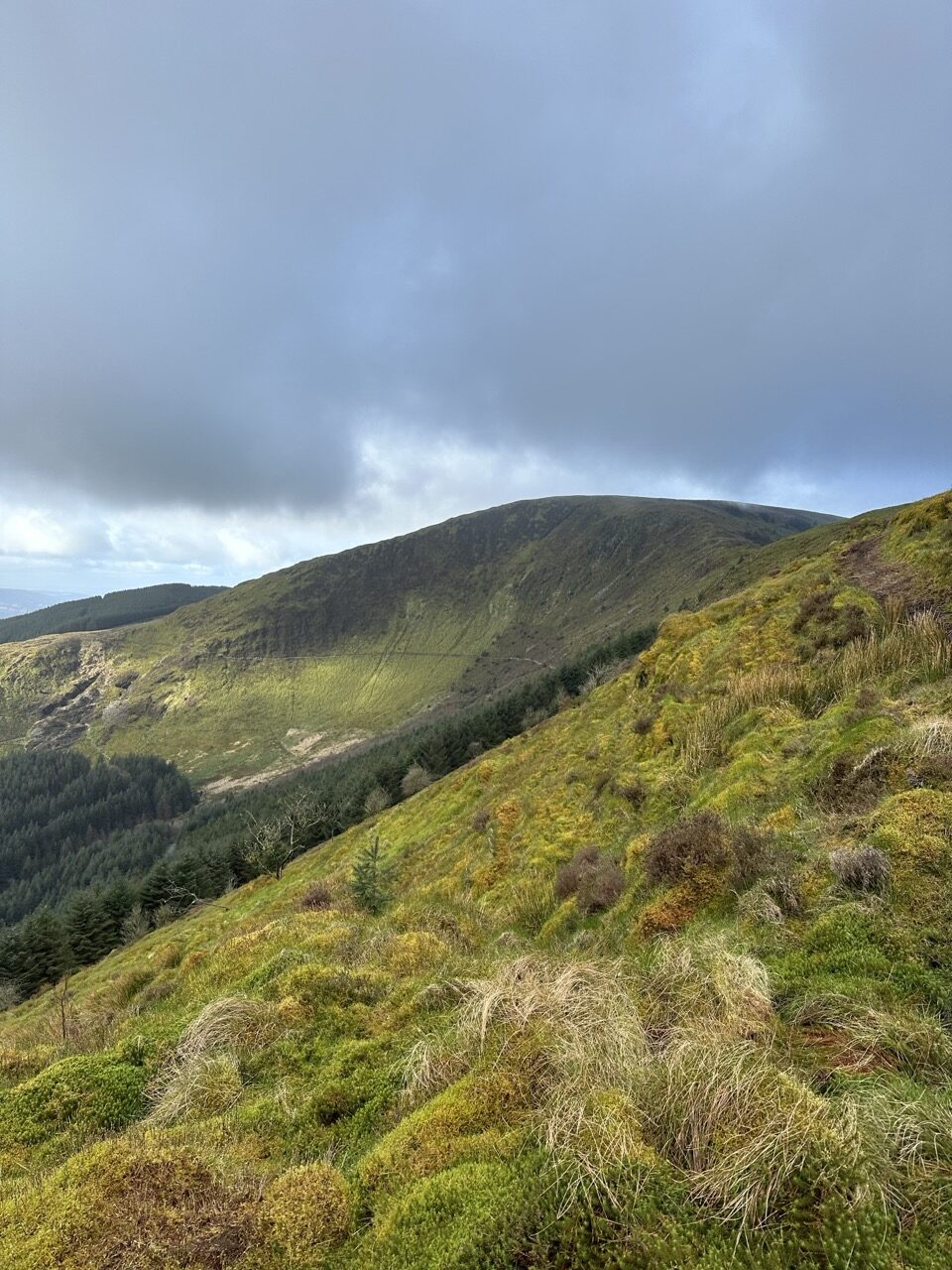
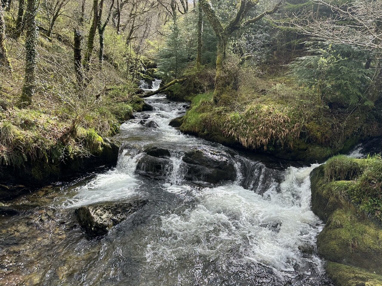
The rest of the route up until the Cadair range included a lot more difficult fell-like terrain and grassy off-camber sections of trail to run, eventually leading onto another short-ish section of forest gravel track, leading down to a beautiful river.
To get to this gravel track, you first need to take a very steep descent down. The GPX I was following wanted me to essentially ‘jump off’ the cliff to the bottom. Thankfully I was going slow. Looking a bit further on from the line, I found an actual trail through the trees on the cliff with a path at a much more reasonable decline angle. I made my way down carefully to the bottom and onto the track. About 1km of nicely runnable gravel to the river.

The river flows downward toward the tumbling rock quarry area. It was beautiful here. If I wasn’t crunched for time to get home to the family in the evening, I would have stopped for a swim in the various pools of water.
This great runnable section eventually takes you to the small town of Abergynolwyn.
Here I was happy to find a small cafe that served Bara brith (a Welsh baked fruity style of bread/cake, which is made with tea and fruit). I bought a couple of slices, shoved them into my running pack, refilled my water, and added a coke for later too.
Just outside, I ran into Alex. A chap who had met Martin, Ben, and myself when we took on the Three Hunters challenge. Alex had stood outside in the dark near the entrance to the town of Machynlleth and provided us with hot tea and orange slices. That was the first time I had met him, and it was a surprise running into him here (about 15 minutes or so away from Machynlleth!)
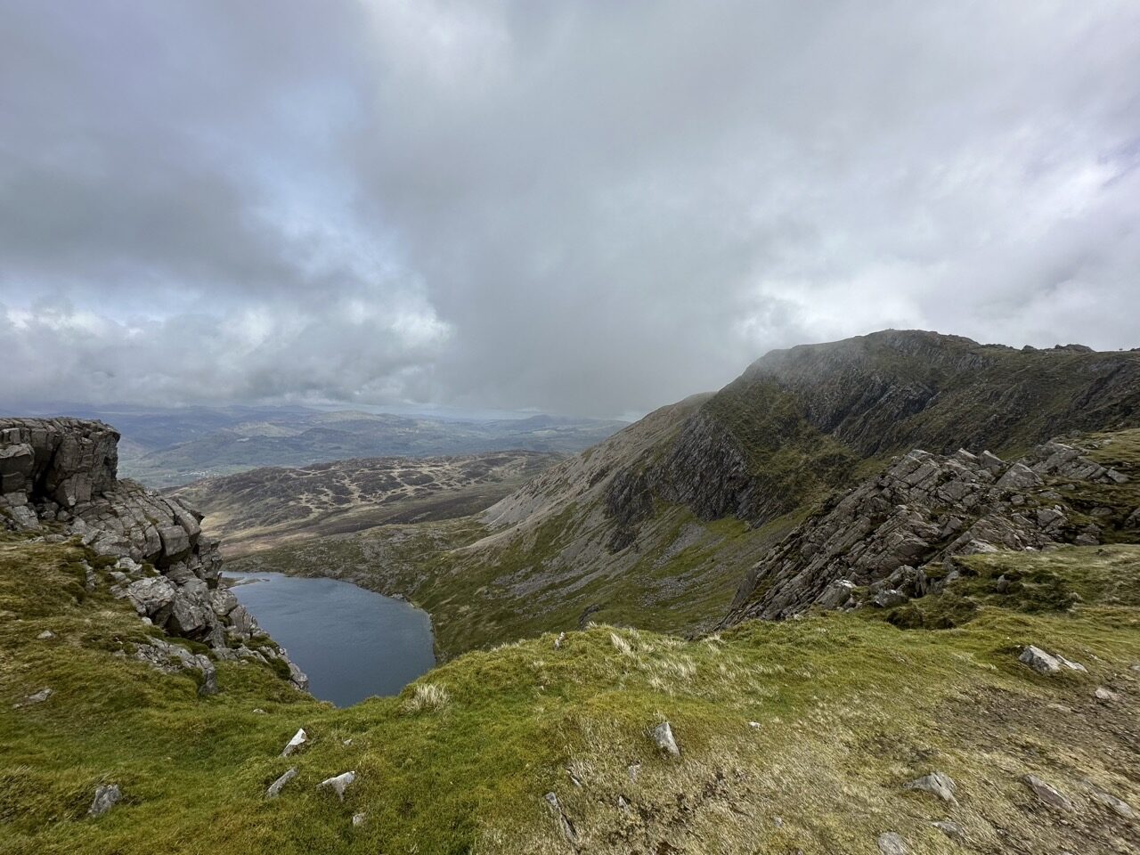
Cadair Range
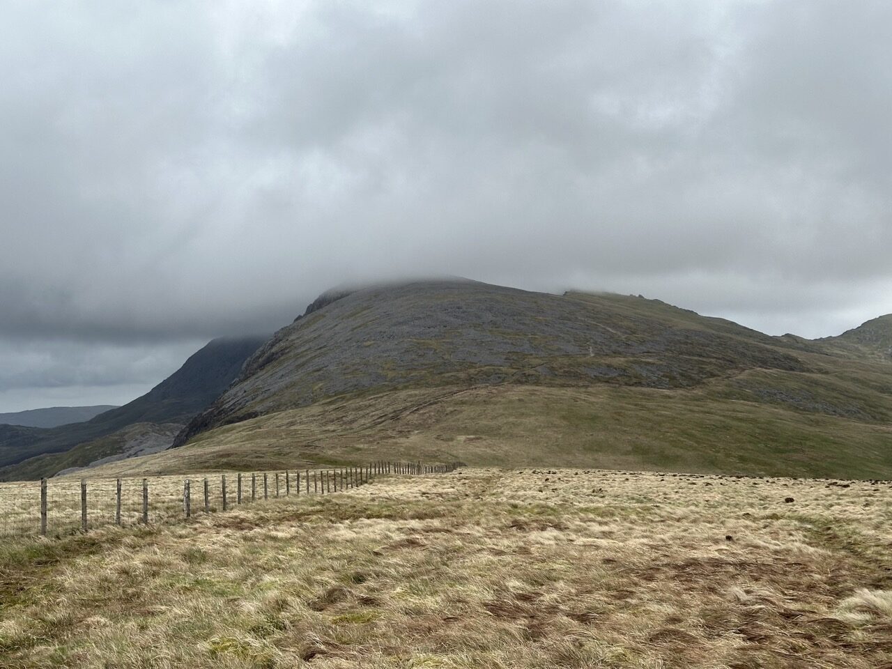
I’m not going to detail all of the Corris Round, so I’m skipping ahead here. There were some real slogs uphill, downhill, and through more difficult terrain to eventually get to the Cadair Range. My favourite section of the Corris Round!
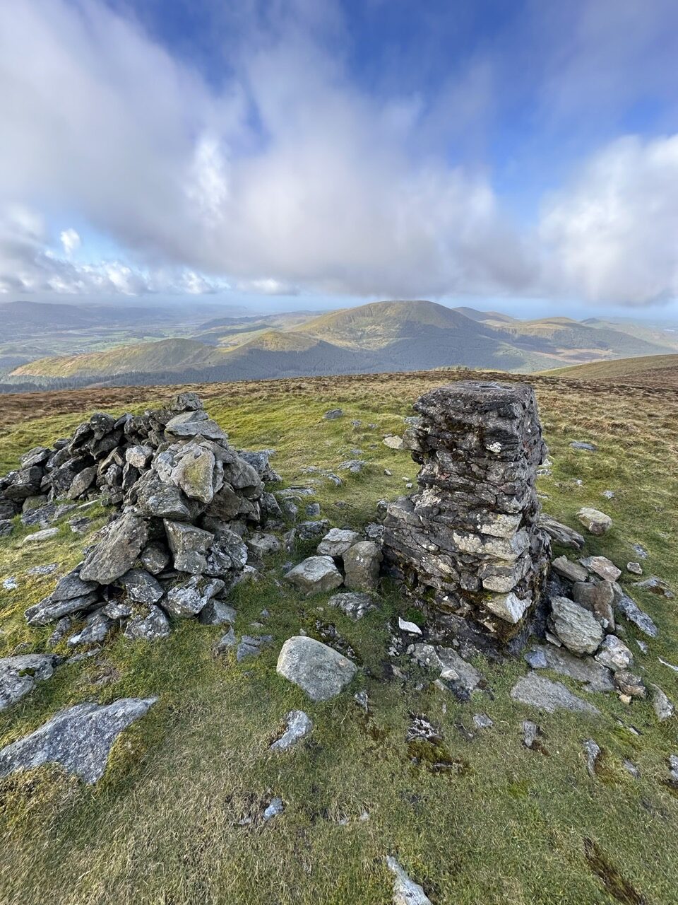
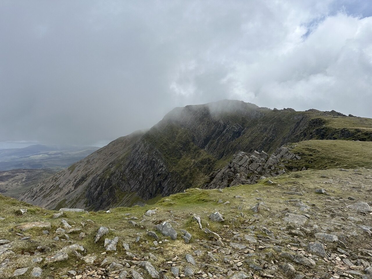
Cadair Idris means ‘Idris’s Chair’. Idris is usually taken to be the name of a giant in local mythology.
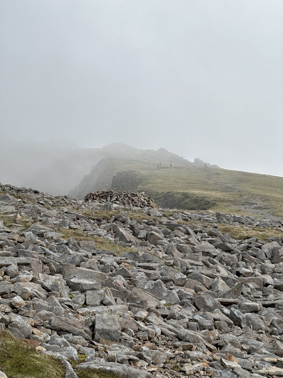
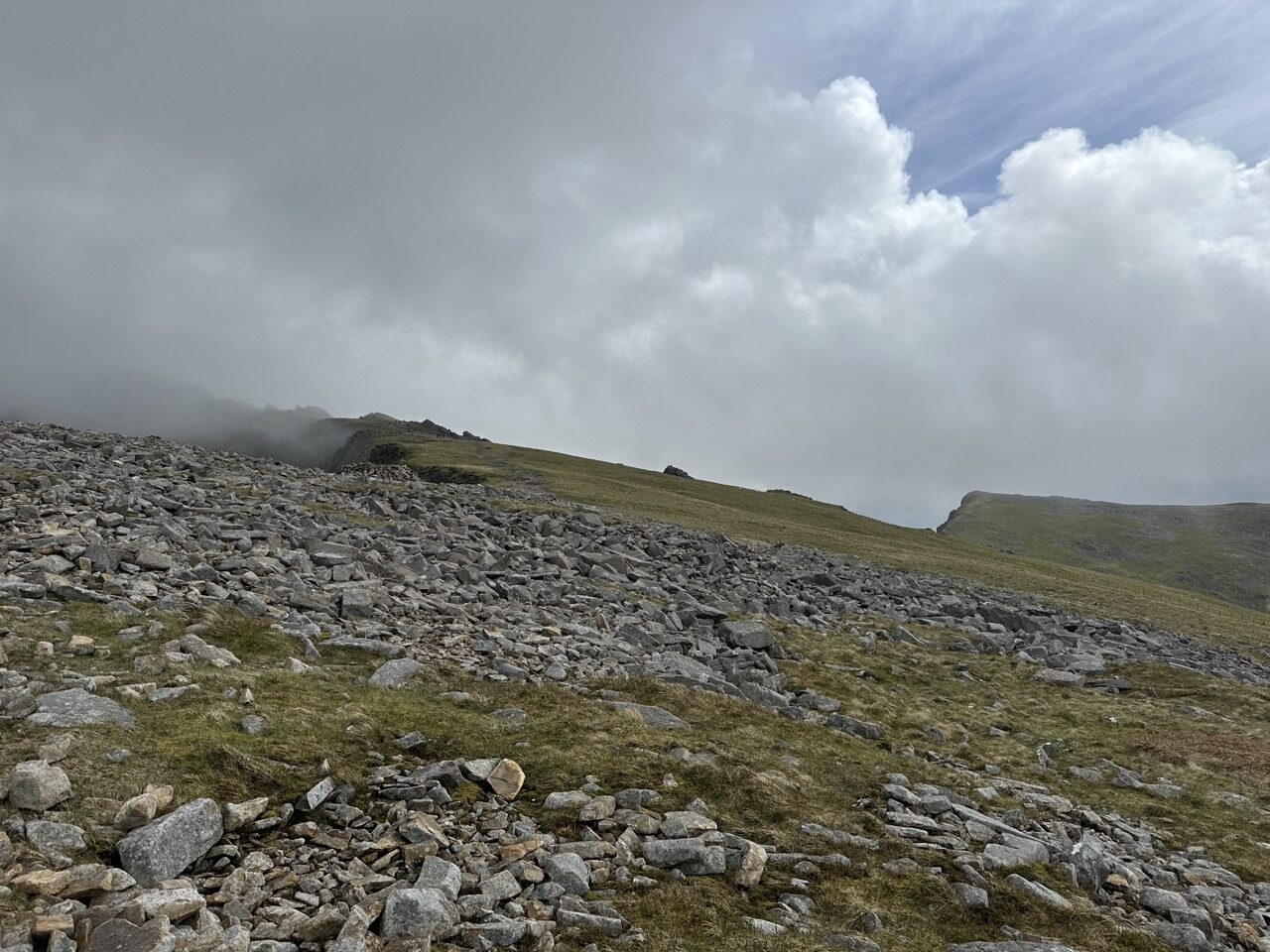
The track up to the top is very rocky, with some stone steps in places. This is great for me, as it’s at least a solid underfoot surface. A welcome change from the soft, sinking in, uneven bogs from before.
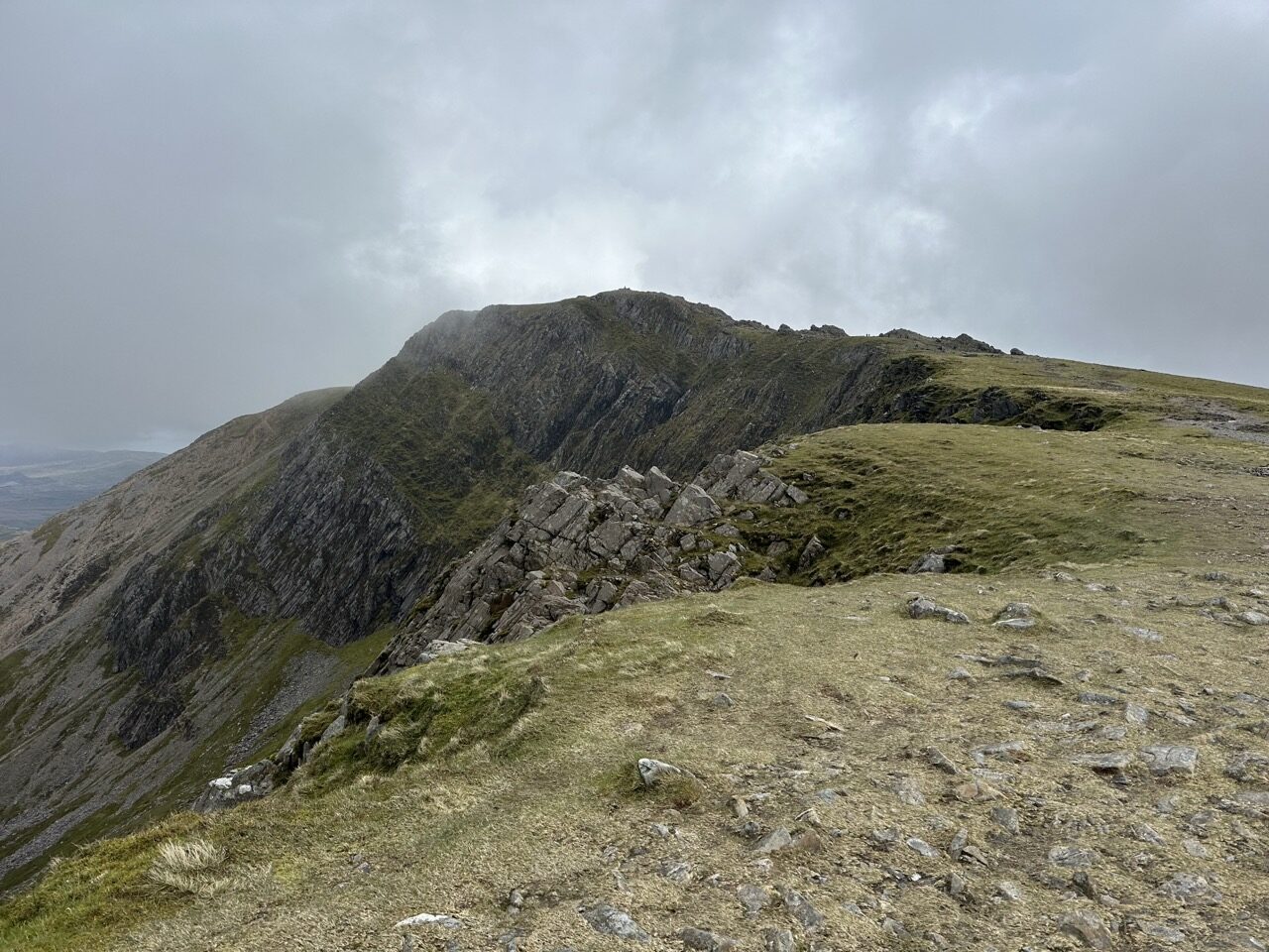
A pushed my pace a little harder, which with the elevation meant I mostly jogged up to the top of Cadair Idris. On the way up there is a child summit off to the left too. Here is a brief view when getting near to the scramble up to the summit:
At the very top you get some steeper parts to climb that require the use of the hands for a little bit of a scramble. The top of the mountain houses a stone and rock constructed mountain bothy.

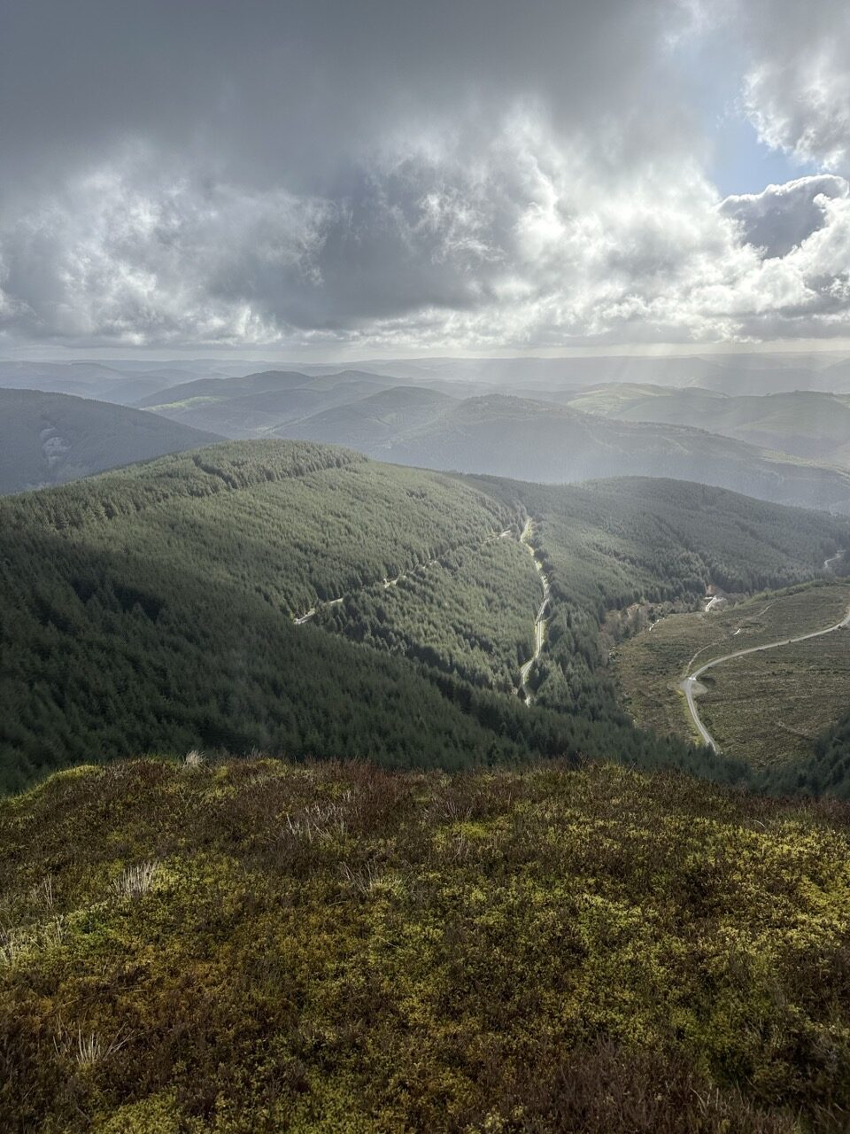
From the bothy, it’s a downhill section for a long way to the bottom of a valley where the “Mach loop” runs through. The Mach loop is a series of valleys in twest-central Wales, which is used as a low-level training areas for fast aircraft. I didn’t see any fighter jets flying through the valley on this day, but quite often otherwise it’s a great area for watching military aircraft zooming through the valley.
The run down the valley into the Mach loop is very steep in places. With the ground being so wet this slowed me down a lot as it was so easy to lose footing from underneath. Trekking poles were useful here to act as mini brakes.
Running through the valley for a few kilometers eventually has you climbing back out again, up a very steep climb. There is no trail or clear path here, it’s just a matter of getting the bearing to the top and finding your way through the thick grass and uneven ground. The gradient is sharp, and a few stops to catch my breath were required.
Onto the Dyfi group
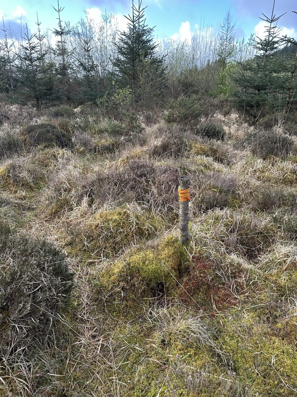
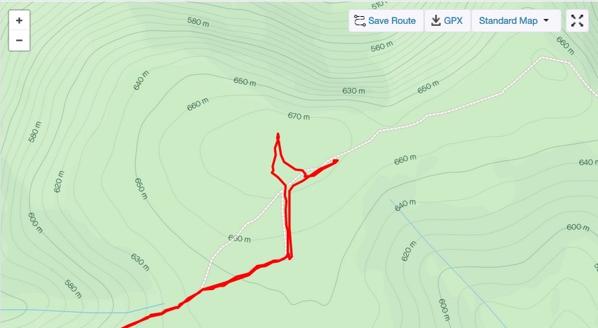
After the sharp climb up, you follow a bit of a ridge line (with it’s own mini ups and downs) where you eventually do an out-and-back style section through very boggy and difficult trail, taking in a few peaks of the Dyfi group, including Cribin Fawr and Maesglase. The former of which has a difficult to find ‘peak’ as the top area is quite wide. I did find a small cairn of rocks and a stick though. A clear indication that this is what is widely accepted as the top!
The last leg back to Corris
Finally, after the out-and-back section, I made my way mostly down toward the final valley which heads back in toward Corris, and the end of the Corris Round.
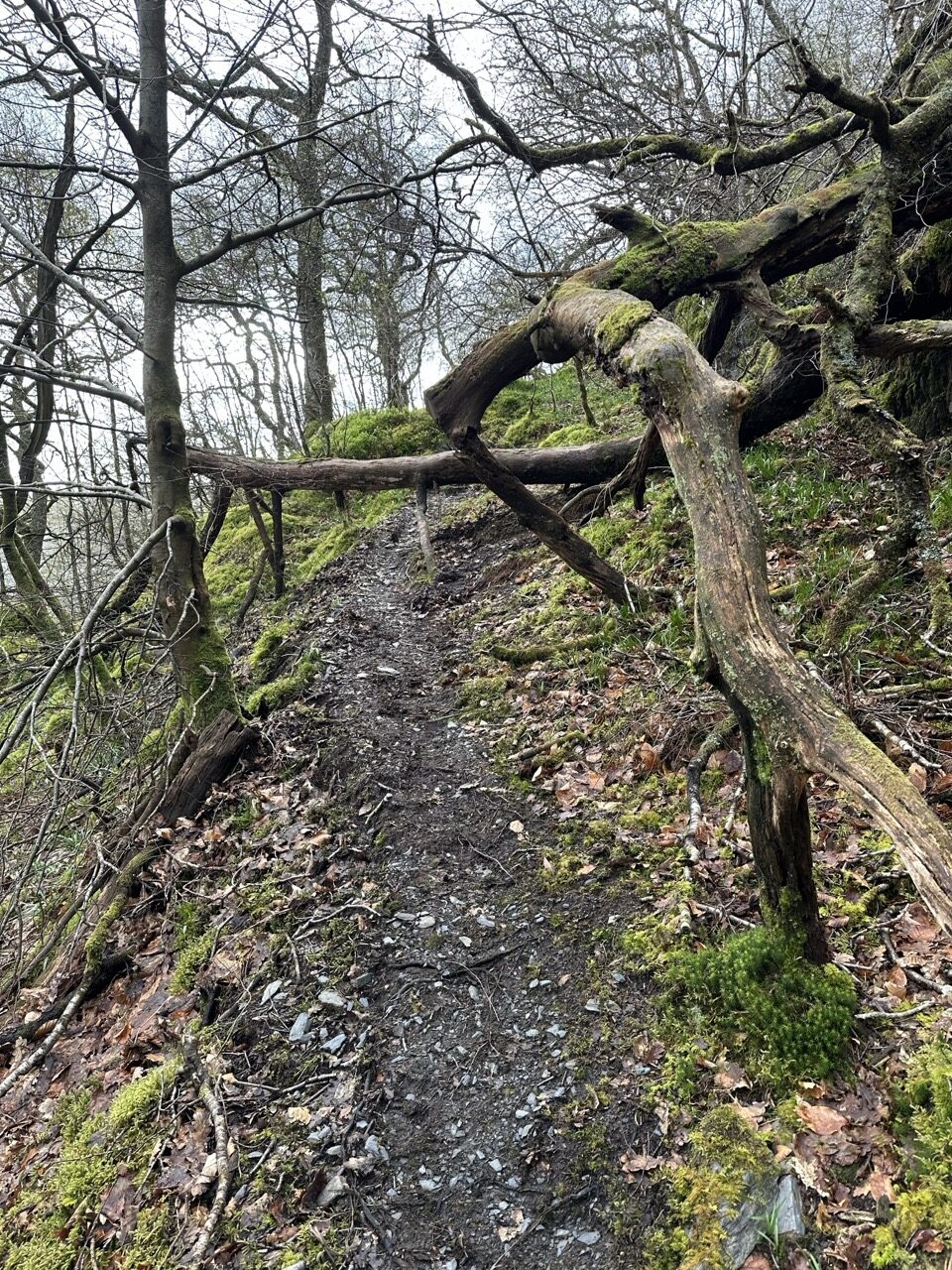
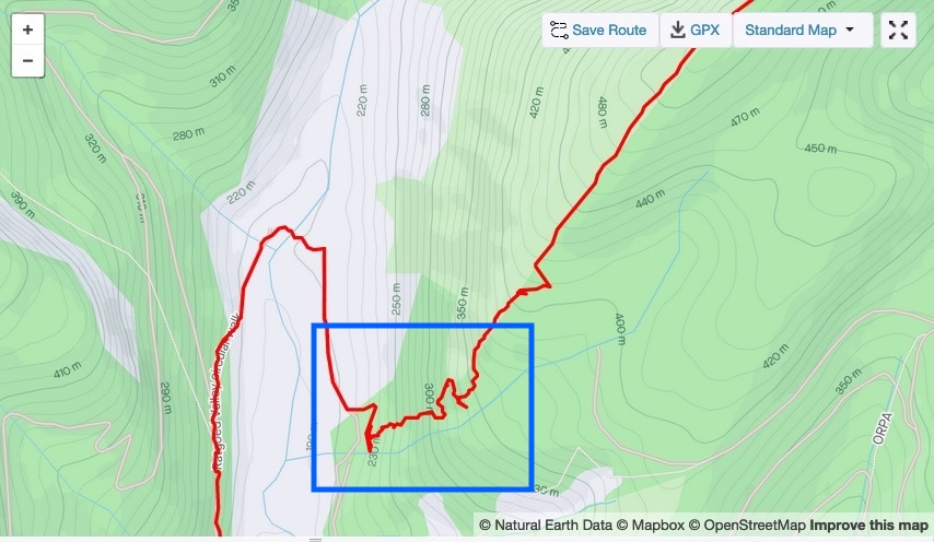
First I had to tackle an especially treacherous down hill section which starts near a ‘dead forest’. A view of hundreds of old broken and dead trees, many of which are still standing, and many of which have been precariously blown over in storms looms ahead as you begin descending.
A barbed wire fence blocks the way. I couldn’t find a gate or way through, so I ended up climbing it carefully to hop over into the ‘dead forest’. The descent here is very steep and kind of follows alongside a river/waterfall section.
I had to go very slowly through here as there was no clear or defined path that I could find at all. I probably missed the correct trail (if there is one). Highlighted in blue on my route is the section I took down.
Once at the bottom of the valley, it was a mostly easy and flat run back to Corris, and the Corris Institute. For me, this ended up being another 6-8 km or so.
I had been graced with decent weather all day, apart from the cold wind, but in the last couple of kilometers I was met with a bit of rain.
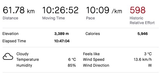
Finishing in about 10 hours 40 minutes, I covered a total of 62km, and 3,389 m of elevation gain. I’m not sure how I added 6 km to the route, but somehow I did. Probably some bad line choices along the way!
If you’re keen on testing yourself on a ’round’, the Corris Round was a lovely route that is achieveable in a long day out. It can be tough underfoot at times, and includes a lot of climbs and descents, but is worth it for the feeling of fulfillment at the end!
I feel I could have been perhaps an hour quicker, but over the course of the day didn’t push myself too hard as much of the ground was wet and boggy, and I wanted to enjoy the day out, not suffer!
Take a look at the official Corris Round short film here to get more insight into the route and creation of this challenge. It’s a lovely story and includes some great history too.
What an awesome trail run!
I love the story behind the Corris Round. Young Tom will surely be a great trail runner one day – I guess having had John Disley as his neighbour is be a great incentive, too.
Doing those difficult, boggy trails at a 10-minute pace is amazing, especially with all that elevation. Did they only have those red trail markers in the beginning? Even with the GPS guidance, it seems quite tricky to navigate (and not to fall off cliffs!)
You are definitely well prepared for the UTS 100km. One week to go! All the best for that, Sean!
After running that day all I could think of was how impressive it was for Tom and his Dad to have run the entire round in 11.5 hours. He definitely must have been spurred on by the history and having had John Disley as a neighbour.
I love the crossover here Catrina – John Disley is one of the cofounders of the London Marathon!
The only markers were the bits of red tape at the beginning. Otherwise if it were not for GPS and a device with the map, it would be a case of taking a map, noting all 12 hewitts, and then using a compass to navigate your way around. Map and compass is not for me though!
I’m in taper mode for UTS now. But it feels like everything is a ‘niggle’. I’ve had this before, so I’m hoping it is indeed just nerves and the brain making up problems for me to worry about.
I’m sure it’s just nervous niggles. All the best, Sean!!!
Great write up Sean, I came to this page today after completing the round yesterday. It feels like a sense of camaraderie and nostalgia as I read this as I share some of the feelings and experiences that you had on this mini-epic round.
Re: the final descent into the forest – from what I recall, there was a small break in the fence into the forest, which led to a small path off the firetrack and a scree-type/ slatey path that winds down back to the firetrack again – I very much did a windy route down that forest but was mostly walkable/runnable to the road.
Great run and I’ll enjoy reading about some of your other adventures.
Hi Amrit,
First off, congratulations on completing your round! How did you find it overall? It’s lovely to hear from someone else who has done it.
Thanks for the insight into that section into the forest and down toward the road. I definitely missed that break in the fence. If/when I do it again I’ll probably go and recce that part first to find the opening. It was a bit frustrating for me pacing around trying to locate a good way down. Your route sounds like the ‘correct’ one.
Cheers!