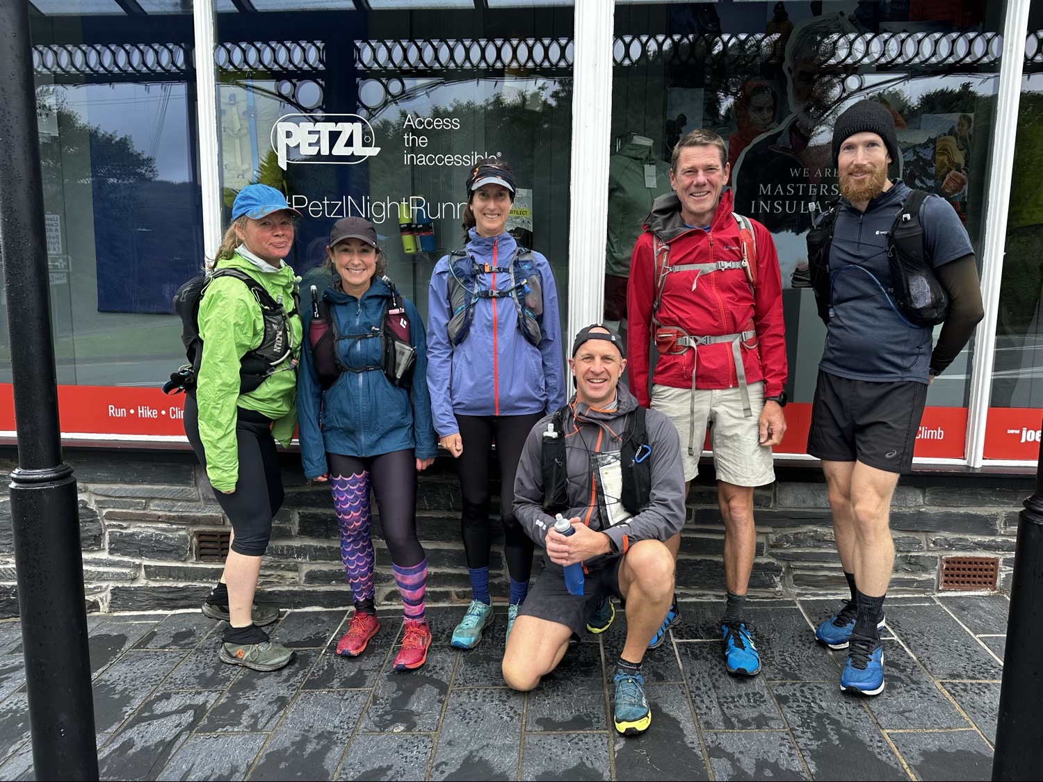
Over the last week I spent 3 days in North Wales doing a Paddy Buckley Round ‘experience’ with a group organised by Climb South West.
The Paddy Buckley Round is a fell running challenge in Snowdonia, Wales (Eryri). The full route itself forms a circuit of a bit more than 100km, with around 10,000m of climbing elevation. You must hit all 47 summits on the route.
I thought I would write up the experience from my perspective, and hopefully it provides a bit of insight to those wishing to tackle it too.
We took on roughly 20-23 miles (32-35km) per day, with an average climbing elevation of about 3200m (10,500ft).
There were two reasons I wanted to do this – one is I would like to attempt a sub-24 hour Paddy Buckley Round at some point in the near future, and the other is 3 x tough days in the mountains on extremely technical terrain, with a lot of time on feet is great training for the Dragon’s Back Race I’ll be taking on in September.
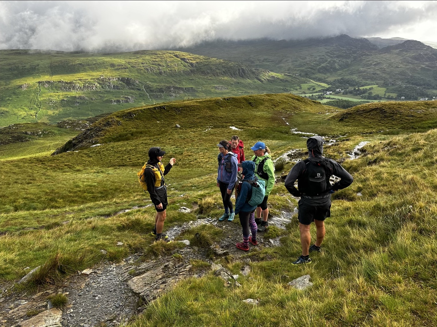
Day 1 – Leg 1 Capel Curig to Croesor
Staying in the Rocks Hostel in Capel Curig, we were well positioned to start with this leg of the round.
Moel Siabod
The first climb goes up to the top of Moel Siabod. The trail up is at first very rocky and features a lot of fern and heather growth.
A bit further up and it gets quite technical in places with masses of rock everywhere making foot placement tricky. Intense focus is required to ensure you don’t roll over on your ankles.
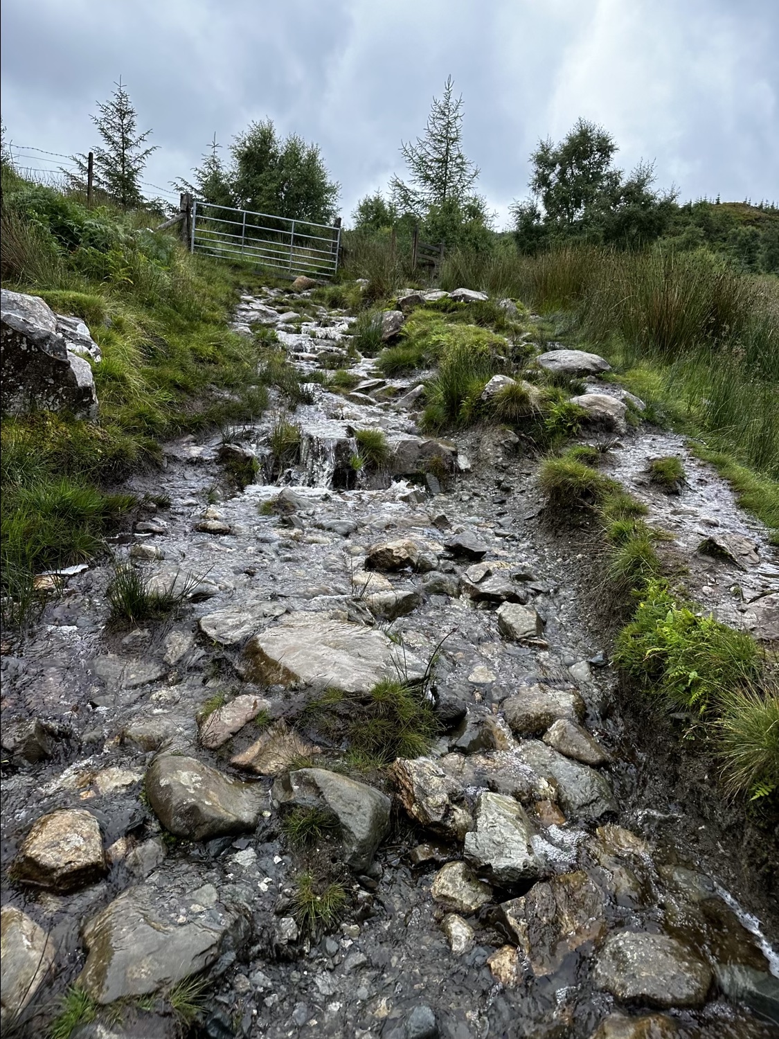
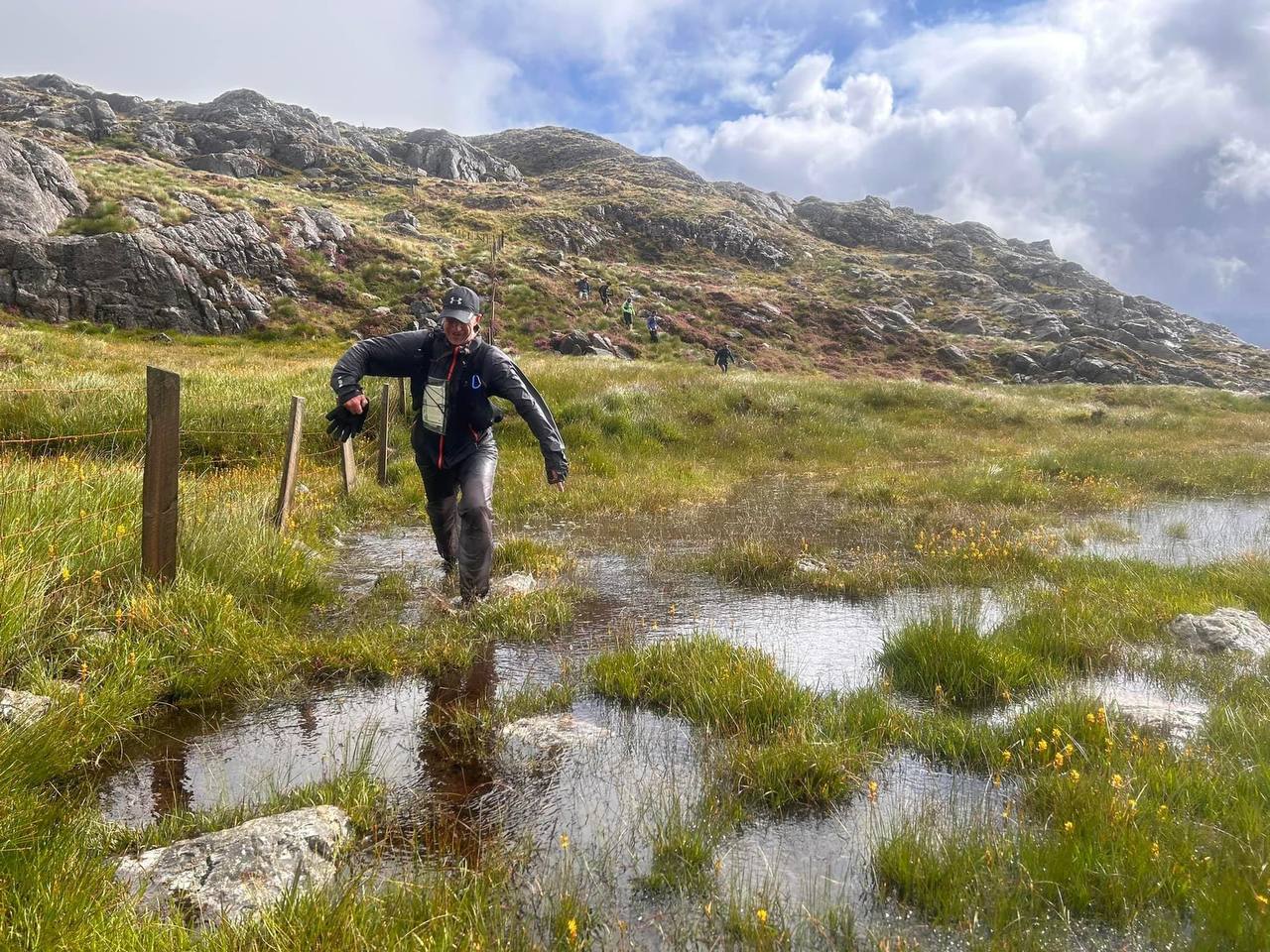
There was a lot of rain the days before (and on the day) so the rocky trail was essentially just a flowing river.
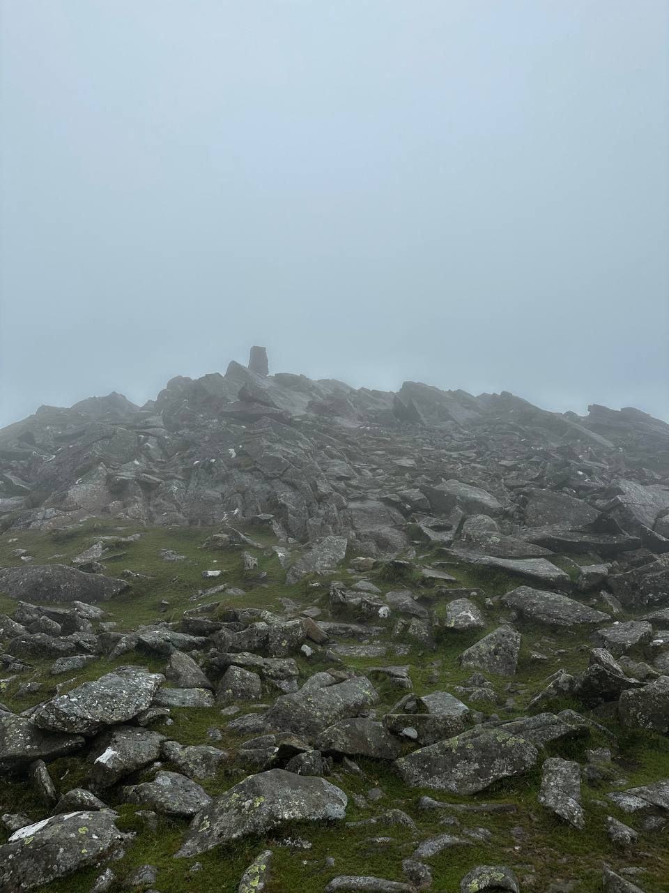
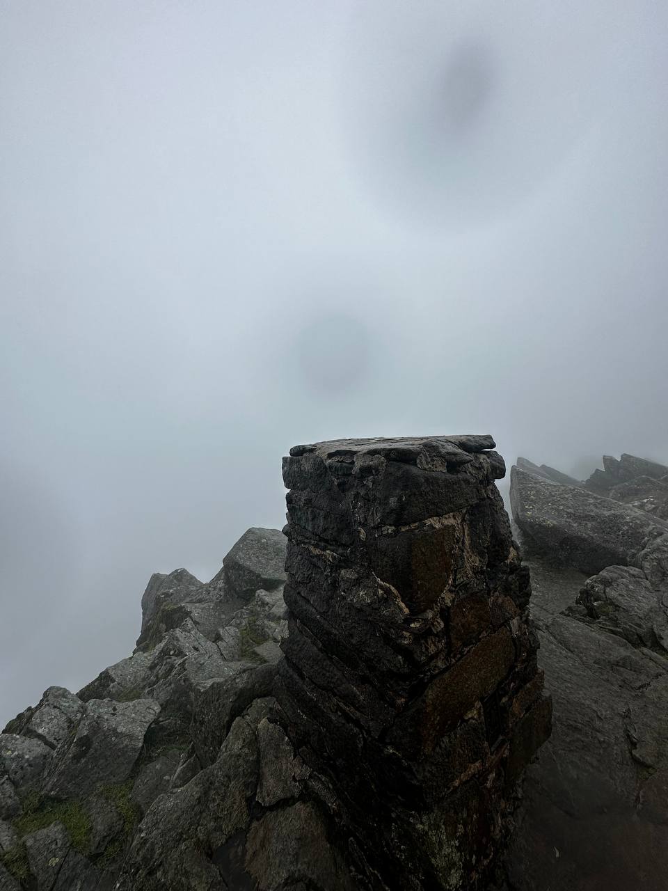
Shells and waterproofs were soon on as the temperature dropped with our gaining altitude. Near to the top of Moel Siabod we entered the cloud layer. The last bit of the mountain has tons of rocks and boulders around the summit, with a bit of a chicane that can be followed to reach peak.
We reached the top with a bit of rain and much intensified wind. Our shoes were already drenched at this point in, and the remained this way with the constant bogs, water logged sections, rain, hail, etc for the rest of the day.
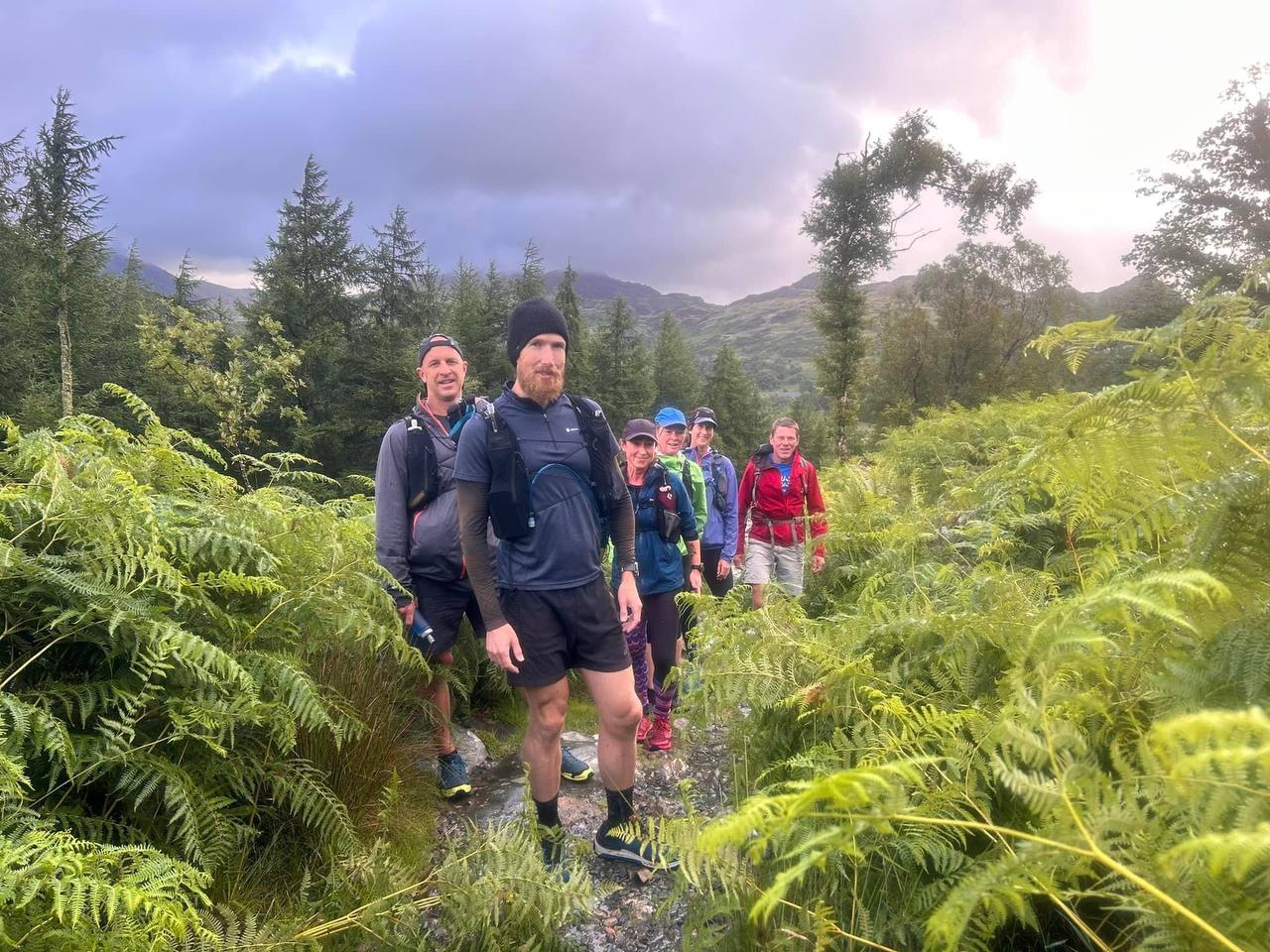
A bit of fell running
With Moel Siabod done, there was a nice bit of down hill fell running to enjoy. Although the weather had other plans on the enjoyment bit as we were whipped around in the wind and had our faces stung with hail.
Many more peaks bagged
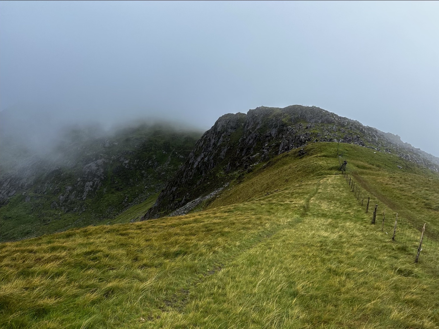
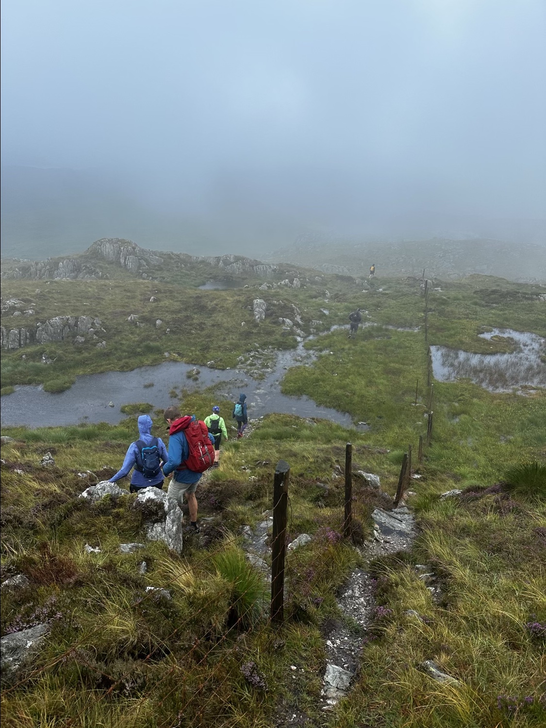
The next part of the day had us tackling more of the Moelwyns. The ground was extremely waterlogged and wet. There were tons of bogs everywhere around and it was impossible to maintain dry feet for the remainder of the day.
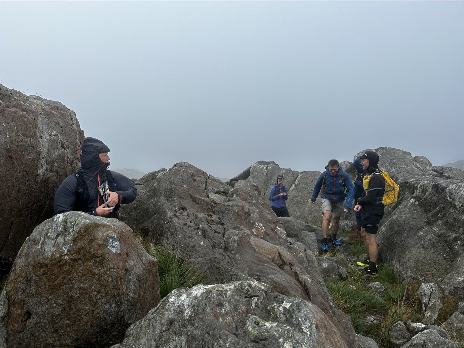
Many of the peaks in this section were tricky in terms of navigation. Some were quite close together and of similar heights, making it difficult to know exactly which ones to bag and which were not needed for the 47 total.
It was all good fun though, and we were of course not racing against the clock either. During this section one of the guys, Chris, took an unlucky step across one boggy section and dropped all the way in to chest height!
Battling the elements we continued to bag summits.
Here are a couple of short videos showing some of the terrain and increasingly windy conditions.
Roughly half way through the day we took shelter and refueled in an old building in an abandonded slate quarry. Some of the group went back to the hostel/camp while the rest of us continued on into the worsening weather.
Bad weather
The bad weather definitely held off for us in the morning, arriving pretty much just after our refueling break. This video taken by Justin (our guide) pretty much sums the rest of the afternoon up:
B and I were even knocked over by the wind as we neared the summit of one of the later mountains. An extra strong gust suddenly hit as we passed over the saddle near the top (usually where wind can really intensify on a mountain). We both had to drop down to the ground so as not to get blown any further off.
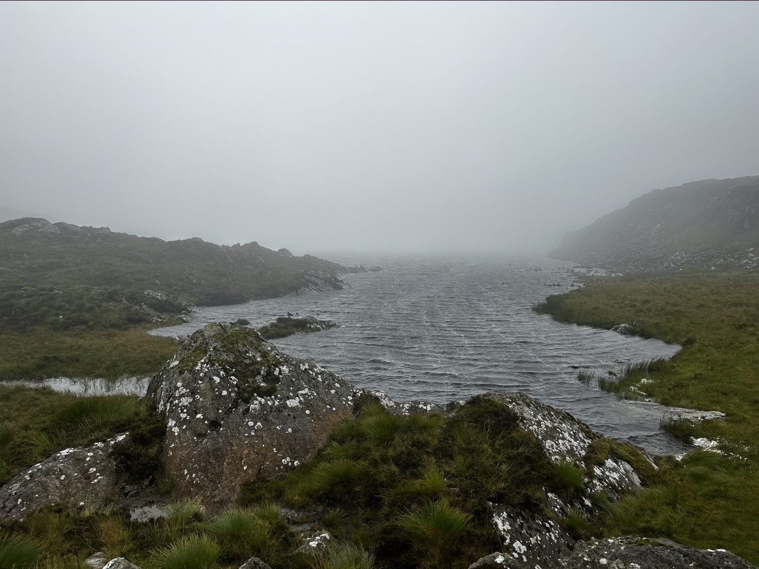
Due to extremely bad weather near the end of the first day, we made the decision to skip Cnicht. This was to be the last peak to tackle of the day. After hitting the top of Moelwyn Mawr we headed past the Llyn Croesor body of water. From here, we took a gravel track down toward Croesor. The track ran parallel on the left side of Cnicht. Soon enough we hit the road where a van was parked waiting to collect us.
Soaked and cold we piled into the van ready to be transported home. Only we found that the lights had been left on after the earlier group departed and the battery was flat! Luckily Josh, who was helping out with logistics managed to quickly secure help from a nearby farm to jump start us, and we were soon on our way back for hot showers.
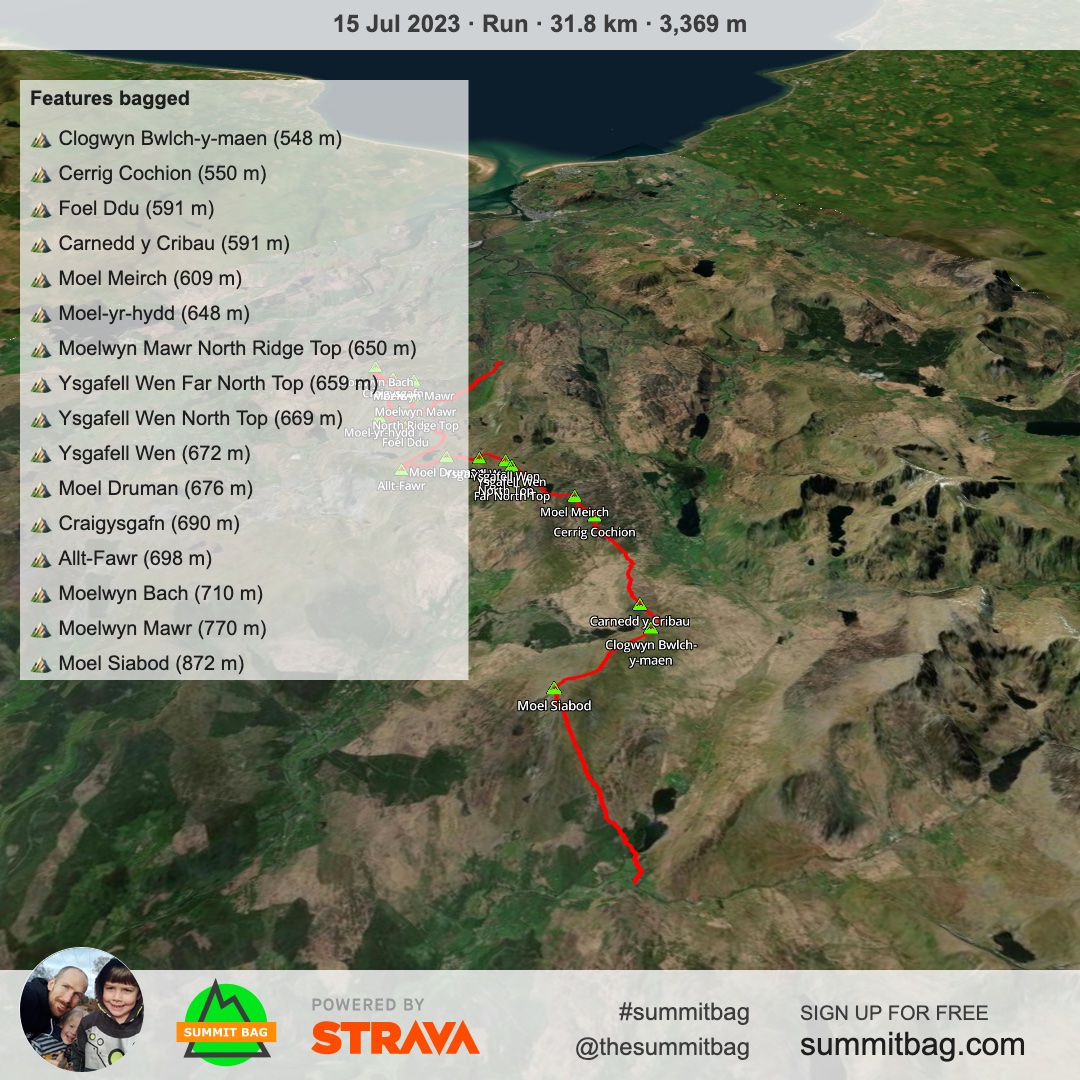
In total, for this leg we managed to get the following summits/peaks:
| Name | Grid Reference | Altitude in meters |
| Carnedd Moel Siabod | SH705546 | 872 |
| Clogwyn Bwlch-y-maen | SH679542 | 548 |
| Carnedd y Cribau | SH676536 | 591 |
| Cerrig Cochion | SH662510 | 550 |
| Moel Meirch | SH661502 | 607 |
| Ysgafell Wen | SH664487 | 650 |
| Mynydd Llynnau’r Cwn | SH663485 | 669 |
| Three Tops | SH667481 | 672 |
| Moel Druman | SH671476 | 676 |
| Allt-fawr | SH681474 | 698 |
| Bwlch Cwmorthin | SH665462 | 470 |
| Foel Ddu | SH669459 | 458 |
| Moel-yr-hydd | SH672454 | 648 |
| Moelwyn Bach | SH660437 | 710 |
| Craigysgafn | SH659444 | 689 |
| Moelwyn Mawr | SH658448 | 770 |
Oh wow!! That weather was insane!! I’m impressed that you held out for so long and only skipped the last summit. Well done for grit and endurance!!
It’s interesting that although the mountains are not that high, you still managed to accumulate an incredible 3’400m of elevation in those 32k. My guess is that you couldn’t stay at your gained altitude, but needed to drop down quite low after every peak. Impressive!!
I think I would have had a meltdown with that flat battery situation. Yay for helpful farmers!
Looking forward to the next instalment!
The weather really did build us up (in terms of having the worst). After that day I felt way more prepared for difficult, wet, cold days in the mountains. I’m very happy we stuck it out and kept going.
Yes – I wondered if you would notice the altitude stats for the mountains Catrina! The highest mountain in Wales in Snowdon (Yr Wyddfa) – at about 1080 meters (we included it on day 2). Quite different to your region I’m sure. Many of them drop down quite low so you need to descend a fair bit and then climb again leading to the high elevation stats for each day. The middle bit of this first leg we did didn’t have too much descending between peaks (you can kind of make it out on that summit bag picture above with the map, or if you look at the strava route) but there are enough mountains on each leg to quickly add the elevation up.
We actually tried ‘bump starting’ the van while Josh was out getting someone to jump start us. We think the van had some kind of electronics or system that prevented it though, as we did 3 or 4 push start attempts with all of us pushing in the car park. Not idea on tired legs – haha!
Thanks for reading as always :]