Continuing on with the Paddy Buckley Round blog series, this post details the experience over legs 2 and 3. These experience or ‘recce’ days were done with Climb South West as a group effort.
See the the previous part 1 (leg 1) blog post here
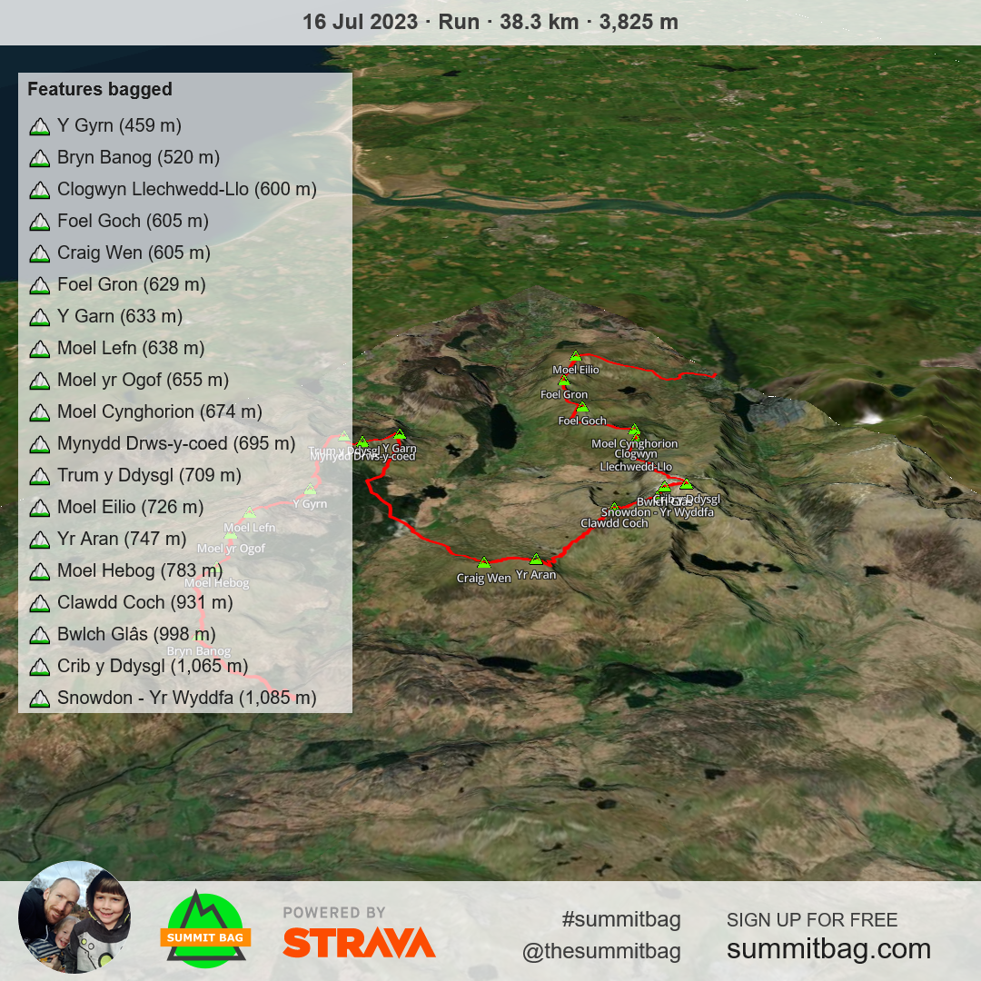
My Strava activity shows we covered about 38km (24 miles) on this stretch (day 2 of 3) with about 3800m (12,500ft) of elevation. The route we followed started at Nantmor and ended up with us finishing in Llanberis.
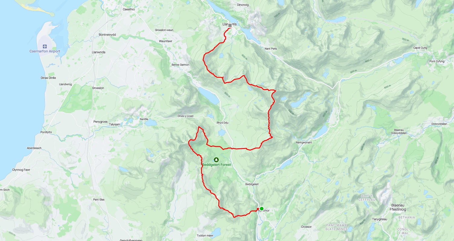
We bagged about 19 peaks on this day (according to Summit Bag) with the highest being Snowdon (Yr Wyddfa).
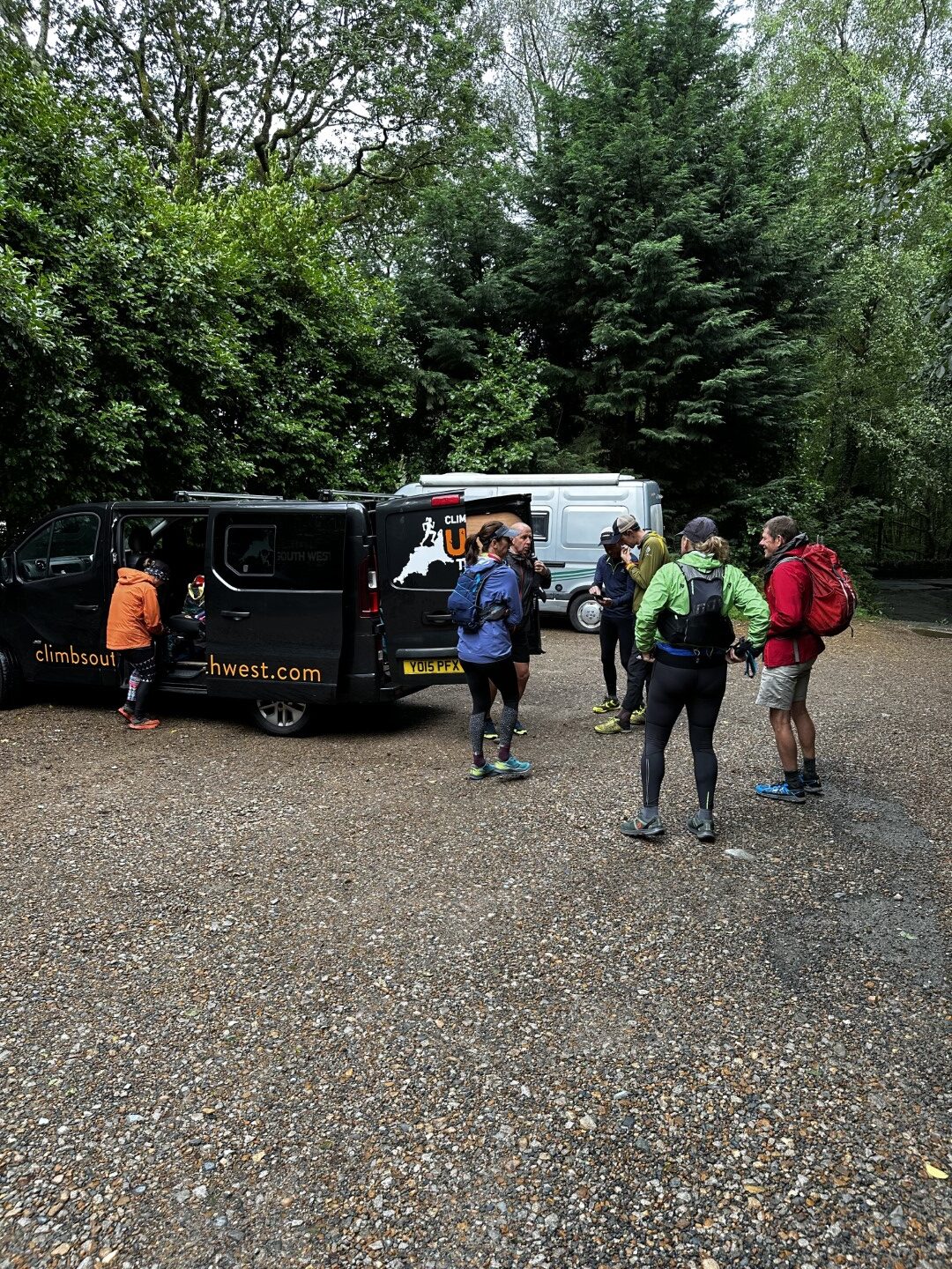
Morning Start
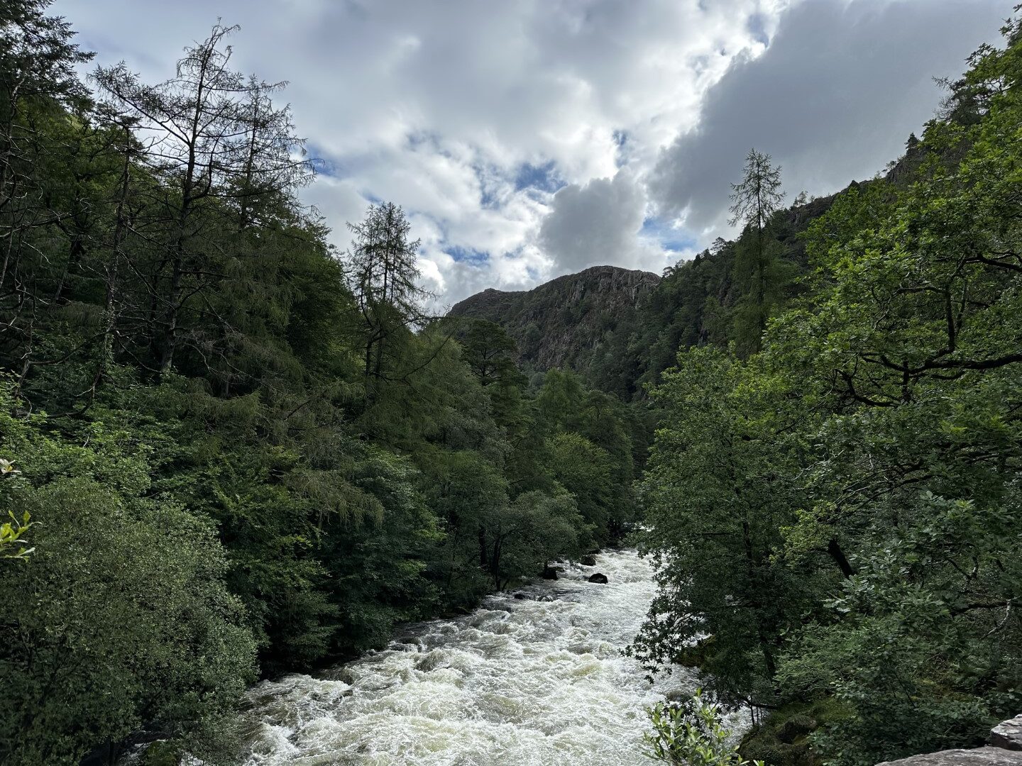
A short drive from the hostel where we were staying landed us in a parking lot near the small hamlet of Nantmor. From here we crossed the Afon Glaslyn river and headed straight up a steep woodland section which eventually opened up into a very wet and boggy hill.
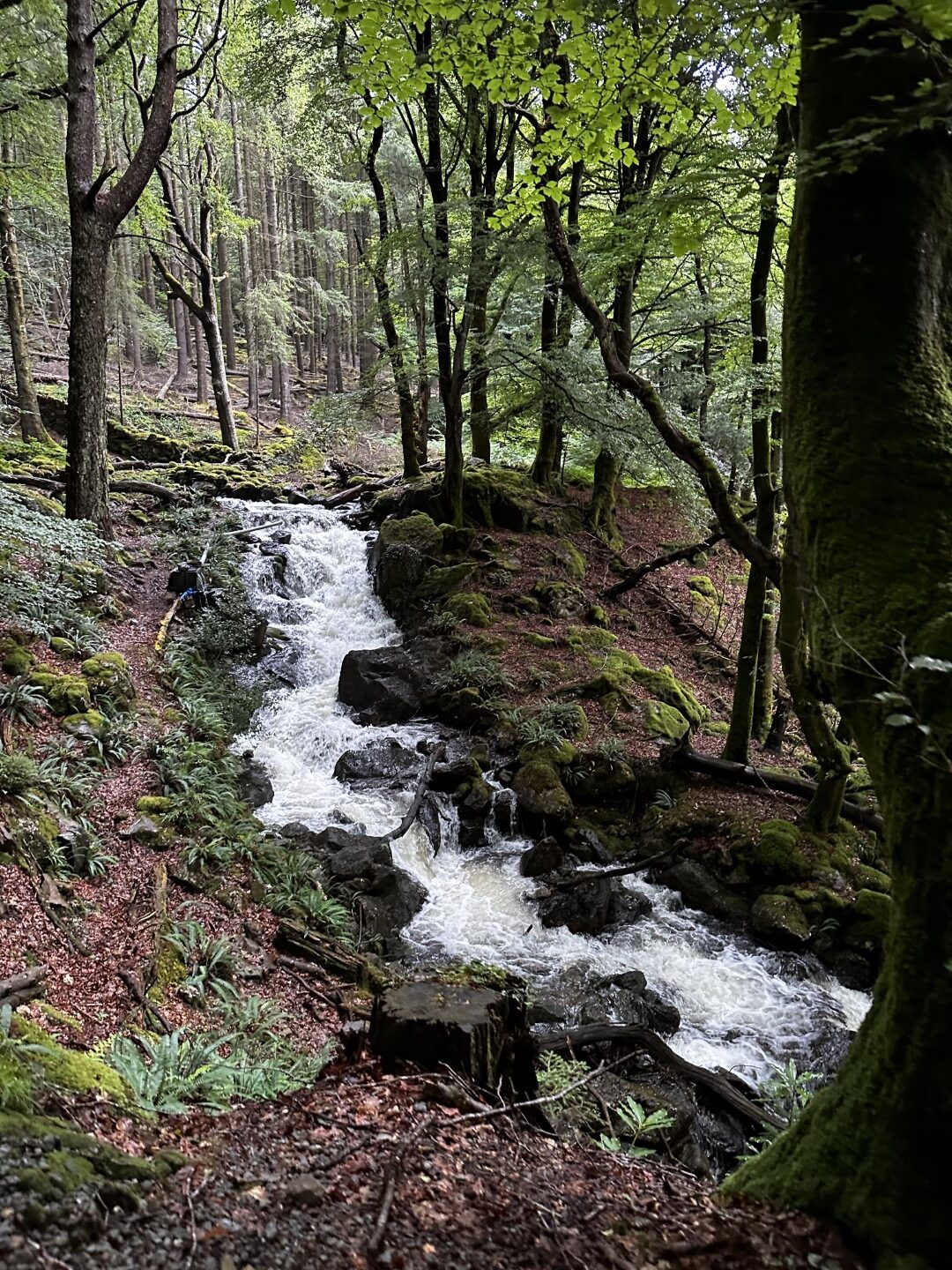
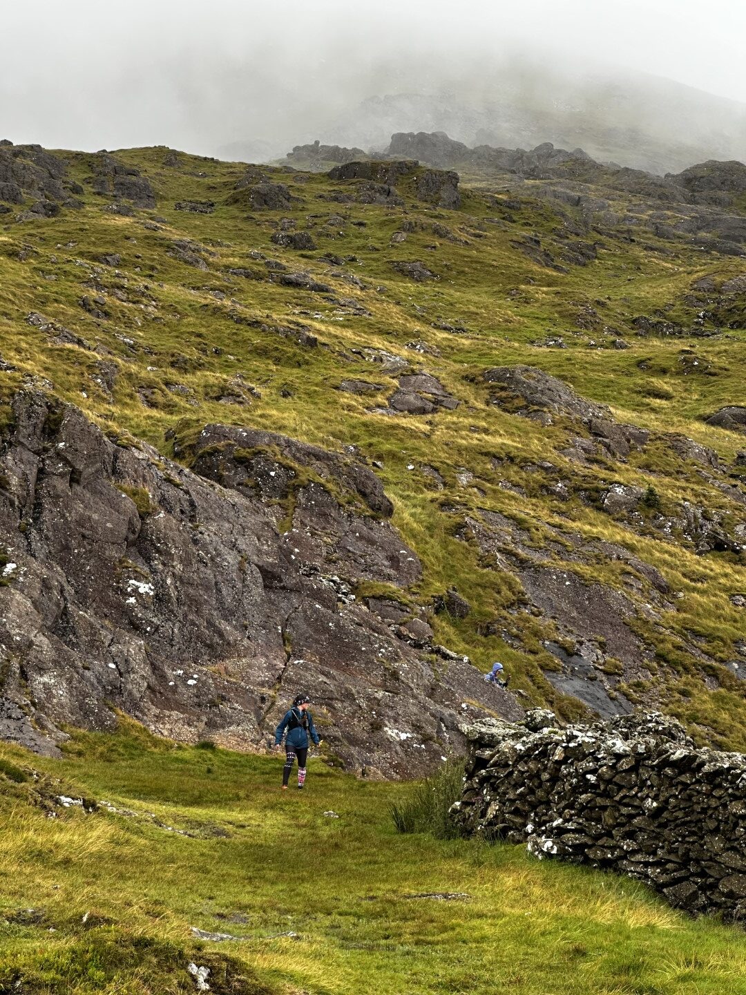
The climb up out of the woodland/forested section opened out onto a boggy section of hill which was really only the start of the climb to our first two peaks of the day – Bryn Banog and Moel Hebog.
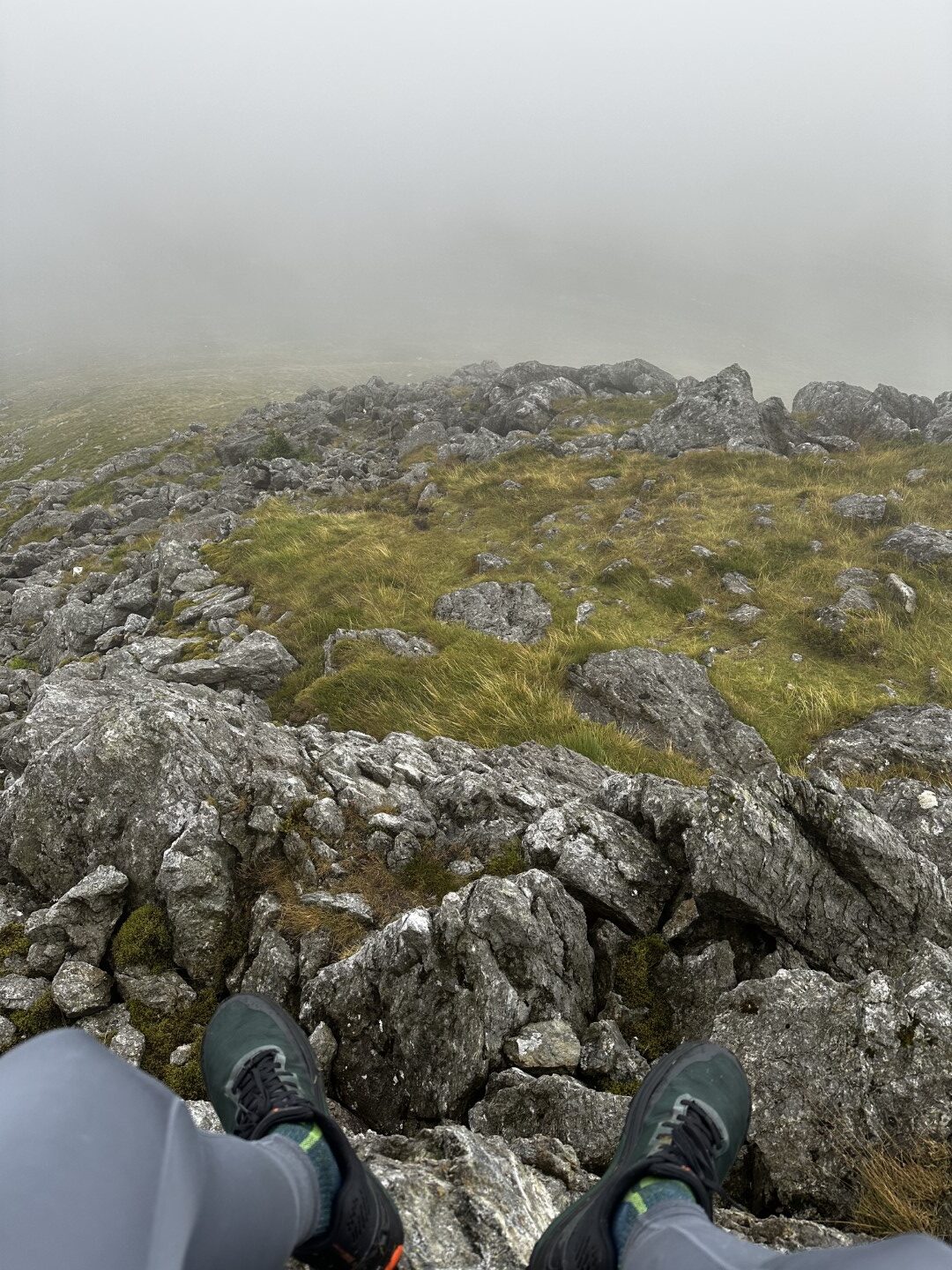
Immediately feet were soaked through the bogs, but at least for today the weather was holding in our favour (compared to the day before!)
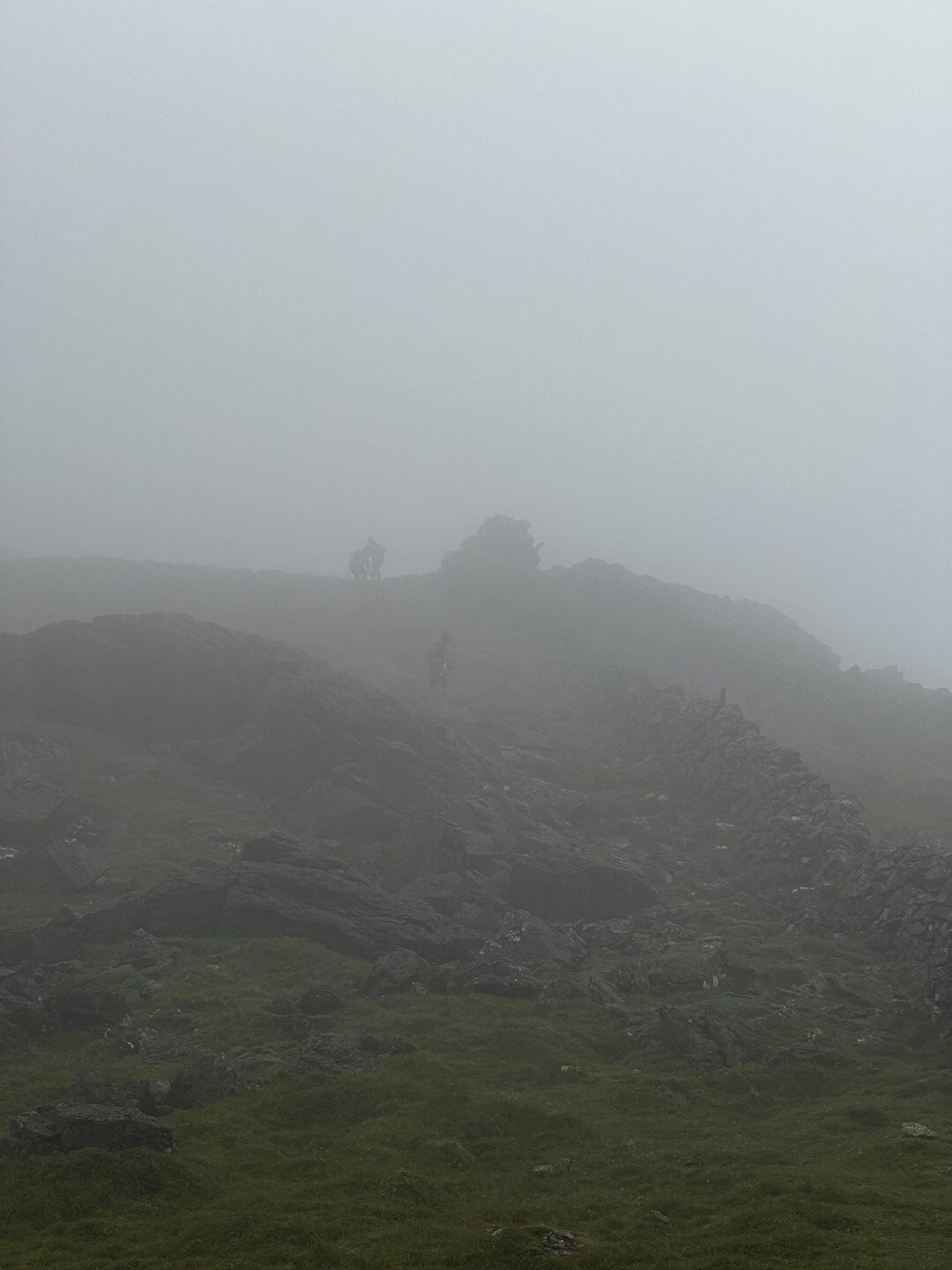
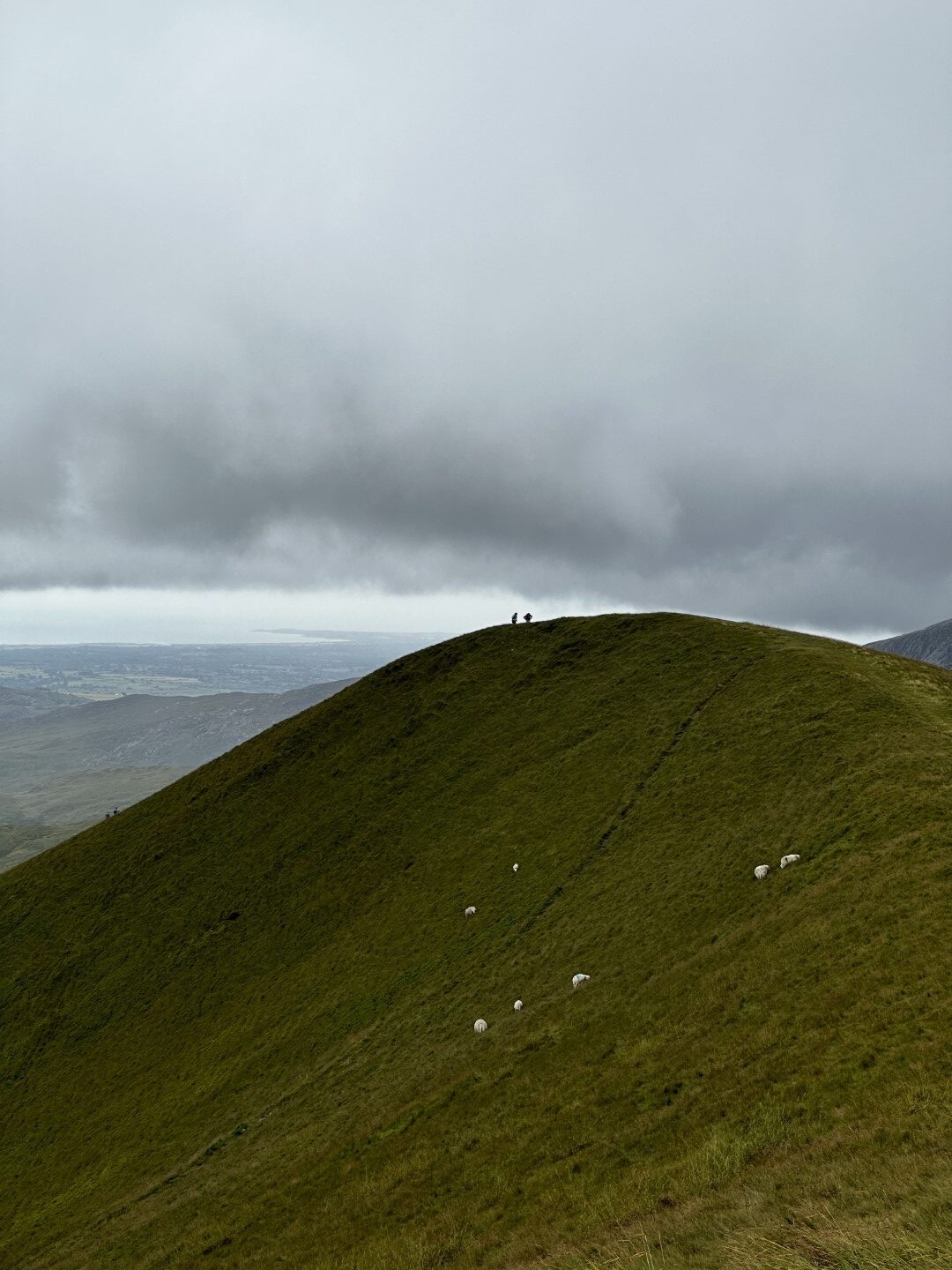
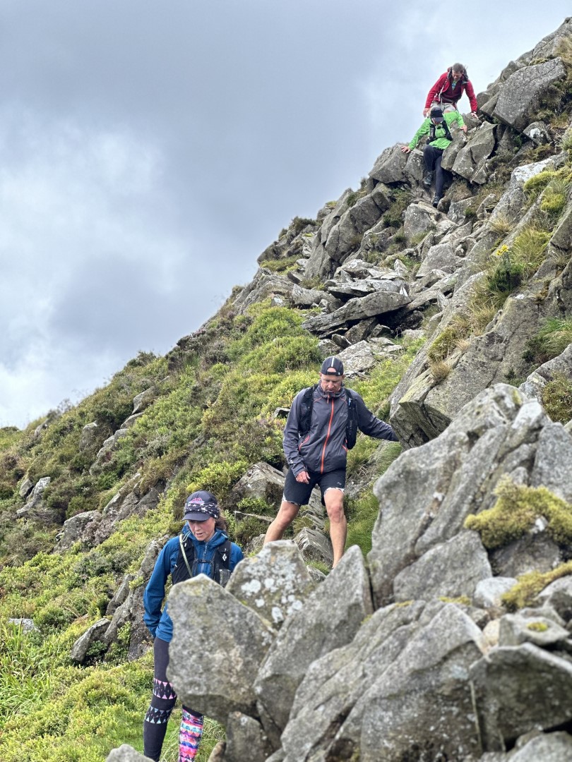
The first running of the day came shortly after our first peak of the day. Coming down through the cloud on quite a steep incline the trail was a mixture of grass and rocky switch backs. On day 2 of the Paddy Buckley round recce, this was first bit of fun for me. Here is the view looking back up as some of the group came in behind us.
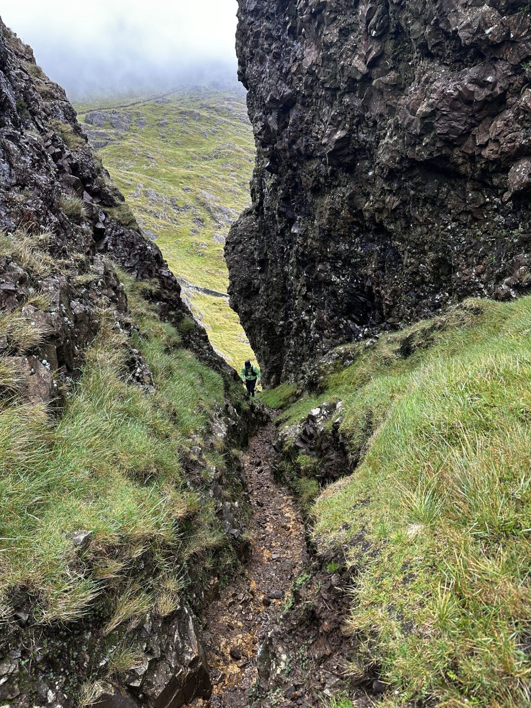
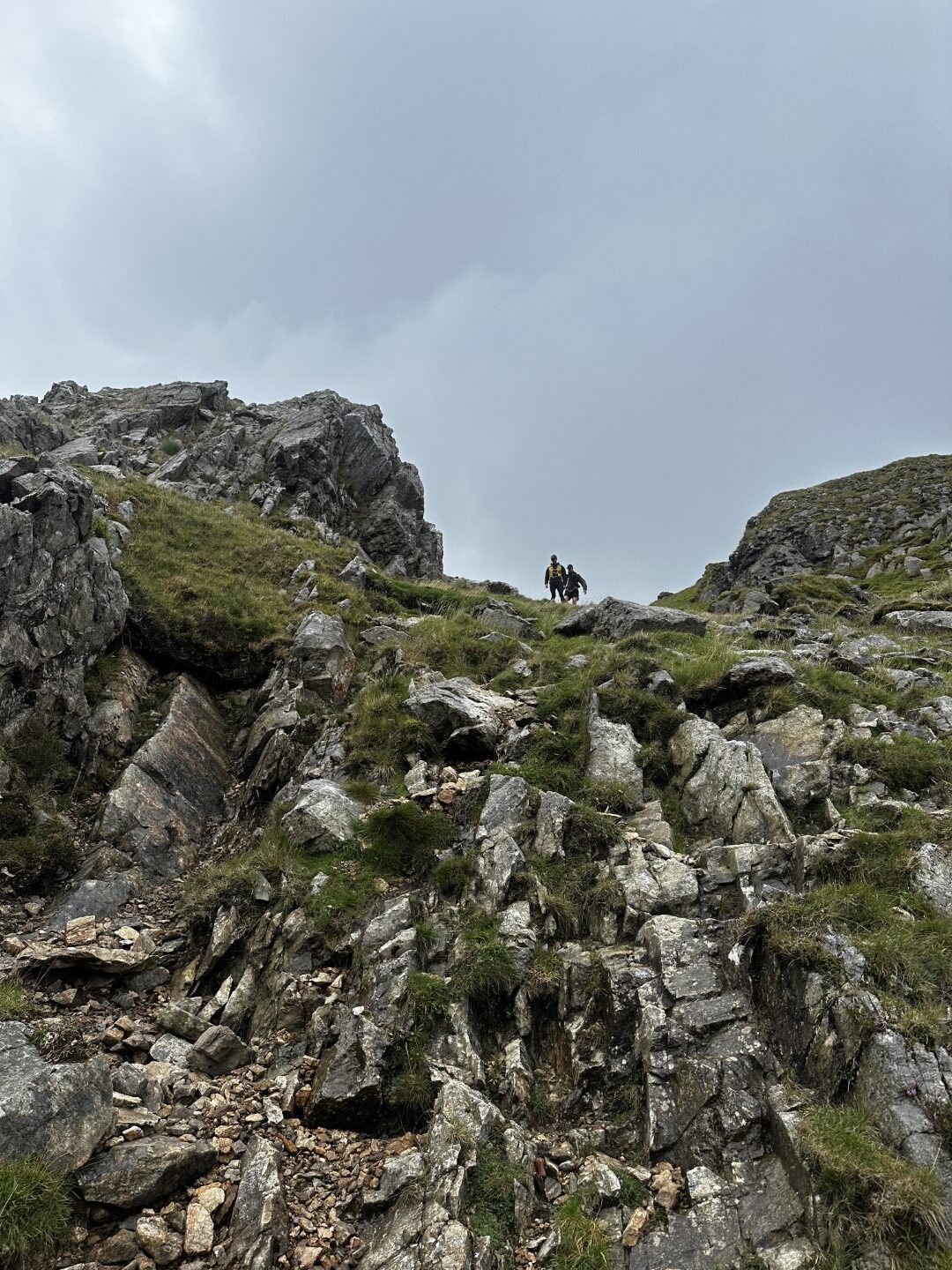
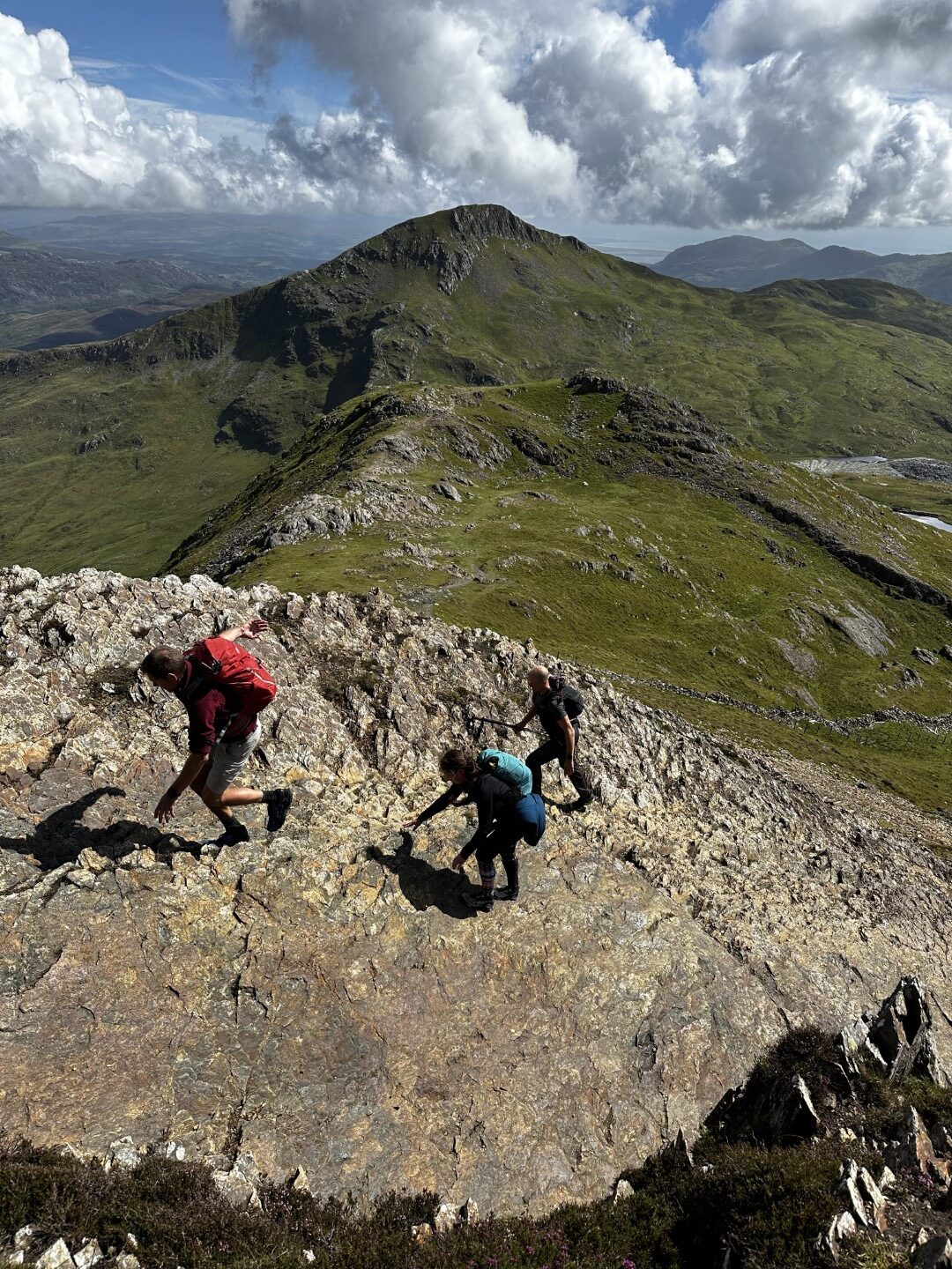
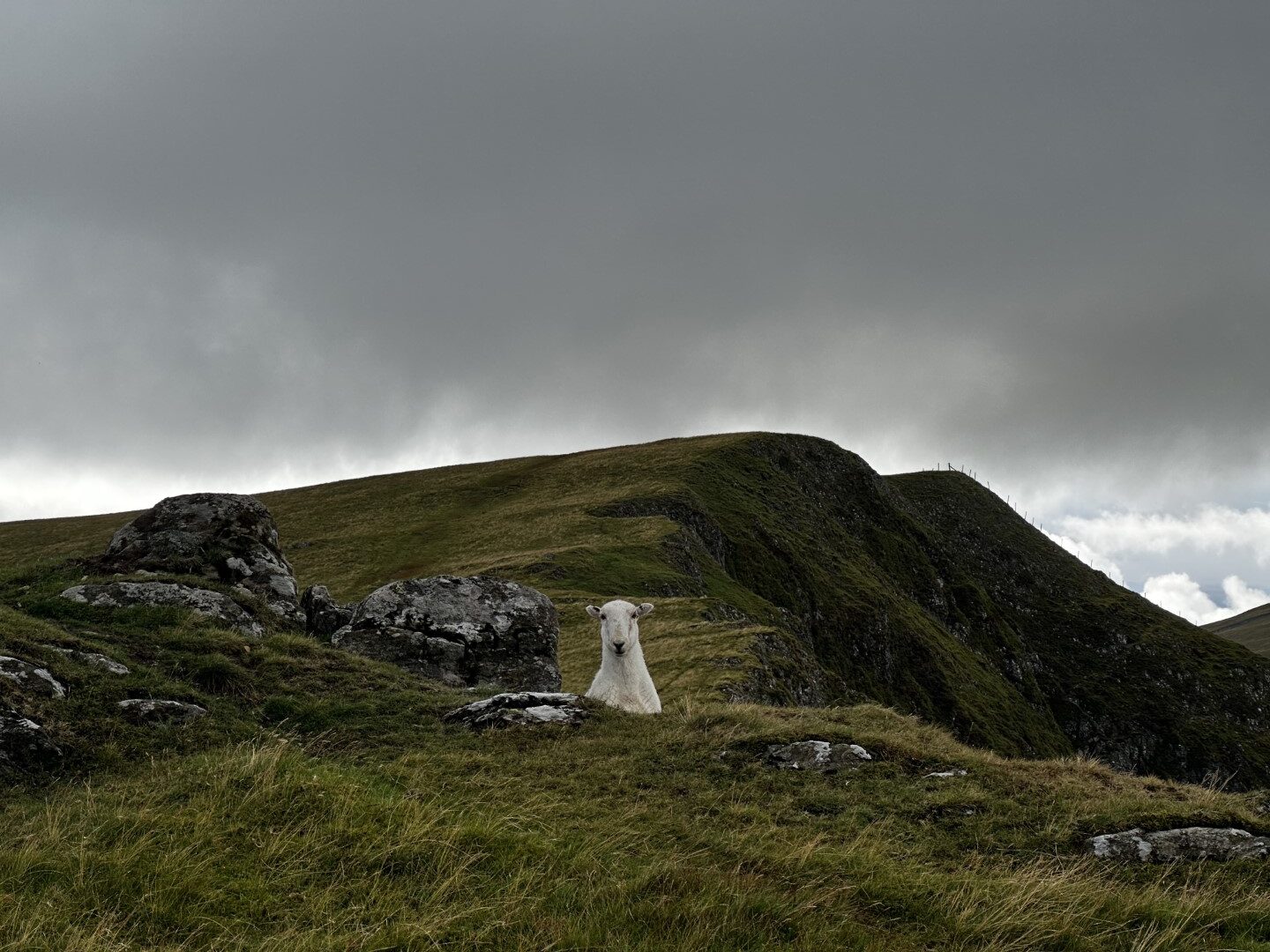
After the first two peaks, we forged on ahead to Moel yr Ogof, which includes a fun little crevice to climb up through.
Continuing the Nantlle Ridge
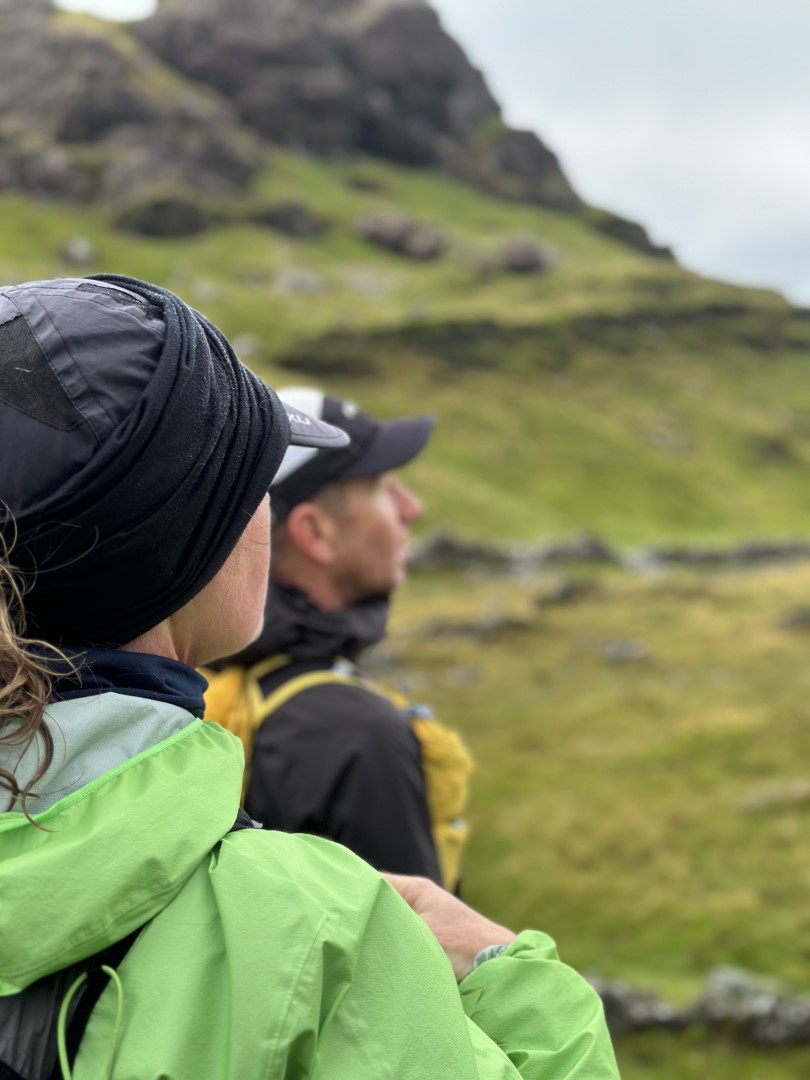
Proceeding onward, we summited Moel Lefn, Y Gyrn, Trum y Ddysgl, Mynydd Drws-y-coed, and Y Garn. Unfortunately my Welsh is not great at all, so I can’t translate these names, but I do know that “Moel” is “bald” or “bare” and “Mynydd” is “mountain”.
At this point I ran ahead for a bit and scrambled up some rocky bits to perch myself on one of the many peaks we were busy traversing. According to the others I was perfectly camoflaged in my all grey gear – nobody could see me as they approached and I watched.
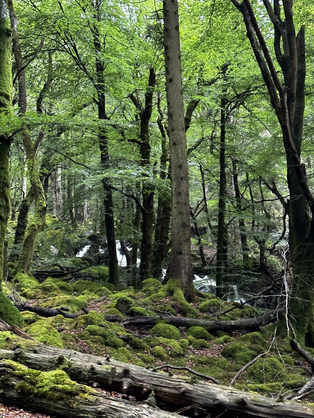
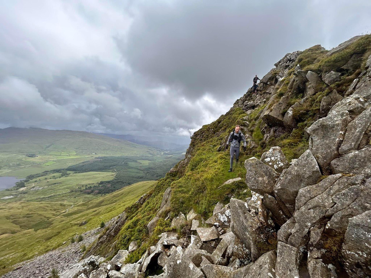
The peaks in this area surrounded the Coedwig Beddgelert region, which includes a bunch of forest and woodland in the lower lying area below.
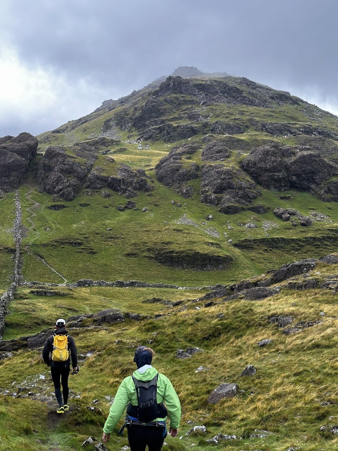
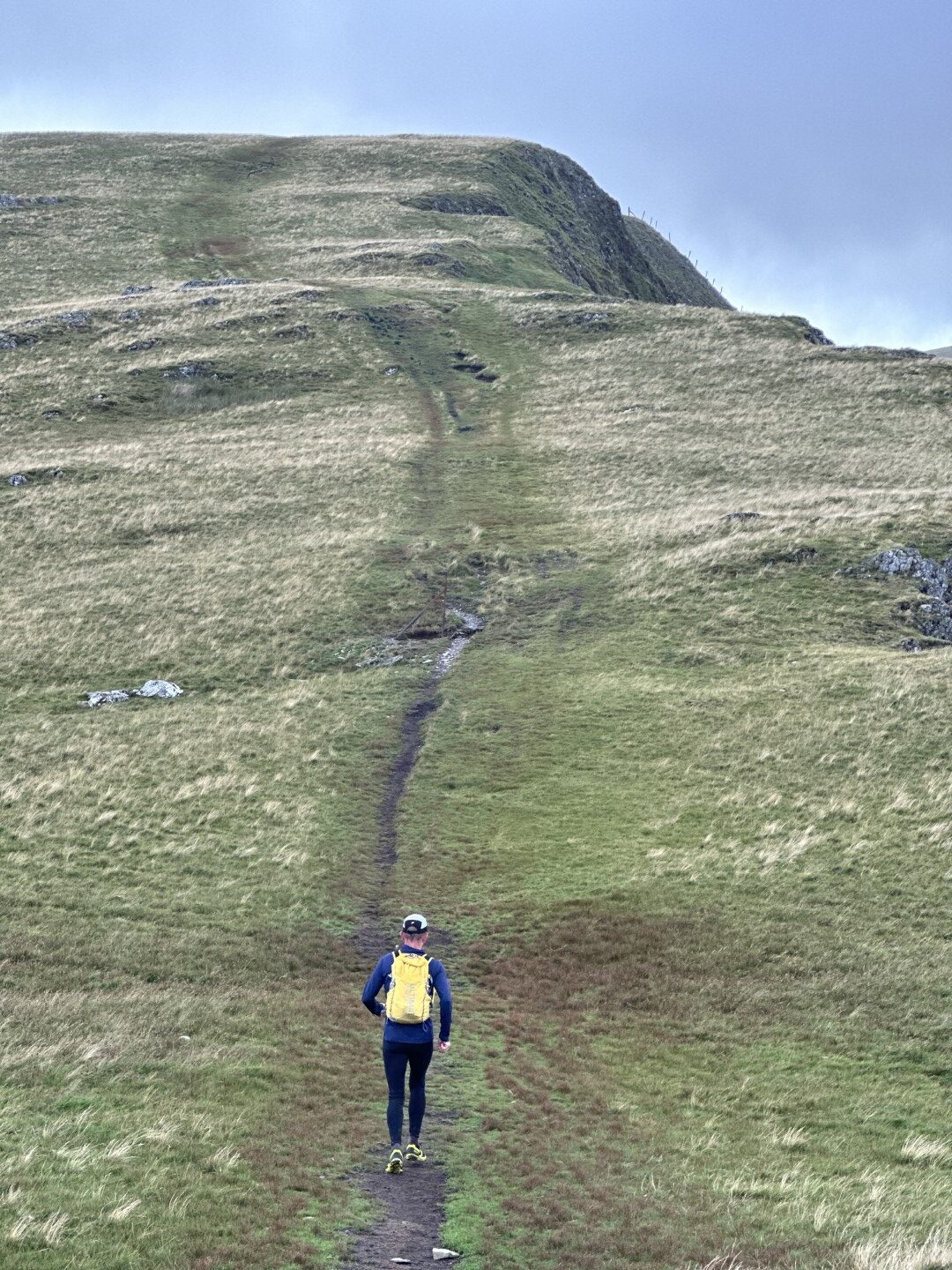
One of the climbs in this region was particularly cruel – a bare and grassy hill with very steep gradient, leading up onto a bit of a ridge.
Howard (one of the group) ended up power hiking up the last 1/3 passing by myself and Justin – his energy seemed to light up a bit of friendly competition in us all. I followed closely behind and as we crossed over the more level ridge we both broke out into a sprint to end of the ridge. He was quick, but not quick enough once I opened my stride!
It was a lot of fun though and really got the lactic acid levels up straight after that very steep climb.
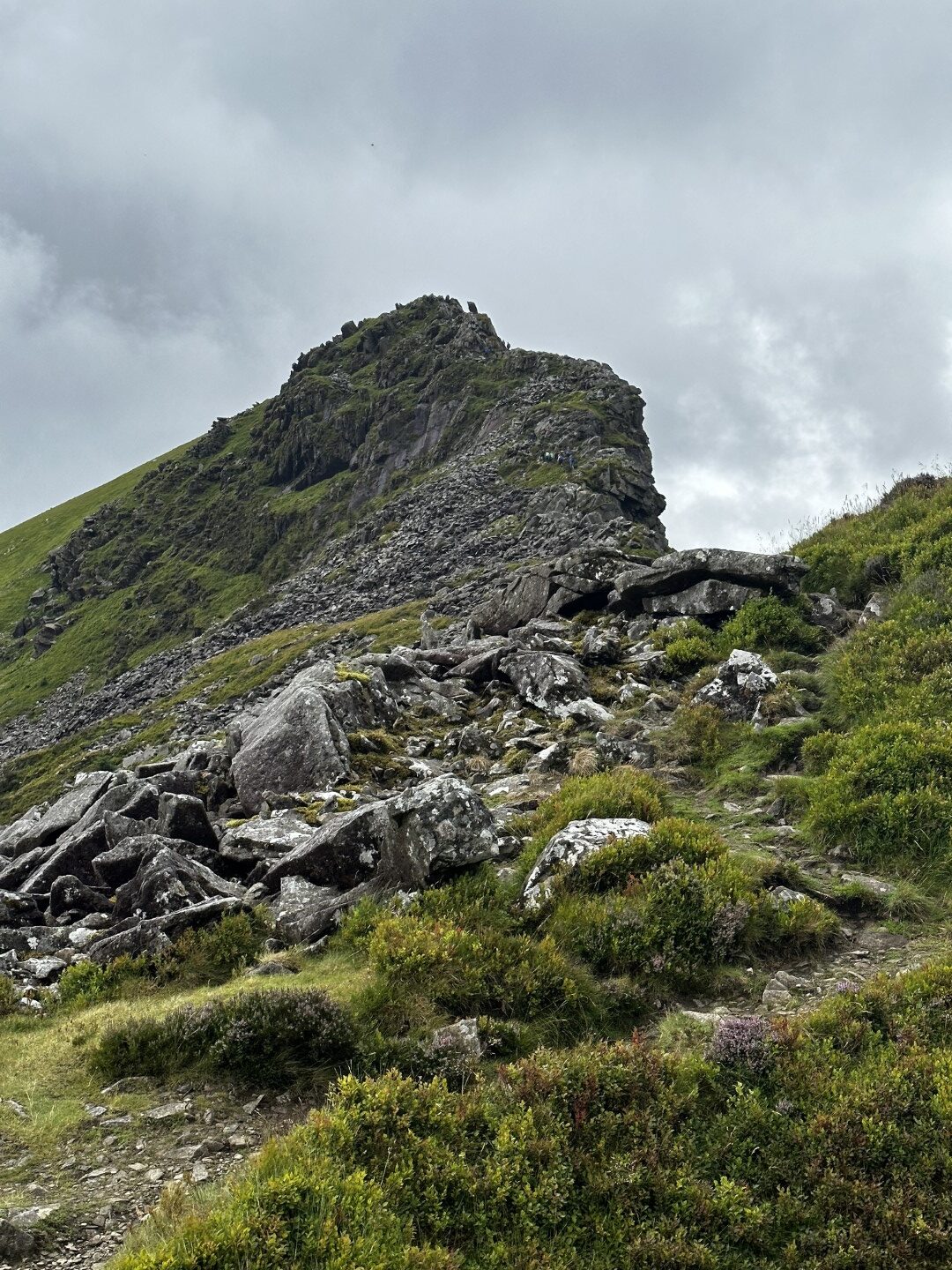
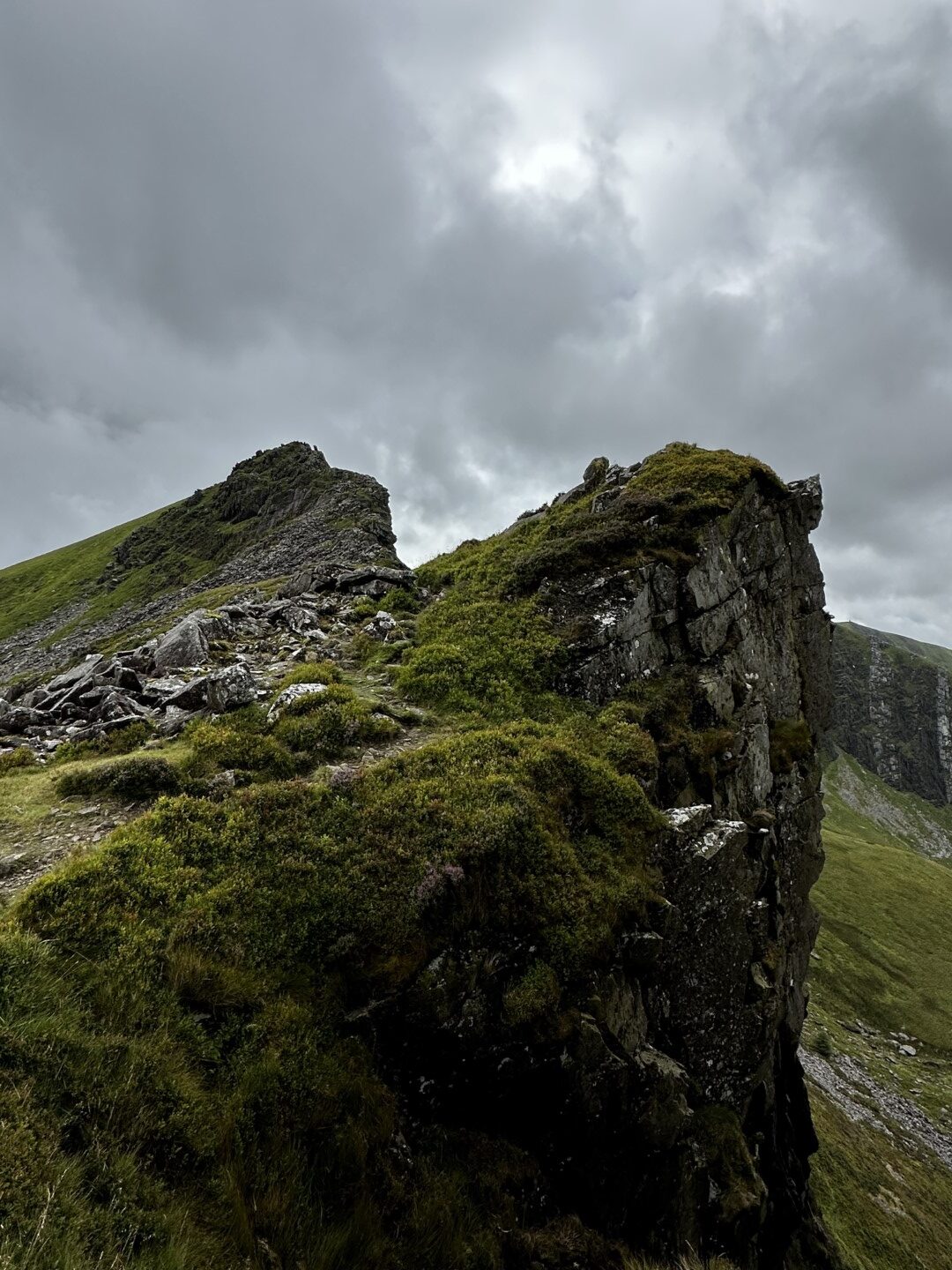
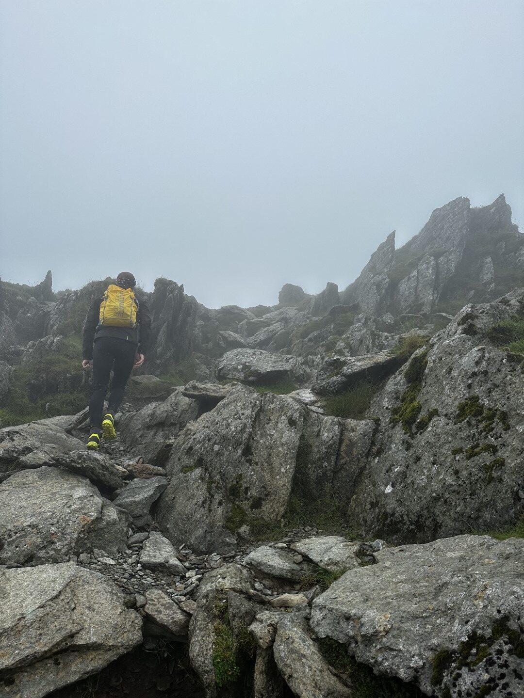
More Scrambling, and more Peaks
A bit of scrambling down some rocky sections, and some more climbing and we were over Mynydd Drws-y-coed.
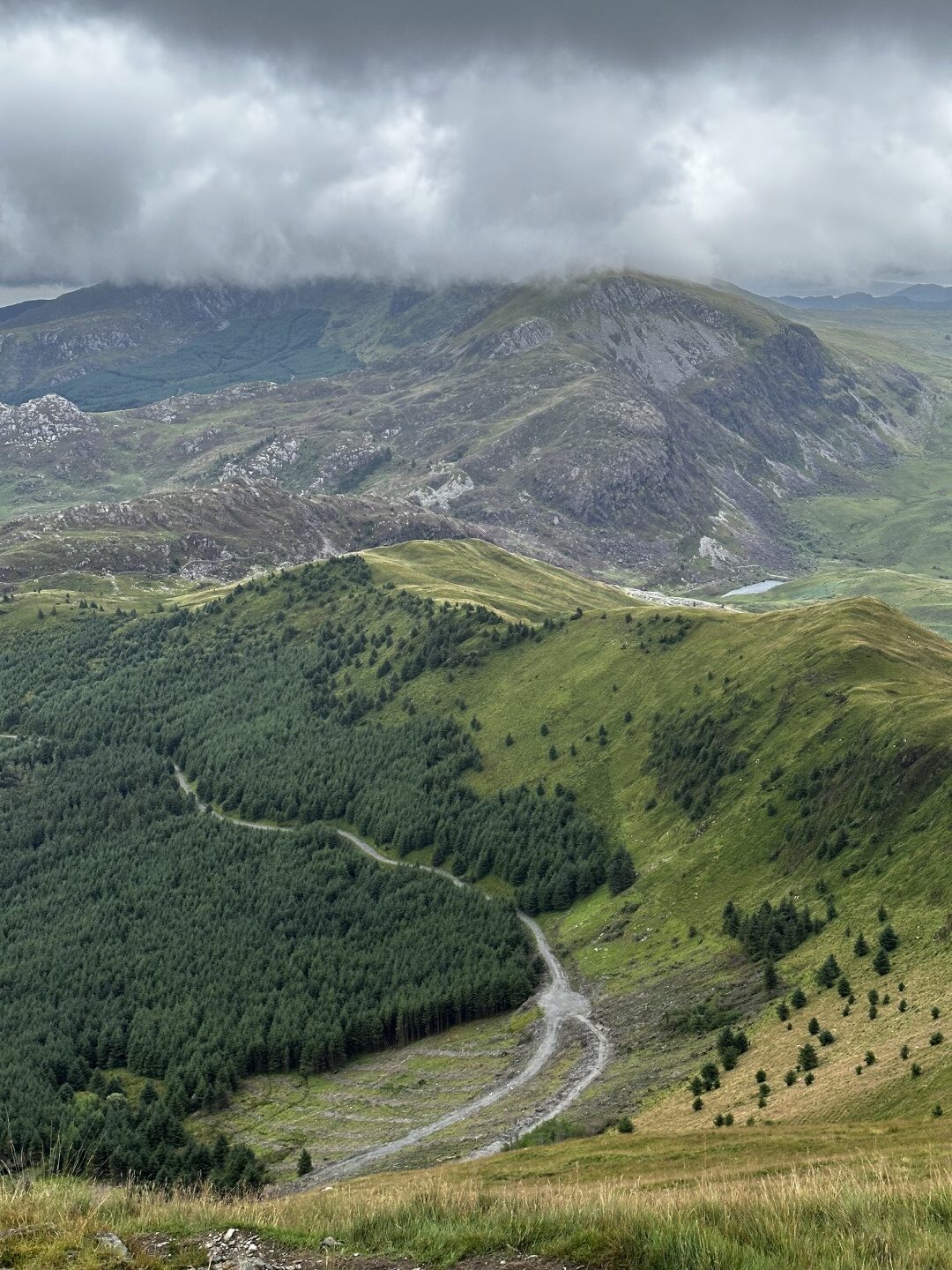
After making our way down through the forestry and a bit of gravel fire track, we met back up with the van by the A4085 road. The plan was to get some food and hot drinks before continuing on with the rest of the day.
This stop was perfectly timed. As we approached the van the sky opened up and a wave of torrential rain came down. We sat in the van enjoying 30 minutes rest and hot coffee / soup, and snacks. Just as we were finishing up the rain stopped. It couldn’t have been planned any better for this day out exploring the Paddy Buckley Round.
Onward toward Snowdon
Although the rain had stopped, we still had to cross a particularly water-logged bog just after the road as we began the climb toward Craig Wen. Shoes were soaked once again, but after the hot food, drinks, and snacks the spirits were still high.
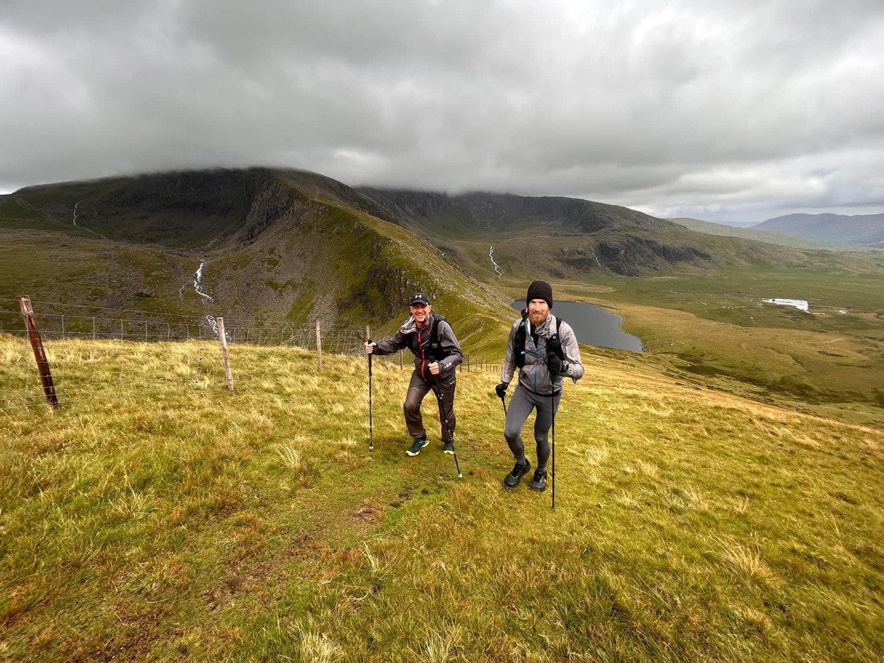
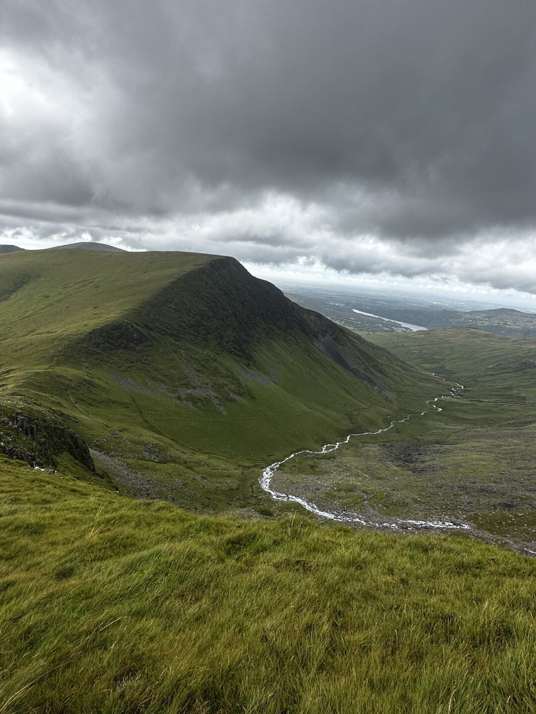
We forged on ahead to summit Yr Aran, and Clawdd Coch. The weather changed once again giving us a nice bit of sun to enjoy the climbing and mini-scrambles.
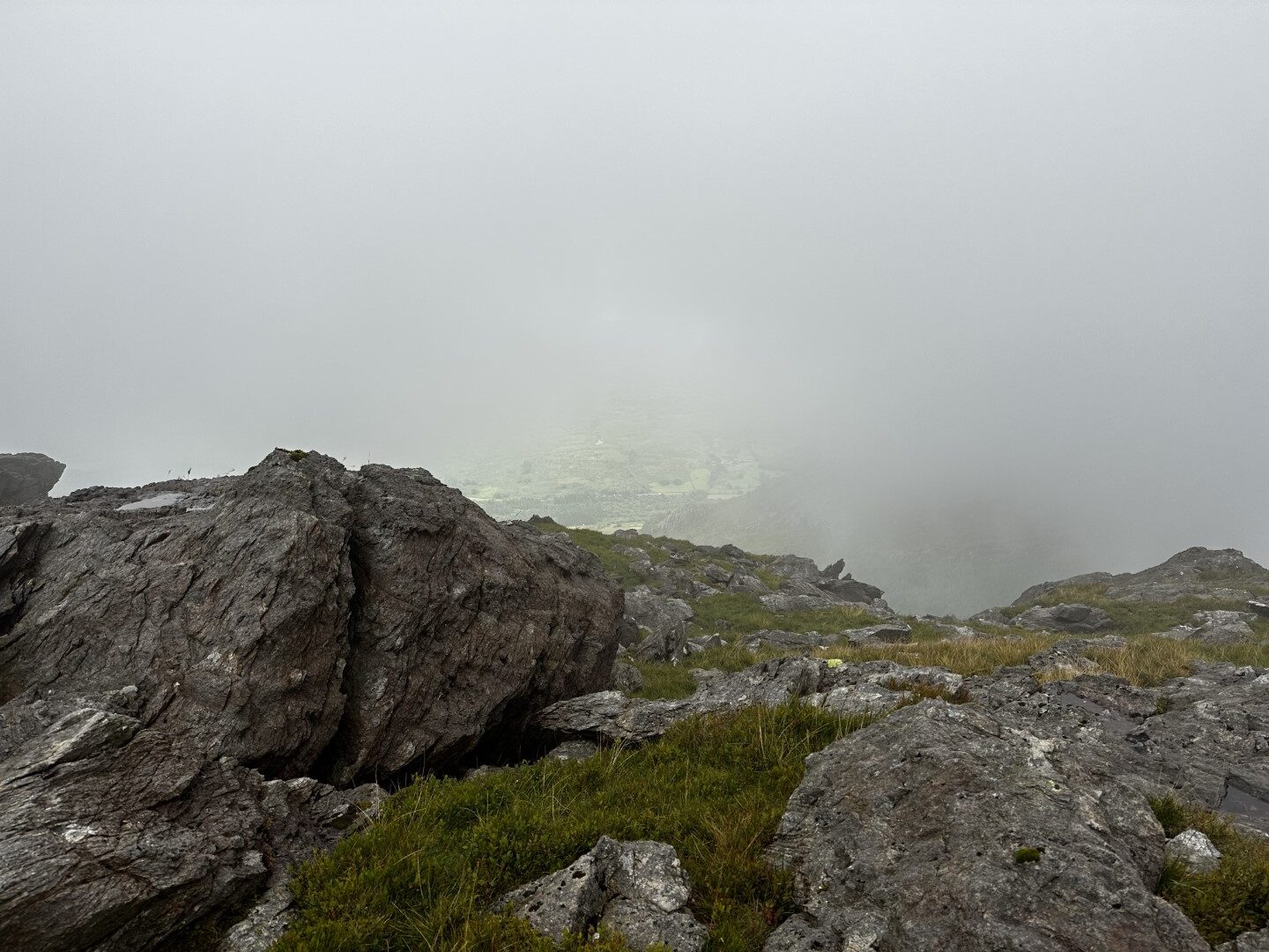
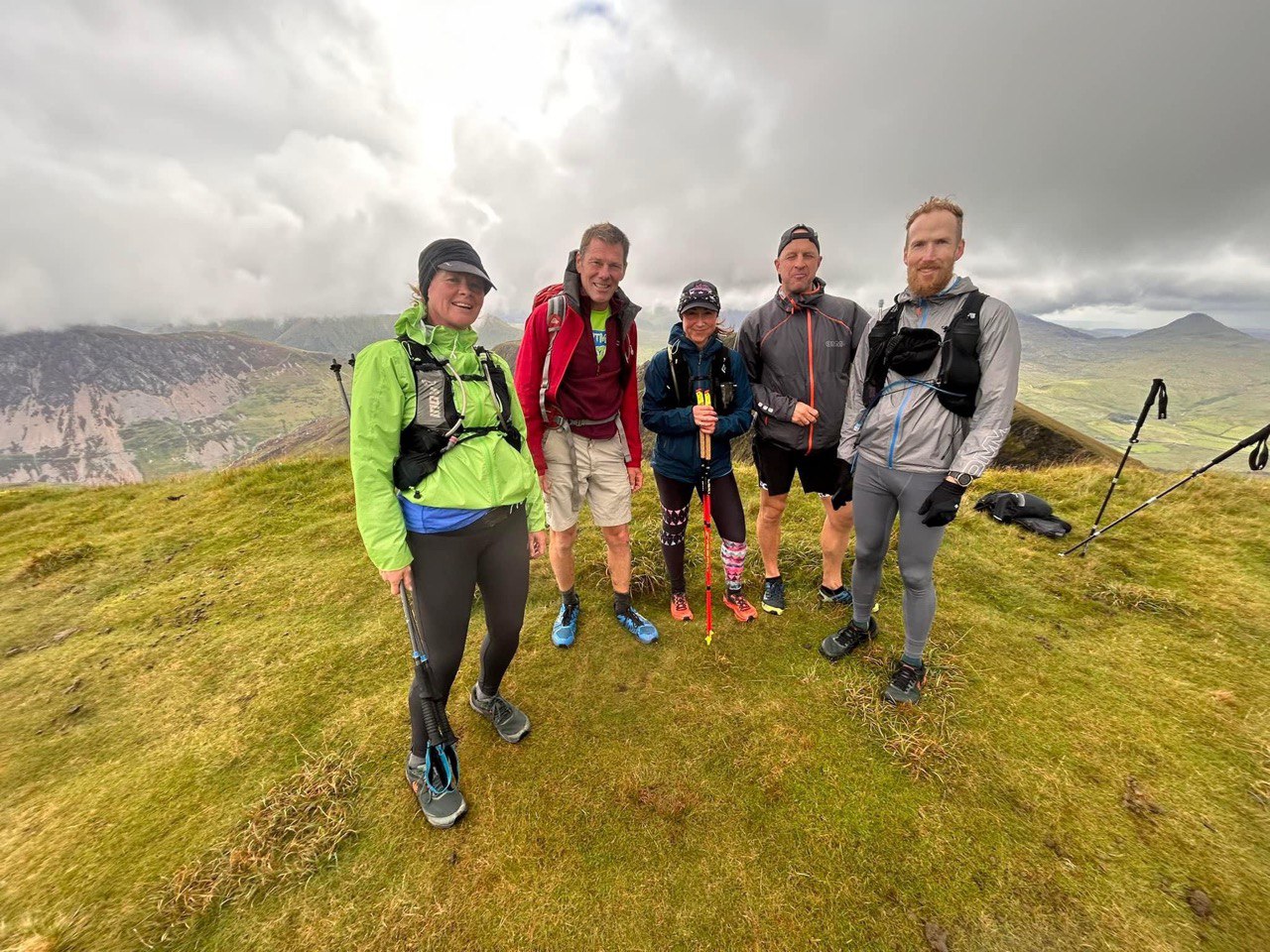
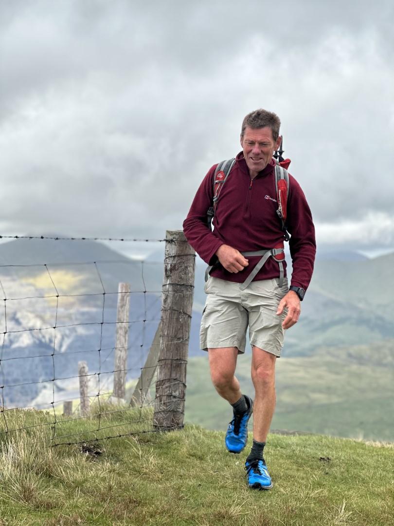
On the approach to Snowdon (Yr Wyddfa) the cloud cover moved and gave us a great view of the highest mountain in Wales. Unfortunately I didn’t get any good photos of Snowdon, but we did stop briefly at the summit for a group photo (after the weather had closed back in on us again!)
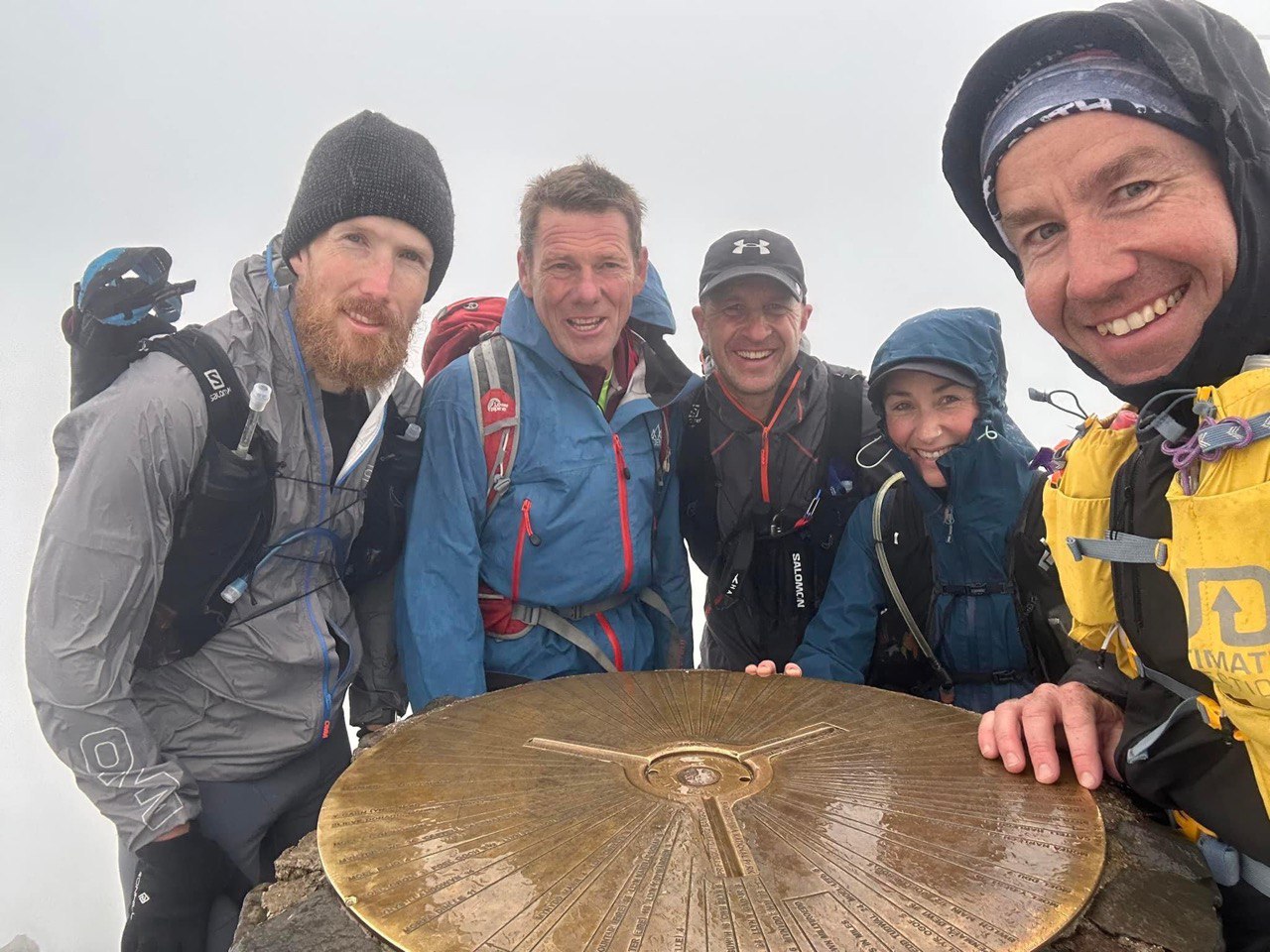
Shortly after we passed the finger stone at Bwlch Glas, and then touched the old and neglected trig point at Crib y Ddysgl.
From here we met up with the Snowdon Ranger Path, losing elevation as we ran down the very rocky trail toward the final set of mountains for the day.
Onward to Moel Eilio
The last set of mountains for the Paddy Buckley fun of the day were much more runnable (but still quite steep). The highest of which is Moel Eilio. The meaning of “moel” kind of makes sense to me here as these mountains are quite “bare” – mostly grassy with few sections of scattered rock. Perhaps a result of overgrazing by cattle in the centuries past.
The range of mountains here lie in the perfect position to provide an almost endless series of “false summits”. If you’re not aware of their layout, they can be quite demotivating as you keep thinking you’re almost at the top. Thankfully I’ve run this section a number of times before so I knew what was coming before we reached our destination in the town of Llanberis.
Llanberis Finish
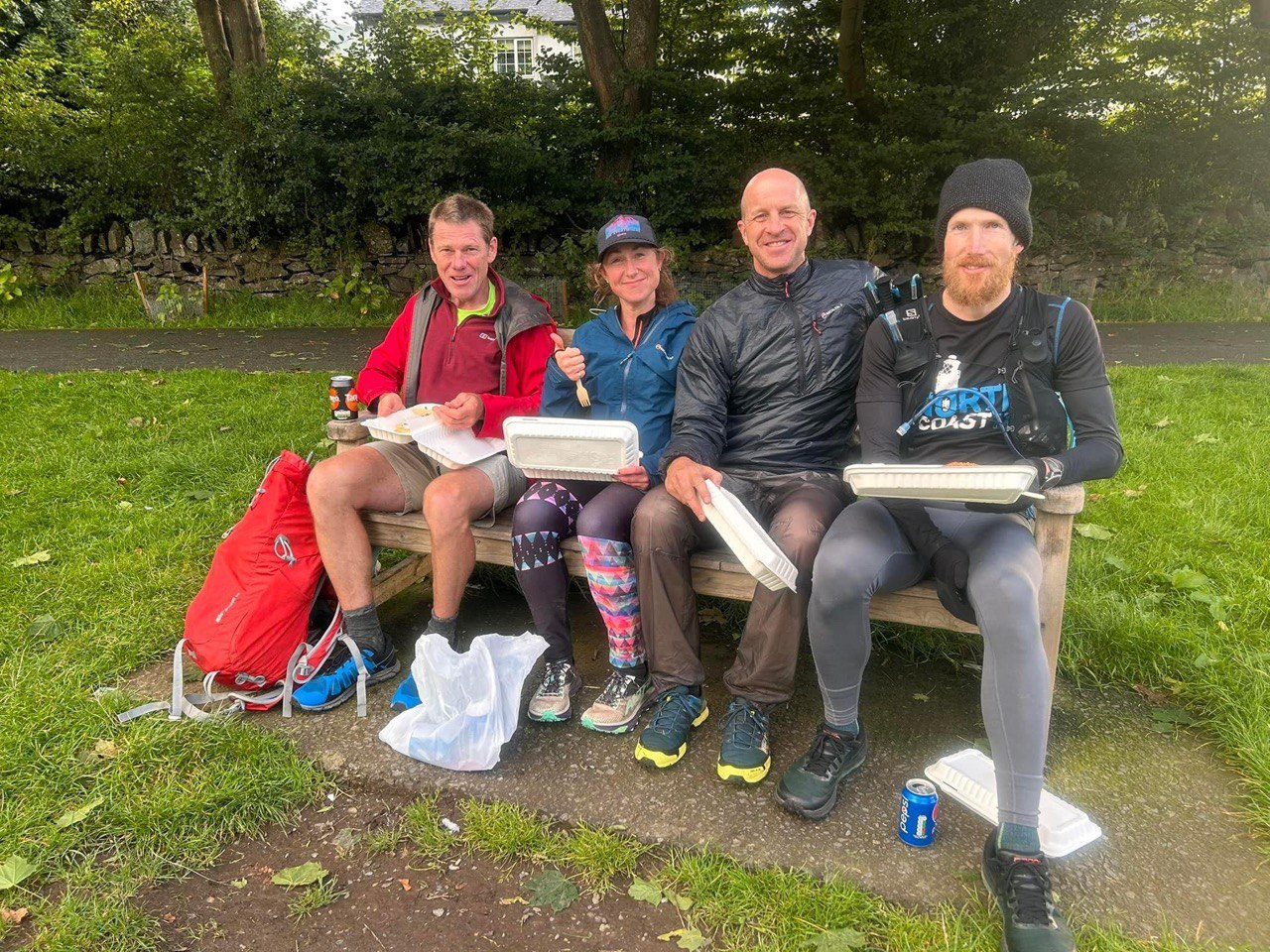
After a long day out on legs 2 and 3 of the Paddy Buckley, we eventually wound our way back down into Llanberis. The last bit of the route was altered slightly to give us the shortest path to a local takeaway shop before it closed at 8pm.
We made it there with 10 minutes to spare and ended the day on a bench enjoying our well deserved food and reciting the days adventures.
What a great adventure, Sean! And some better weather than on leg 1, although it still looks like a very wet outing. Well done, all of you!
I am amazed at the raw and untouched nature in Wales. It looks so beautiful, green and pure.
The photos and your explanation about the meaning of “moel” made me google “Why does Wales have fewer trees?” Apparently, one of the reasons is “Wales experiences a higher rainfall than other parts of the UK, which can make it difficult for trees to survive”. What?! I didn’t know that!!
I guess that when you get to the van it’s possible to opt out on some of the route? I see that not everyone of the group seems to have continued.
And did you return to the same overnight accommodation?
I would love to do this one day!
Thank you Catrina. I think the group effort was excellent.
There are some truly remote and isolated feeling parts in Wales, especially some of these mountains further off the main tourist areas (and thinking about it, parts of mid Wales too).
Now that is something new I’ve learned (thanks for looking that fact about the trees and rainfall up!)
Yes – the van checkpoint at roughly half way each day was a good opportunity to refuel and for anyone wanting to cut the day short to do so. Each day there were one or two people who decided to leave early, either to do shorter stints, or because they had to get back home earlier. I nearly cut off day 3 myself, but am really happy to have stayed on to do all 3 x full days in the end.
The overnight accomodation I stayed in (as well as 4 or 5 others in the group) was the Rocks Hostel in Capel Curig. It’s a really comfortable, almost luxurious hostel, and 4 of us shared a room with bunks. I didn’t get any photos of the hostel, but might take some off the site and add them to part 3.
I totally recommend doing this. I’m happy to provide GPX files if you ever find yourself this way (or you could find the official Paddy Buckley round OS Map and use that too).
Enjoyed reading this, Sean. Looks like a wonderful group sharing in this adventure with great camaraderie.
It really looks rugged and challenging. What a massive elevation change (100 meters per kilometers) over that 38 kilometer distance.
That’s a great photo on top of Snowdon. I wasn’t sure what a trig point is. But assuming that is what that is in the photo with you and your group.
Great timing for the rain to hit when you were at your van.
A great accomplishment, Sean. Thank you for sharing. 😀
Thanks for reading Carl. Yes a very rugged landscape indeed. I learned about trig points quite some time after moving to the UK years ago, they definitely seem unique to our country. You’re right – that’s a trig point with our group photo on the top of Snowdon (Yr Wyddfa). There is more detail about how they work with triangulation and sitting something on top of them into the slots and using the lines and angles on the surface, but I’m not 100% familiar with exactly how they operate.
Cheers!
You are very welcome, Sean. I did look up more on the trigonometrical points. It is quite a complex network (6,282 trig points in the UK) though one reference pointed out that “Although stations are no longer required for many surveying purposes, they remain useful to hikers as navigational aids”.
It’s very fascinating. 🙂
I would definitely agree on the second point – it’s always a good way to pinpoint a top – looking for the trig point!