Moel Eilio is a mountain in Snowdonia, North Wales. It lies just a few miles off from the highest mountain in Wales, Snowdon (Yr Wyddfa).
Just the other week, while doing some mountain running of Snowdon and the surrounding area, Moel Eilio was pointed out to me as a great route to try.
The morning after my day out in the mountains, I woke up early and met up with friend and accomplished runner / film maker Martin to run up to the summit of Moel Eilio.
So why run up Moel Eilio? For me, it’s an easy answer – I’m up for any kind of trail, fell, or mountain running! Also, who would want to miss out on this kind of a view from near the top?
Moel Eilio route
Our route would start in the town of Llanberis, where we would make our way up to Moel Eilio, via Telegraph valley, running a loop, back down to Llanberis again. Parts of this route cover some of the UTMB UTS 50 ultra marathon course.
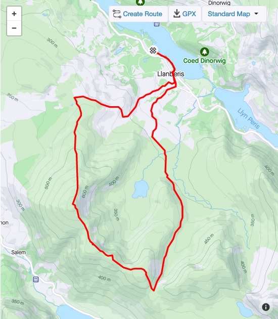
If you want to try it yourself, download the Llanberis to Moel Eilio loop GPX of the route we took here:
Running up to Moel Eilio
On the way up, through Telegraph Valley, we were treated with some spectacular views as shafts of sunlight broke through the clouds and illuminated the valley and river below.

Once reaching a boundary fence and gate, we took a hard right to begin the meatier sections of the ascent. This is the point on the UTS 50 route where you would also take a hard right, to make your way up to the summit.
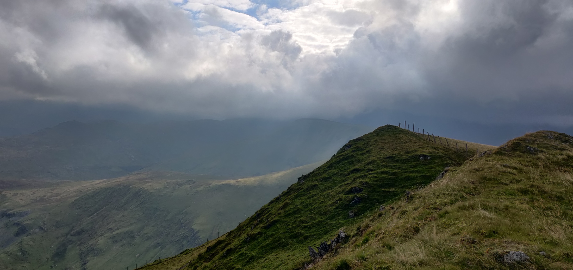
The run up follows fairly gentle undulating terrain. There are some significant up and down bits of elevation, but the running is fairly easy with the grassy trailed top.
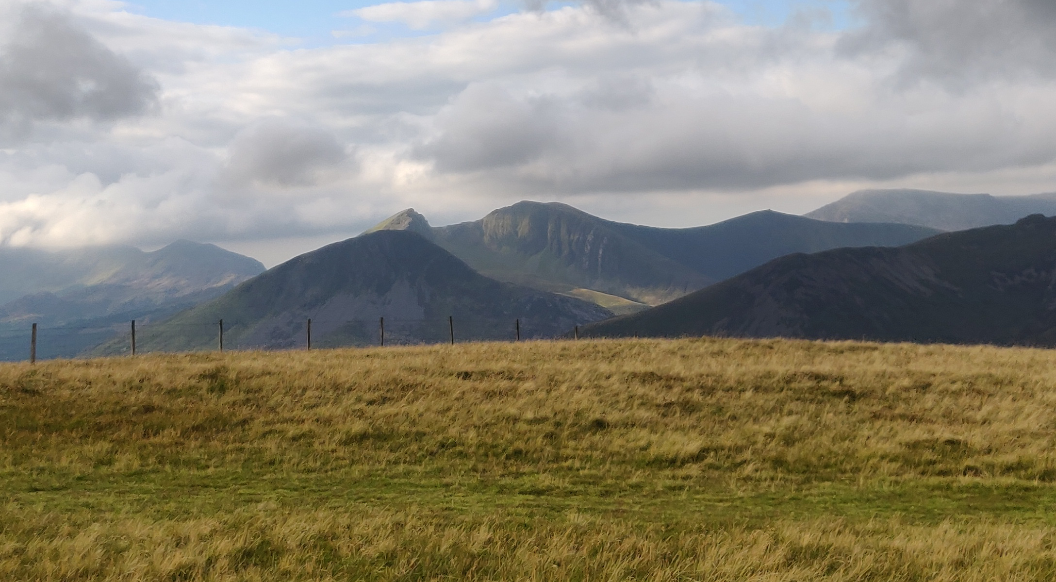
From the side it is easy to see the ‘false summits’ leading up to the top, but when lined up directly and actually running, these can catch you out.
Here is a short clip that illustrates these false summits.

Running over the undulating hills up to the top is a lot of fun.
Here is another view, taken from near the top, where you reach a little bit of a plateau.
Running back down to Llanberis
Concluding the run, we followed a path down toward an old slate mine / quarry on the other side of the mountain. The run followed gravel track and path until we hit the town of Llanberis once again.
This part of the route still offered up some great views of the surrounding landscape.
The run (or hike) is totally worth doing for the landscape, views, challenge, and of course if you’re into recce’ing the Ultra trail Snowdonia (UTS 50) race route too.
Those views! That photo with the sunbeams is amazing!
I would love to run in Snowdonia one day. The hills look so soft and inviting. Martin’s dog seems to be enjoying it as well!
How long was the total circuit? And how much elevation did you cover? It looks like at least 600m, but it could be more with all the undulating trails.
The views up and from the top were magnificent, even with the cloud cover! Otter (the dog) is a little machine. Very fit and energetic. He loves running so much.
The total circuit was roughly 14km with 784m of elevation – you can see the distance/elevation stats on my activity here: https://www.strava.com/activities/7735455623 – good estimate with your 600 guess Catrina! We didn’t run it all – there was some power walking and stopping for the views and to record some video too. Martin is working on various film projects so it was a good opportunity for him to get some material there. Check out his youtube channel – he has some great running and ultra running documentaries! (also linked above on my video’s menu at the very top of this page – search for Kelp And Fern)
This is amazing, Sean. I love the fact that you ran both sides of the mountain. Your video clips are amazing. A great illustration of the false summits. Quite surprised to see the sheep way up so high on the mountain!
Thanks for taking a look Carl. It’s always nice to see all aspects of a mountain or trail, and it was convenient that this was also the way the UTS 50 route goes too (great recce run for next year’s race). Those sheep sure do move around a lot. It’s interesting seeing how farmers have different methods for different terrain. The sheep farming in this region ‘feels’ more traditional and old fashioned compared to the more commercialised ones you see elsewhere.
It really is cool that it is part of the UTMB UTS 50 route. Traditional and old fashioned is what I always love seeing in farming methods. 😀