The North Coast 110km ultra was a spur of the moment booking for me. I found it, and signed up for it exactly one week before the event itself, on the last day that registrations were open. Talk about being trigger happy!
Part of my decision to book this in was me looking (impulsively) for my next challenge. The other part was to form part of my training and readiness for my planned Wild Horse 200 South Wales next year in April.
It’s not the same terrain as Wild Horse 200, but covering this 70 mile distance in one shot, in a reasonable time is what I thought would be a good mental hurdle to overcome on the lead up to running the 200 mile multi-day event next April.
The Route
The route leads you all the way along the North Devon coastline, following the official coastal path trail, all the way from the town of Barnstaple to Minehead.
Though I only recorded 109km before my battery died, the total distance on my Garmin was 114km (70 miles) for the gpx route. The route included a lot of up and down elevation. Total elevation measured was 3685m (12089 ft).
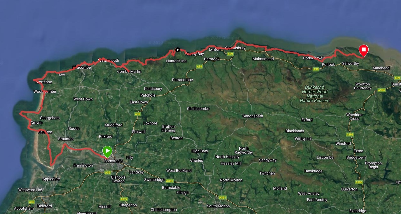
The initial 17km out of Barnstaple were flat and easy to run, then the bumps in elevation started as we got onto the proper coastal path trail.
North Coast 110km Gear Selection
There was of course a mandatory kit list, so my gear selection simply followed this, as well as a few extra personal choices.
Mandatory kit list I carried with me
- ODLO Performance Lightweight long sleeve baselayer top
- Lightweight merino wool long sleeve warm layer
- HOKA Speedgoat 5 trail shoes
- Inov-8 Stormshell waterproof jacket with taped seams
- Salomon Adv Skin 12 running pack
- Salomon 2L hydration pack (mounted inside my running pack)
- Survival bag
- Basic first aid kit (2 x wound dressings, a selection of blister plasters)
- Warm beanie that could cover my ears too
- Whistle
- Ledlenser NEO10R headtorch with rear mounted battery
- Spare Petzl headtorch + batteries
- Mobile phone
- Nutrition – I carried 3 or 4 Clif bars, and some Kendal mint cake
Drop bag contents
I packed a bunch of spare things as well as some extras in a drop bag which was situated at around the half way mark – 55km in.
- Black Diamond Distance Z Carbon trekking poles
- Saucony Peregrine 10 ST trail shoes
- OMM Halo spare waterproof jacket
- Extra pair of long compression socks
- Extra pair of short socks
- Spare lithium-ion battery for headtorch
- K-tape
- Towel to dry off if required
- More first aid kit stuff
- Extra set of running clothes – shorts, runderwear, ODLO t-shirt
- Can of coke
- Random bits of nutrition – snack bars, sweets – a variety in case I wanted something in particular
- Spare salt/electrolyte tablets in case I needed extra
To start in, I wore the ODLO base layer, a pegasus ultra running tek t-shirt, some Adidas running shorts, Injinji ultra compression toe socks, and my Hoka Speedgoat 5 shoes.
I was also sure to coat my feet and toes (as well as other areas likely to chafe!) in Bodyglide.
Tip: Applying bodyglide to your toes and feet makes putting on compression toe socks MUCH easier.
Running the North Coast 110km Course
I’ll start with the bus ride in. As the course was one way only, I drove to the finish line in Minehead slightly earlier in the day, where a bunch of us took a bus to the registration and start in Barnstaple.
Unfortunately, I tend to get a little car sick if I am not the one driving, and the bus itself was very bumpy, which lead to me feeling rather nausious the whole hour or so journey there. Thankfully that subsided soon after arrival, and just in time for the start. (The bus ran quite late!)
I met a familiar face at registration – Nick, who has volunteered on various Pegasus Ultra Running races this year so far. He helped me out with pacing/positioning info on the last checkpoint on my previous ultra, the RIDUM.
It was great catching up with Nick and quizzing him about his experiences on the 3 x Wild Horse 200 races he ran this past year.
Start
We started at about 8:40pm, running 10 minutes late (due to the bus!)
The initial 17km were flat and easy to run. I intentionally kept a slow pace, ensuring my heart rate was staying low too.
Nick and I ran together for this whole section. It was nice to have company. At one point we did get slightly separated and I made my first navigation error, just before crossing over a small trench/canal. That cost me about half a kilometer of back tracking and put me right at the back of the pack.
I wasn’t too fussed about position though – my goal was to simply finish this event, not race it.
Soon enough I was back in the middle of the pack though and a group of about 10 of us made our way together along the coastal path – destination: Woolacombe Village Hall, our first checkpoint at the 29km mark.
Nutrition update: I ate a single chocolate chip Clif bar on the way up the first climb in this section.
Woolacombe – CP1
This checkpoint actually arrived around 32km for me – not sure if it was the bit of backtracking I did, or if the the course checkpoint distances were slightly inaccurate, but it did feel like a long time running before arriving. The time was roughly 12:30am – a little after midnight as far as I recall.
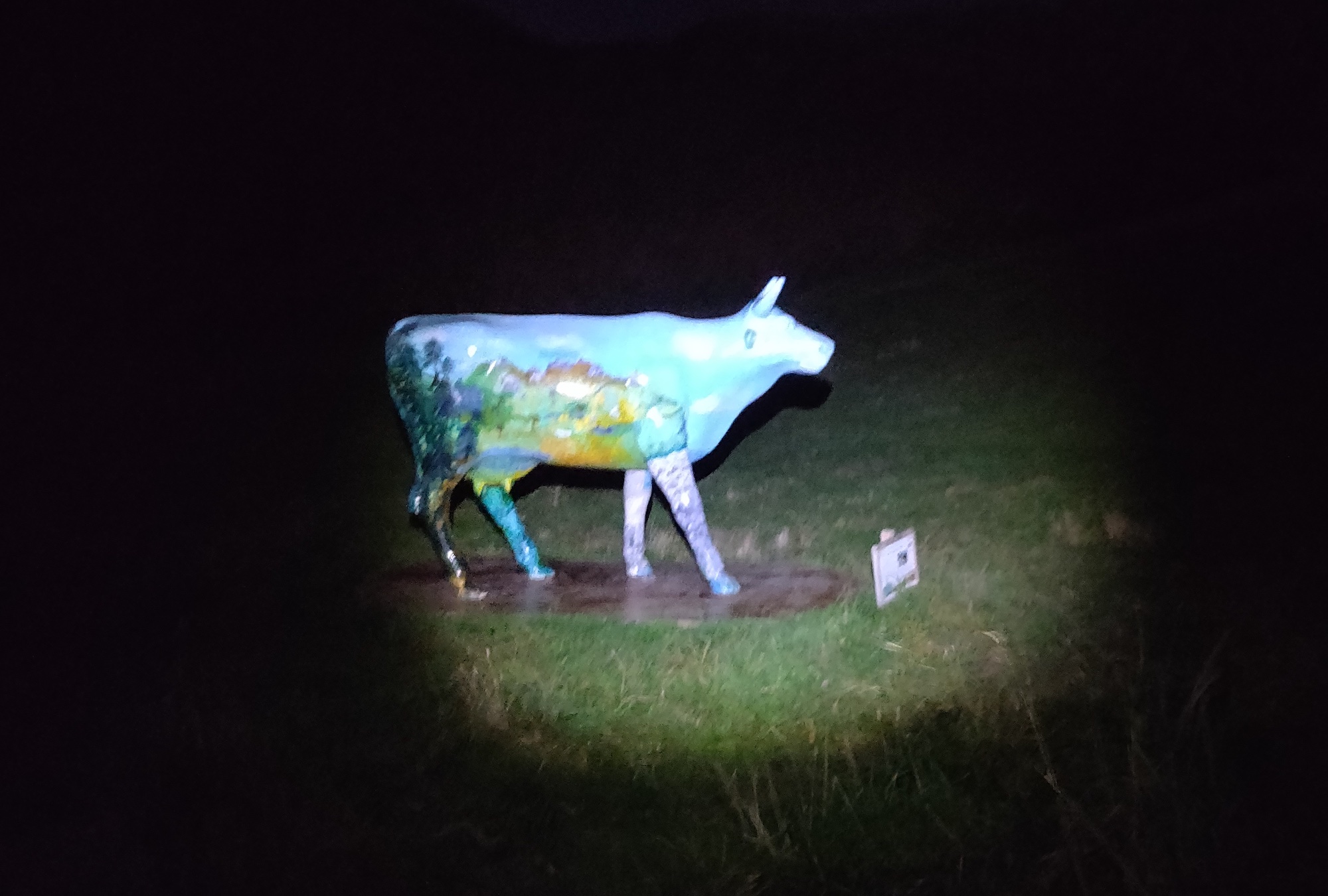
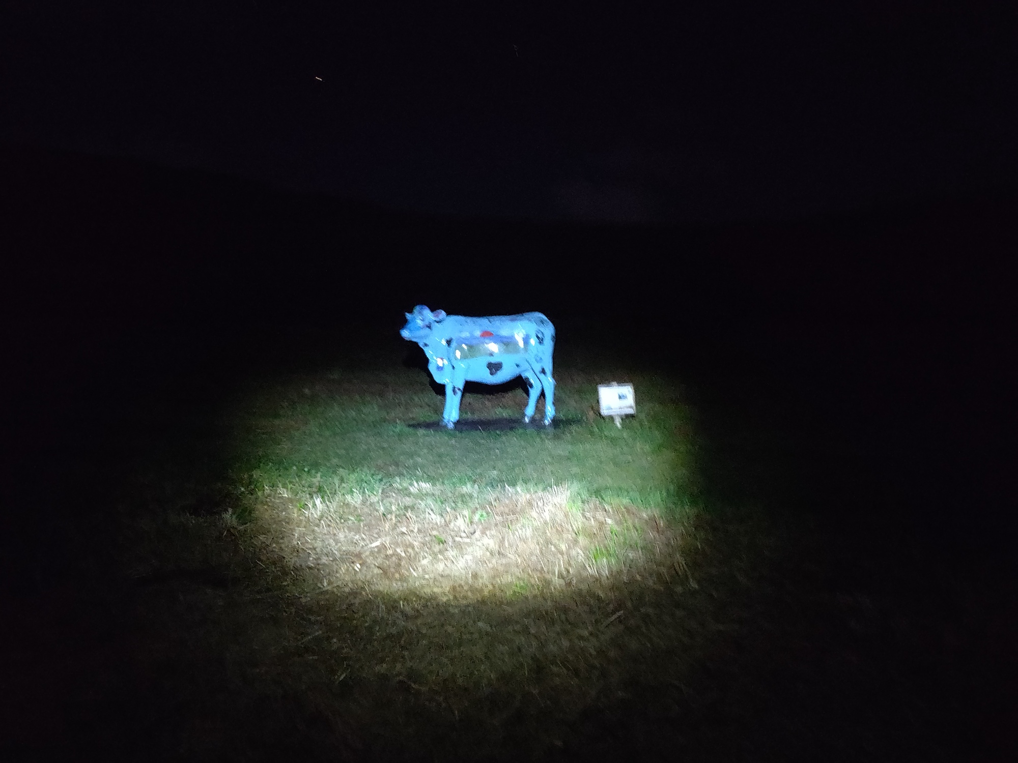
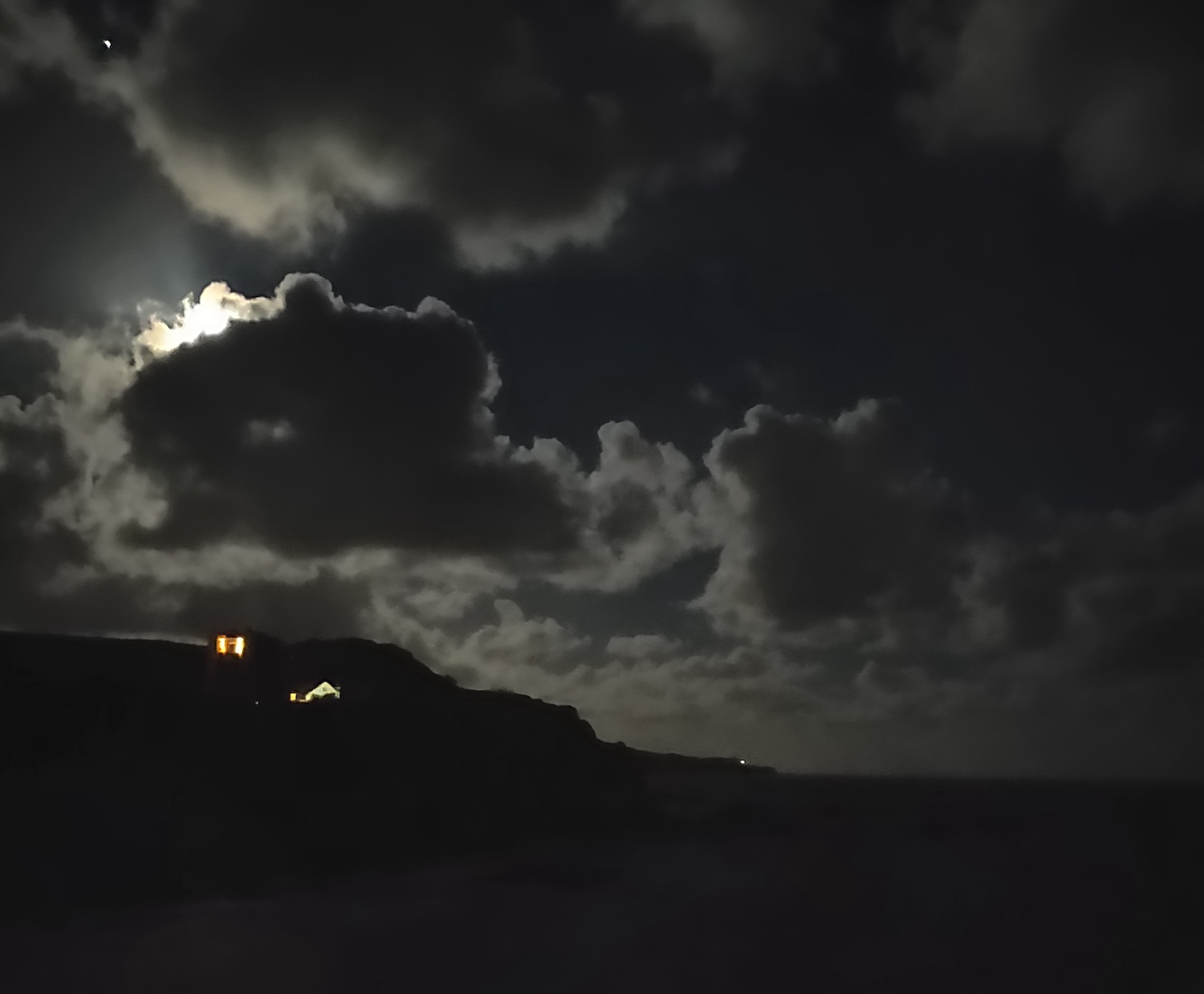
Just before arriving in the town, I spotted a few strange looking cows in the dark, just off the beach. At first glance I wondered if I was hallucinating, but it was too early for that sort of thing! No, they were real – just some odd statues along a section of coast that was once heavily fortified against potential invasion in WW2.
On the way up the hill leading into the town I met with another runner, Michelle, who mentioned she lived near the Alps in Germany and was looking forward to the technical terrain in the later half of the race.
The checkpoint itself was warm and inviting after running 20 miles so far in the clear night’s cool air.
I had my water pack refilled – adding 1.25 liters to replace the 1.25 liters I had already drank (with a light tailwind mix).
Nutrition update: At this checkpoint I ate a small caramel chocolate bar (Tesco) and a couple of generic biscuits. I also had 2 x small cups of coke to give me a little boost.
Continuing the Coastal Path to Combe Martin (CP2)
Leaving the previous checkpoint and running back down the road to join the coastal path once more was slightly lonely. I didn’t want to get too cosy in the warm village hall, and there was a lot more work to be done.
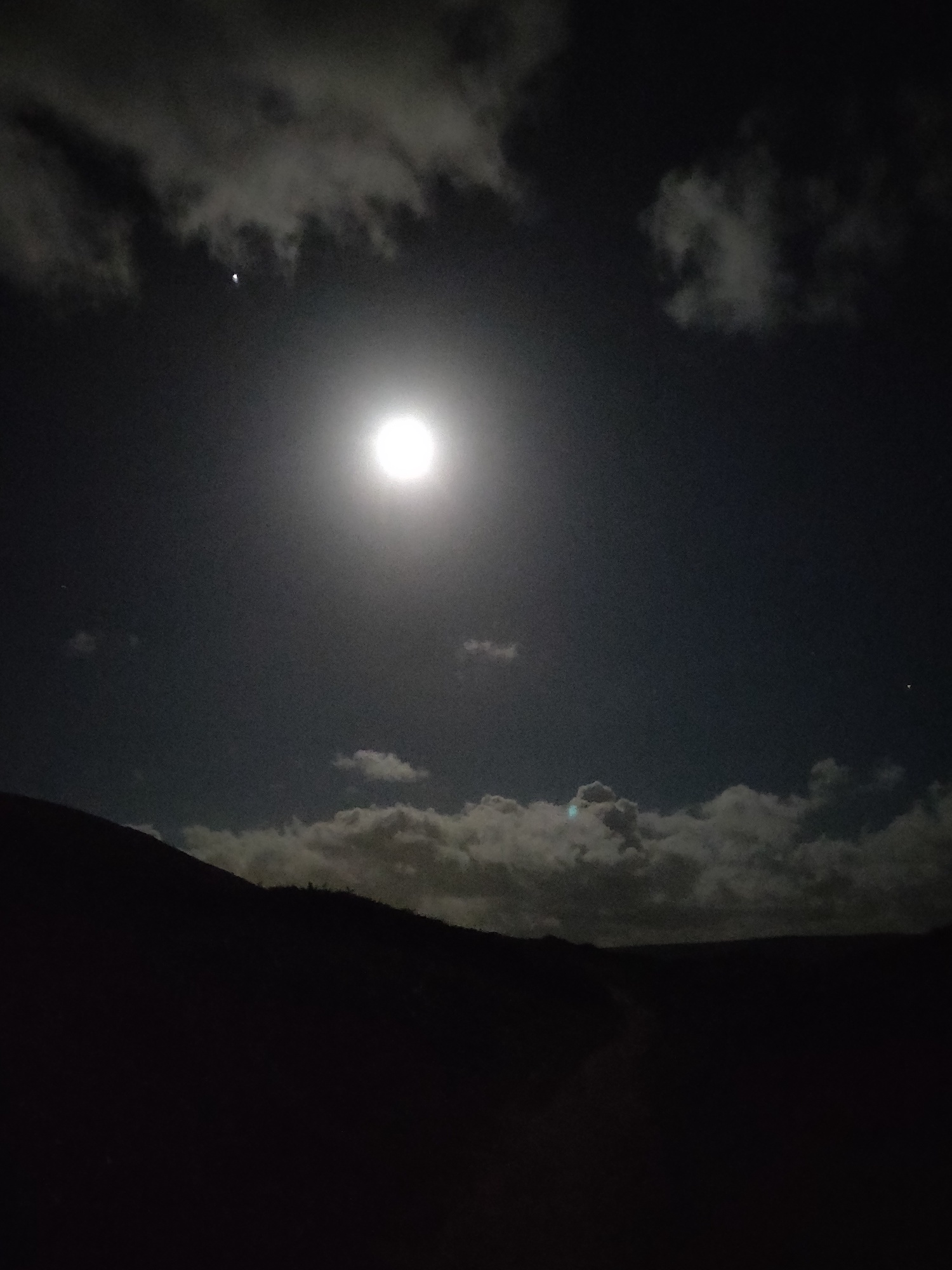
The next 23km of coastal path had a lot of elevation fluctuation and got quite technical in places. It led us right along side the sea, with some beautiful shimmering moonlight over the ocean views.
The trail quite jarring in places, it was important to keep focused on the trail right in front with my headtorch set quite brightly.
In the dark I caught my foot once or twice on bits of rocky outcrop that nearly resulted in a tumble.
Due to the technical trail and jarring elevation changes this section took some time.
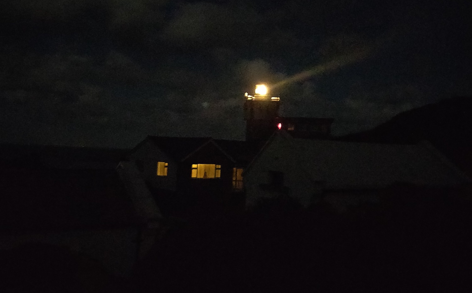
I remember passing through Ilfracombe harbour on the way. This was brightly lit, but quite eery in the early hours of the morning, with nobody to be seen. Some of the footpath through had been closed off for construction, so a little bit of searching around was done to get past the fenced off sections of the harbour.
Eventually I arrived in Combe Martin for the half way mark (CP2) at around 4:30am. I had met up with another runner, Jeremy (originally from France) and we ran in together.
Water and tailwind was refilled (another 1.25 liters) and I had another cup of coke to top up energy levels.
Nutrition update: I had a bit of a feast here. Hot soup, toast with butter, a large flapjack, and one or two biscuits were consumed. It all went down very well.
As this was the half way point with my drop bag, I changed my shirt for a dry one, mopped up as much sweat as I could with my spare towel, changed beanie for a dry one, and removed grit and small stones from my shoes. A bit of maintenance that would be worth it over time! Although there were only a few more hours left till dawn, I also took my spare headtorch battery, just in case. Didn’t end up needing it though.
I also picked up my drop bag can of coke, and took my trekking poles out. They would have been useful over the previous 10k, and the remaining section of the course definitely called for them.
Onward to Lynmouth (CP3)
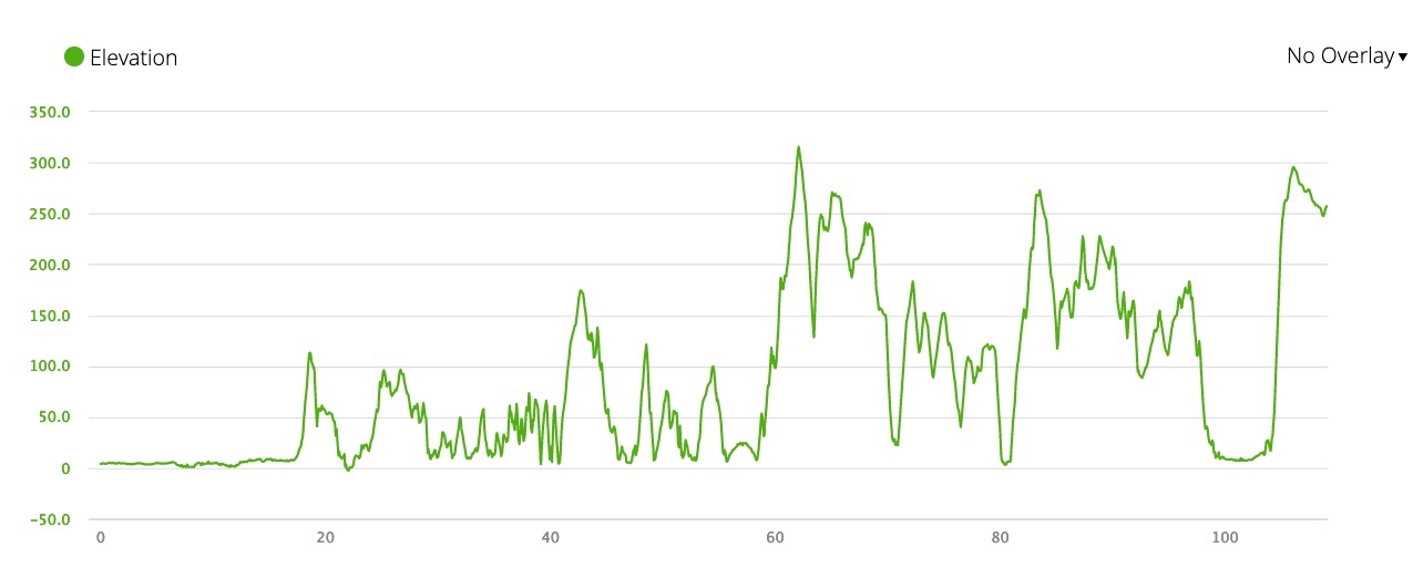
A short while after leaving CP2, after departing the road in town, and turning left after the hotel on the outskirts, I entered the coastal path once more. There was a lot of elevation coming up, confirmed by checking my Garmin Fenix 7 elevation profile for the course.
I made my way up in the dark, headtorch guiding me, however missed a coastal path sign and ended up in someone’s garden half way up the initial climb. It must have been a nice property with a great view out to sea. I back tracked a little bit and found the missed turn. Only 5 or so minutes wasted.
This section of coast was home to two ‘peaks’ – little hangman and great hangman. I drank my can of coke, and strapped the empty tin can in my running belt straps where my trekking poles usually go. Fueled for the climbs, I dug the trekking poles in and started power hiking up.
Nutrition update: A few bits of Kendal mint cake, topping up energy as I climbed.
After little hangman was complete, I honestly thought I had just finished the small and big versions. However, in the dark sky ahead, my eyes readjusting to the light, I noticed a massive looming shadow of a hill/mountain that cut into the slightly lighter area of sea in the distance. This was GREAT hangman – still to come. A little sign a bit further on confirmed that, indicating another 1 mile or so to the top.
With a bit of a chuckle and sigh to myself, I continued on, relentlessly pushing up to the top.
Jeremy had caught up with me and we both made our way up, helping eachother out with navigation.
After some time we separated once more. I had a little bit more speed in me at that time and felt like running solo for a bit.
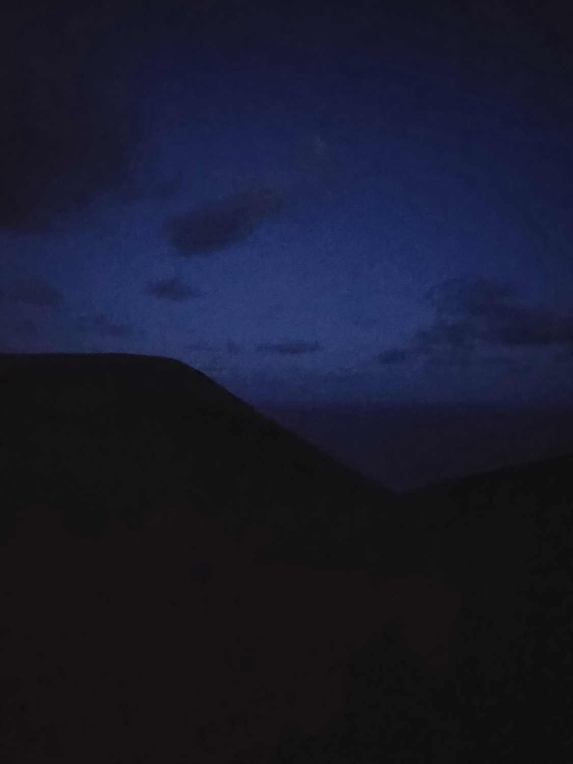
Coastal Path to Lynmouth – Early Hours
The distance ticked over for what felt like an eternity during the night, but soon the morning light slowly bled into view.
I livestreamed a short section of running on my Instagram account as the light started to appear. The light was invigourating and unleashed a burst of energy in me. If you watch the stream, be aware it is very shakey!
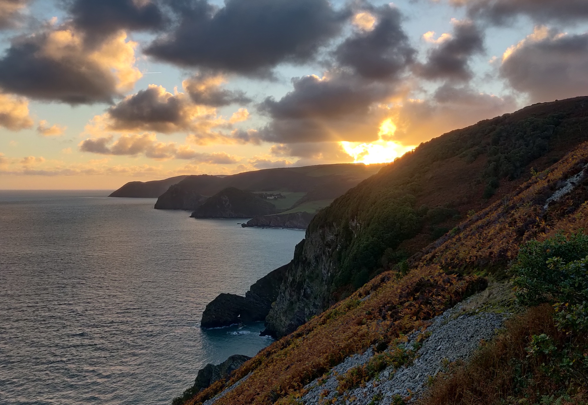
The morning light provided for some spectacular views, and the North Coast 110km route does not disappoint.

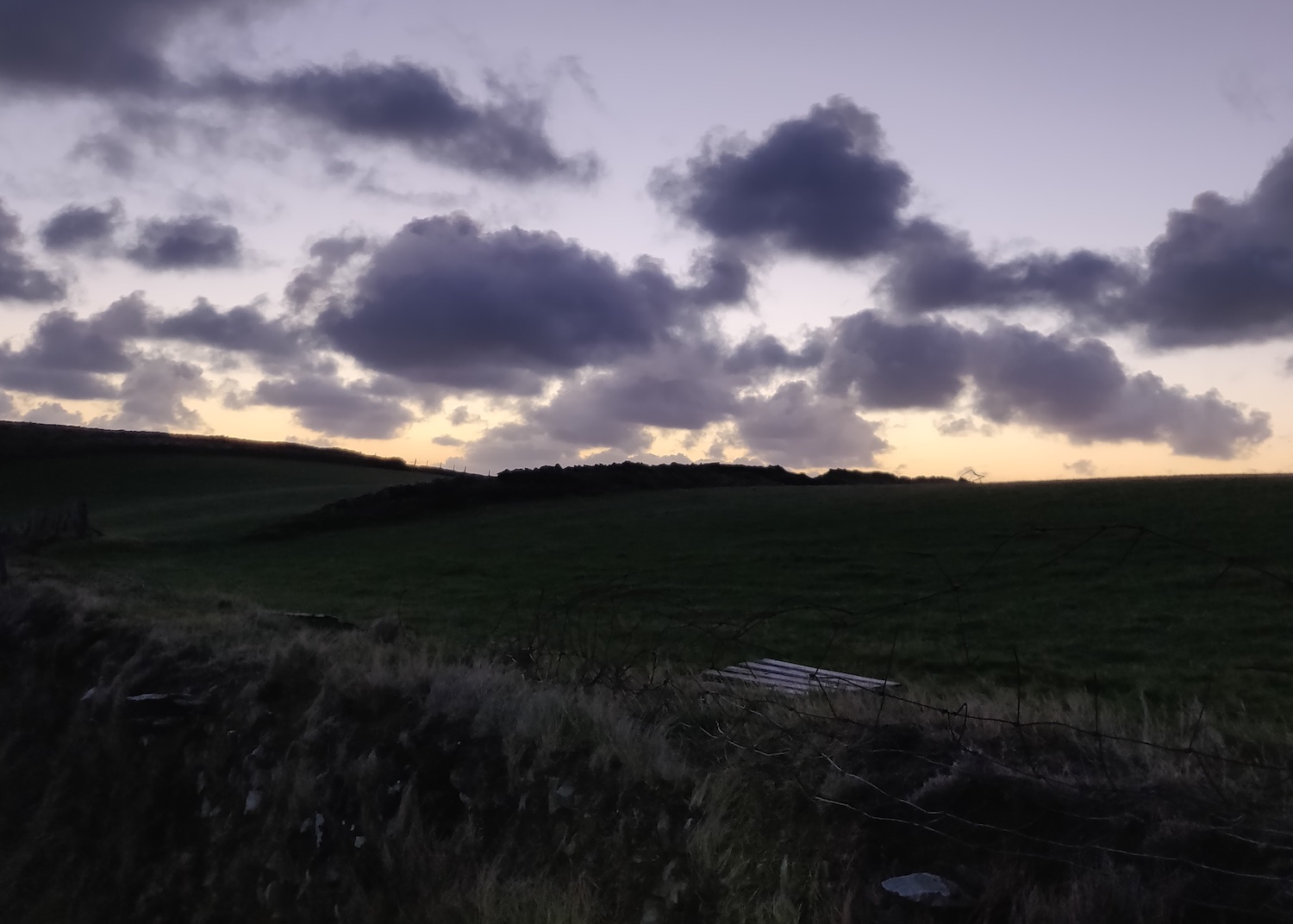
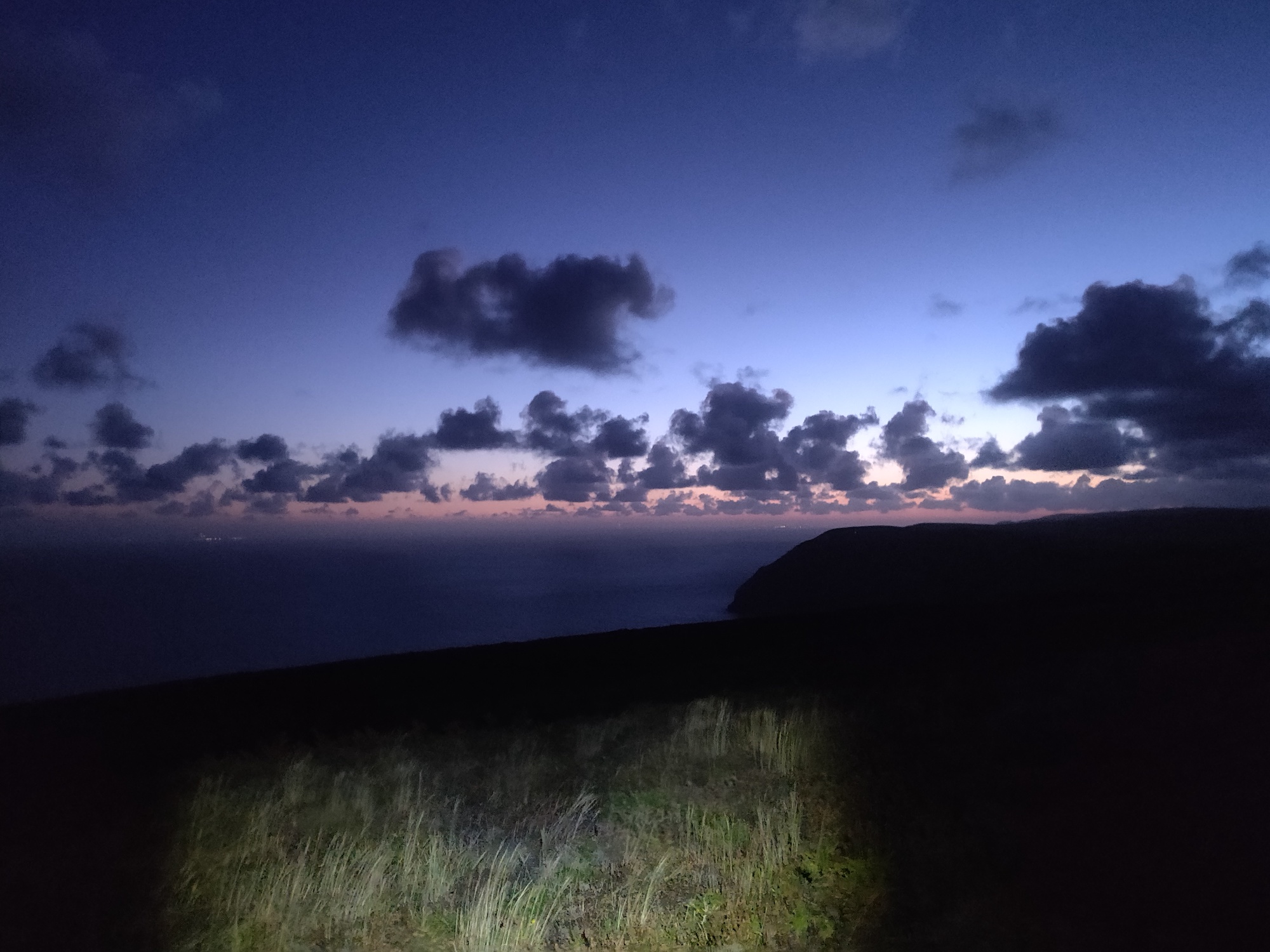

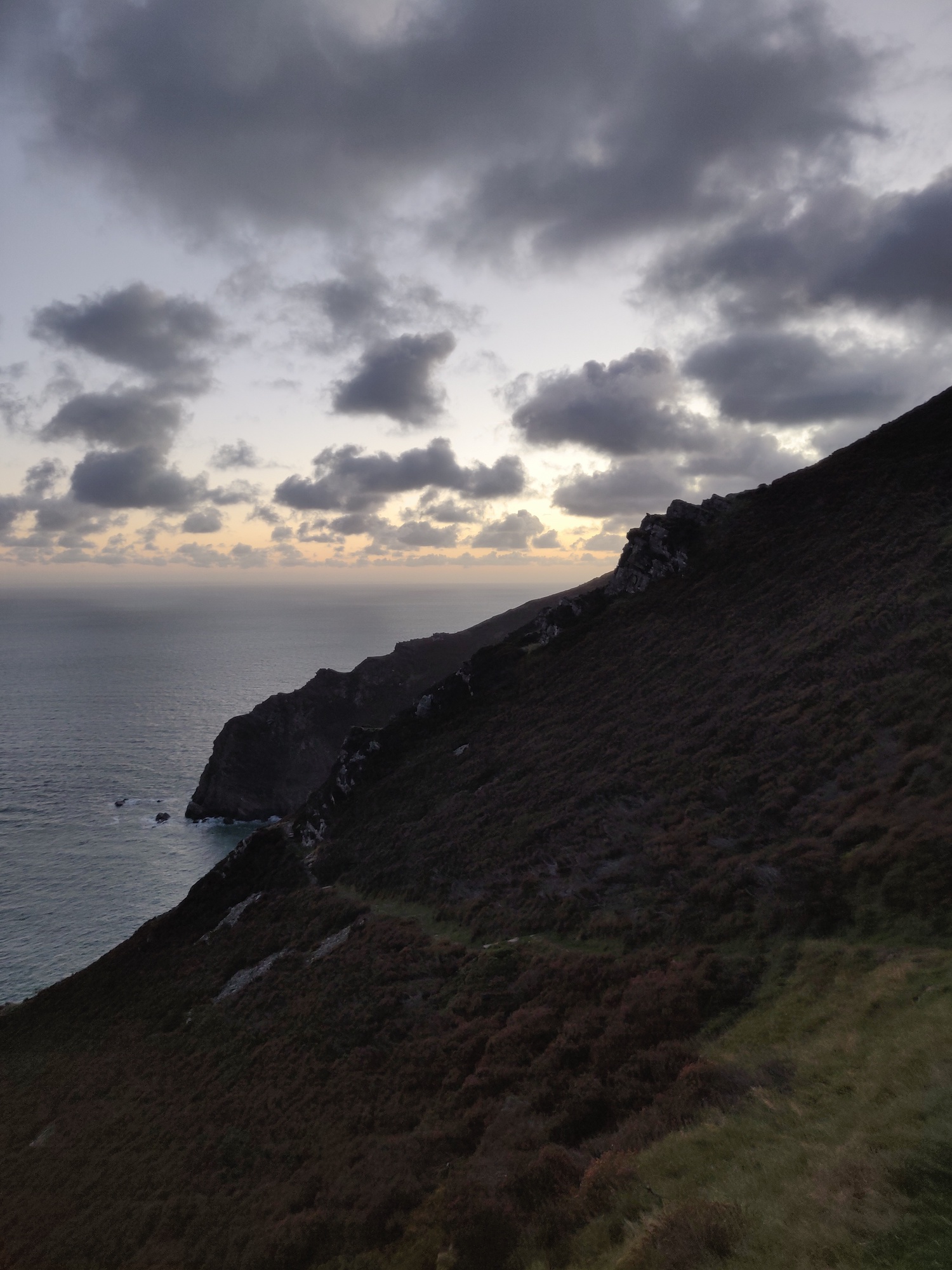
I really had a lot of fun running this section of coast. It was slightly technical, a bit of up and down (but not too bad) and the light peeking out on the horizon provided these awesome views.
The energy also helped me catch up and pass a few people on the way. I still had to stop for more pictures though!

Lynmouth CP3
Continuing the morning, I soon found myself nearing Lynmouth, the next check point. The run from the coastal path down into the small coastal town included a series of switch backs down the a steep descent.
Nutrition on the way: A few bits of Kendal mint cake to keep me topped up.
My right calf muscle was beginning to hurt – something between a cramp and a dull pain. I had to keep pushing on though.
The checkpoint was in a small shelter along the harbour area in Lynmouth. The sun was just able to shine through the glass into the shelter, and the warmth felt amazing.
I had my water refilled once more – another 1.25 liters, and drank a couple more cups of coke.
Nutrition update: I ate a large slice of victoria sponge cake, and had a cup of hot tomato soup here. I spent an extra 5-10 minutes resting up, and removed my base layer here too.
Onward to Porlock weir CP4
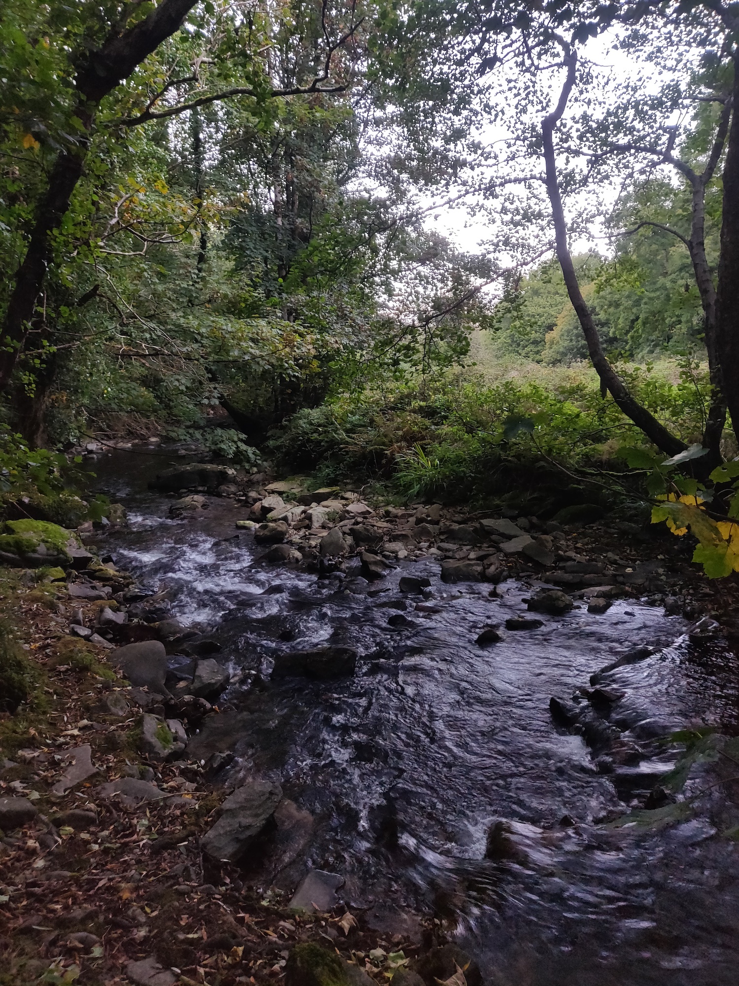
Leaving Lynmouth had us climbing a fairly steep section of coastal hill and path, initially though some woodland forest. With base layer removed it was still a little bit chilly, but I soon warmed up from the climbing.
This section of the route had us enter the longest stretch of coastal woodland in the UK – part of Exmoor National Park.
The woodland was really amazing. It was the perfect time in the season for mushrooms and other fungi, and the views out over the coast between trees were excellent.
However, my right calf muscle was really hurting now, and I had to struggle on through this section. I used my trekking poles as best as I could to alleviate some of the pressure, and soldiered on.
It was a mix of half a km jogging, half a km power walking/hiking for the entire woodland.
After 3 hours and 10 minutes (since leaving Lynmouth), I finally made it through the woodland and arrived at Porlock Weir checkpoint.
The volunteers helping out here were really amazing at this point in the journey. I was struggling a bit with my calf muscle, and they were very supportive and encouraging. One of the ladies (I think her name was Liz, and from what I recall she was a very accomplished ultra runner) helped motivate me to keep going. She reassured me that the last 15km left would be easier, with just one sharp, sustained climb, and otherwise flat or downhill terrain.
I topped up water once more – the last refill I would need, added tailwind, and applied sunscreen – the sun was out and up above now, and there was no more tree cover.
Nutrition update: I ate a large chocolate brownie here and had some more coke.
Last section to the North Coast 110km Finish
This final section was 15km in length and consisted of a bit of beach, a lot of flat coastal farm land, a short and very steep 300m climb, a plateau at the top, and then the final drop down through coastal woodland into the finish at Minehead.
I managed to start putting the pain in my calf out of mind and sustained a much better pace through the flat sections after the checkpoint.
I kept fluids going in, and ate a bit more Kendal mint cake as I made my way along. Finally, the big climb came.
I met up with another runner, Clare at this point. She was running the 55km version of this event and it was her first ultra too. She was doing an amazing job! It was great chatting with her and battling up the climb together. She had a good amount of energy and kept me motivated.
Finally we got to the top and ran the plateau for a bit. Clare ran ahead and I continued on, managing to maintain my running now.
At about 109km my Garmin watch battery died. This was my fault – I hadn’t tweaked the backlight settings or used the battery saving GPS mode. I was also using my external heart rate monitor which appeared to drain battery too.
With my GPX / map route now gone, I made a small navigation error as I made my way down to Minehead. I had to call the event crew on my phone who confirmed I had gone past a turn about 500 meters back.
Backtracking up the hill again, I found the correct trail and began my descent through the woodland toward the finish.
I broke open into a much faster run, energy levels peaking (as much as they could at this point), making my way down the forest trail switchbacks.
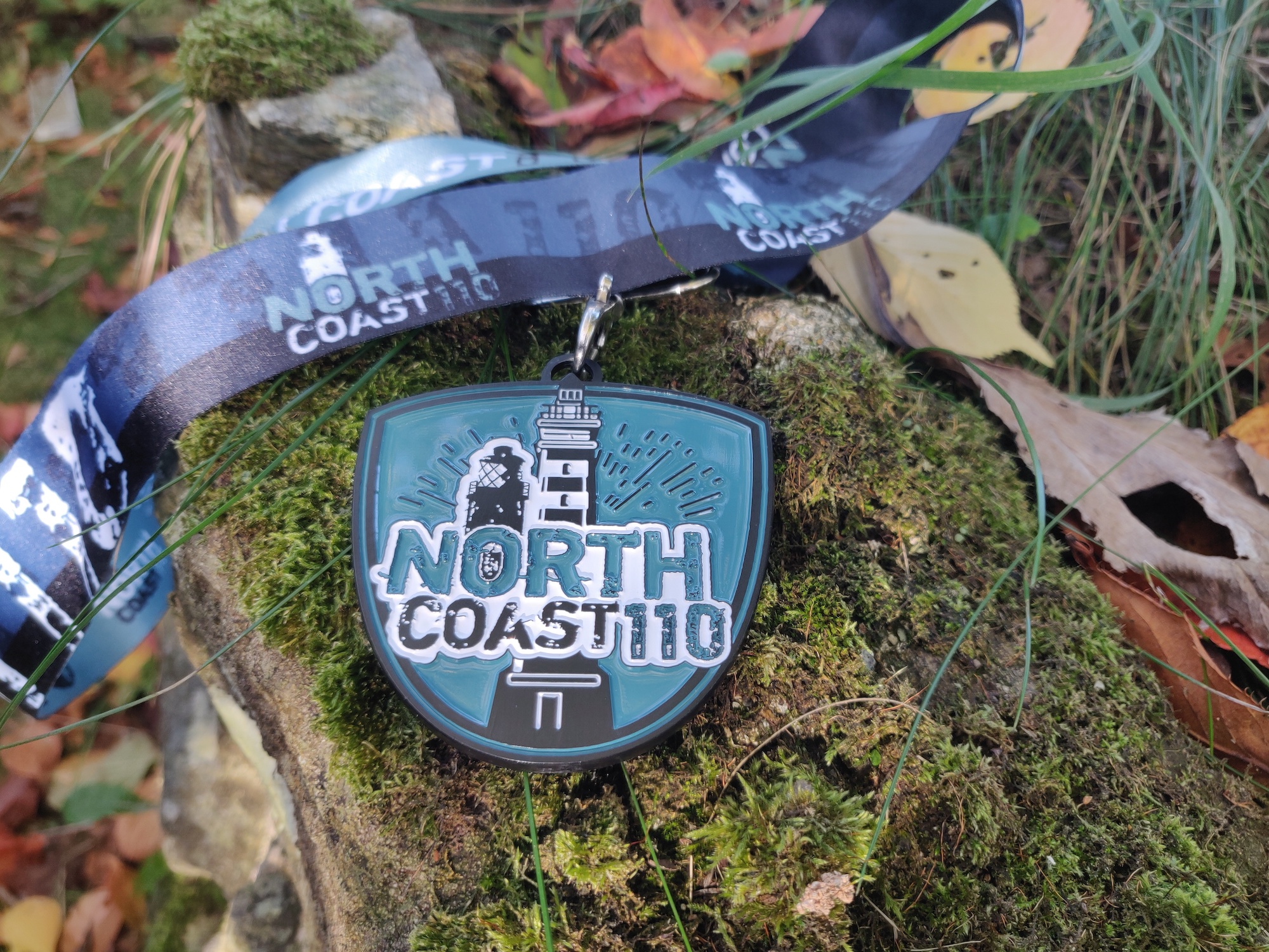
Finally the town arrived and I ran through the finish line. Total time: 18:05:06.
I placed in 8th position out of a total of 22 runners. Unfortunately a handful of people had to pull out of the race resulting in some DNFs.
Post Race
Sitting down on a bench at the finish line I rehydrated a bit, ate some food provided at the finish line and had a chat with a few other runners as they came in.
I made my way back to the car, attempted to freshen up as best as I could, and unrolled the sleeping mattress and pillow I had in the back. It was a 4 hour drive back home, and I was in no state to drive, so a nap was required.
I slept from about 4pm to 7pm in the car (very uncomfortably) and eventually arrived home later that evening.
Nutrition and Hydration
Food and nutrition was a win on this one for me. I ate at every checkpoint and snacked in-between. I ate everything from cake, to soups and toast, to brownies and flapjacks, and felt great.
My tailwind mix was slightly lighter than normal, not too strong. I still needed to forcefully sip it and sometimes when I hadn’t sipped in a while I gulped down extra to catch up. Hydration certainly wasn’t perfect, but it felt OK. I think I must have drank about 10 liters of fluid in total – including the cups of coke at each checkpoint.
Going Forward
The North Coast 110km race provided me with a bump up in difficulty and challenge compared to the other ultras I ran this year. 114km is the furthest I have run in one go, and the 3600m elevation also added to that challenge. I ticked off one of my goals I set out in this post though!
It’s given me a mental boost now that I can clear a 100 miler next – i.e. “only” another 30 more miles on top of what this was, and was needed ahead of the Wildhorse 200 next year.
Strava activity link for the North Coast 110km (albeit with the last 6km missing!)
Oh my goodness, who signs up for a 110km as a spur of the moment?!
But in view of the 200-mile adventure in April, it makes total sense.
What an absolutely amazing race – I love that you started at nightfall and then, when you were really tired, you had the sunrise to give you energy.
Those photos are spectacular! My favourite is the one that you also chose as a header.
I think I’d be scared to do this race simply because I would get lost. I think I would have panicked if my Garmin packed up, too. Oh my!
Well done, Sean! Congrats on finishing as 8th despite not racing this one. You are ready for the Wild Horse. How does your calf feel now?
Hey Catrina,
It was such a great experience. The navigation wasn’t too daunting to be honest. I think you would do just fine. The coastal path is marked with boards with an acorn symbol, so at worst if something doesn’t feel right, or you don’t see those for a while then you just back track. At least you know to just keep parallel with the coast the whole way along!
I learned a lot about battery management on the Garmin now though at least. And thankfully it was only the last 5 or 6km that it died and not earlier on!
My calf is feeling better already – just still slightly stiff. I just got back from a physio appointment and the verdict is it just needs rest for 7-10 days (ideally) so I’ll be doing much less running this week, and when I do it’ll be really easy/slow running.
I was happy to hear your achilles is feeling good at least for light activity and hikes, and that you’re currently in a block with no more races to help aid recovery.
Thanks for dropping by!
Very well done Sean, it seemed like quite a grueling race, but you completed it with flying colours and seemed to have such a positive mindset all the way to the finish.
💙
A tremendous accomplishment, Sean. I enjoyed your recap, what was included in your race kit, hydration, nutrition etc. What a great tip about putting on bodyglide to make it easier putting on compression socks.
You did really well to get yourself back on course after getting off track.
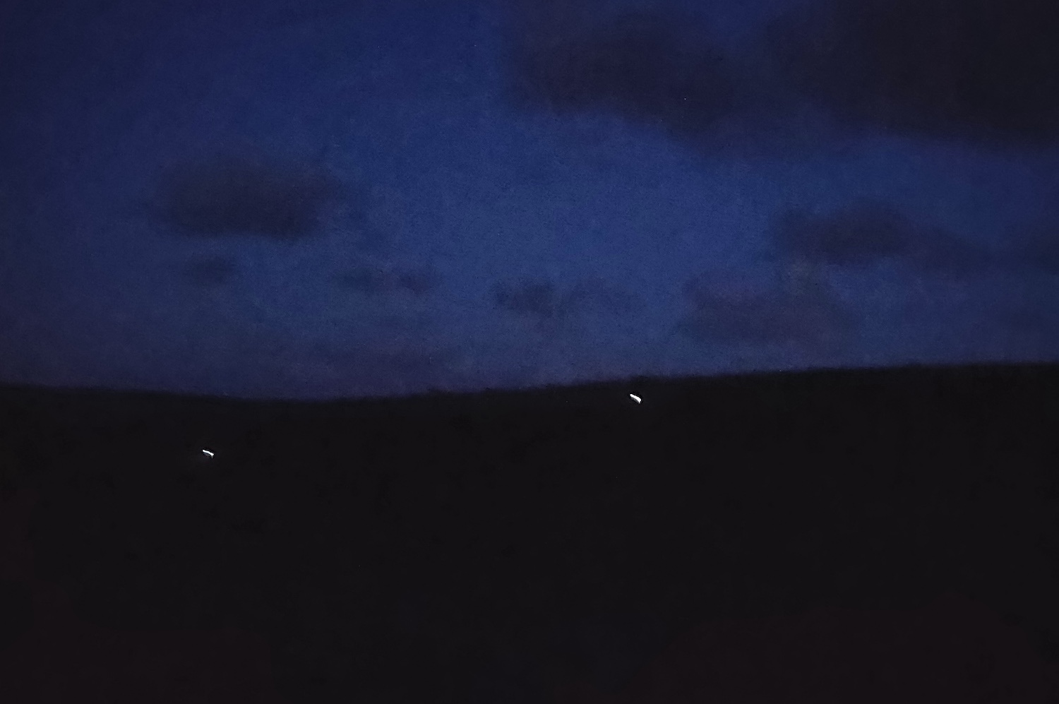
I love the photo of the 2 runners in the distance with their headlamps. It would have been amazing to see daybreak, plus run through Exmoor National Park. What a massive elevation. Congratulations, Sean. 🙌 🏃😀
Hi Carl,
Thank you! Yes, the bodyglide trick is great. I always used to struggle to get toe socks on, especially the compression ones, and that trick makes it so much easier.
The distant head torches are also one of my favourite captures from the night. I remember the descent into the valley behind me, then the power hike up and out of it again being really tough – sweat dripping everywhere. I stopped for a moment once I emerged, looked back, and saw the two head torches of others about to descend on the other side. I ‘blinked’ my headtorch a couple of times at them to say hi from across the way 😀
Yes, daybreak was a real high point. It gave me a renewed energy. The elevation ups and downs throughout the night had me quite worn down, but with morning came a sense that I could keep doing it (and did) all day again till the later afternoon.
Thanks as always for stopping by and reading.